deec4995d2624f899e58ec7f50ec0f57
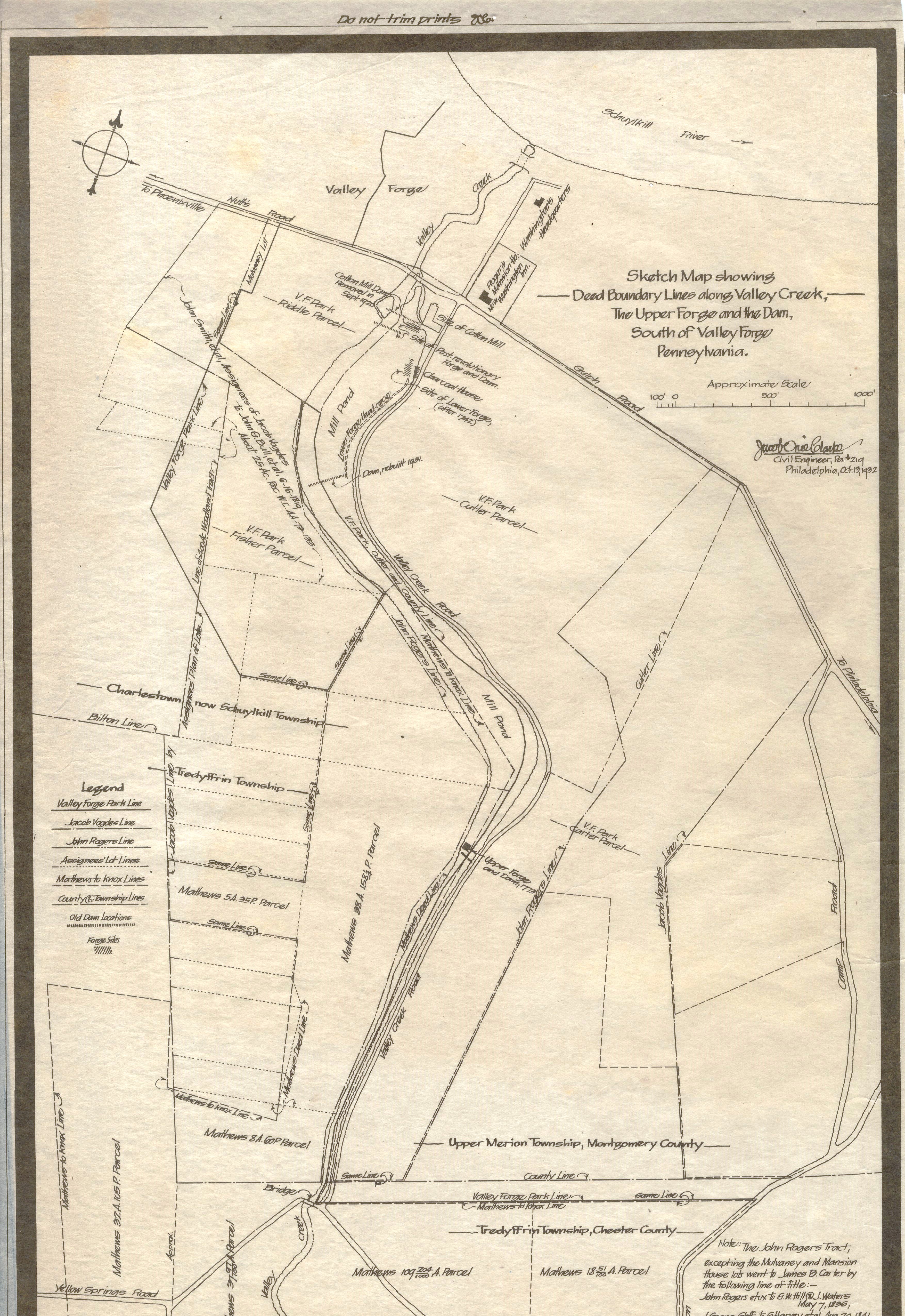
Upper Forge and Dam Excavations, Valley Forge Park
Jacob Orie Clarke Collection, D Series: Upper Forge/Middle Dam
MapId: 10 MapNo: D10 Material:Linen
U. S. National Park Service
Fair. Yellow spots, adhesive residue or stain.
Permission must be secured from the individual copyright owners to reproduce any copyrighted materials contained within this website.
Restrictions apply on use and/or reproduction
Valley Forge National Historical Park, Code: VAFO
H 42.5, W 24 1/8"
Public Can View
Person: Curator
Organization: US National Park Service
Address: Valley Forge National Historic Park, King of Prussia PA
Friday, September 29, 2017 1:00:55 PM
Friday, September 29, 2017 1:00:55 PM
VAFO 61083 D 19 Sketch Map Deed Boundary.jpg
Wednesday, May 13, 2015 8:04:31 PM
4.5 MB