a75f814e400e4679babb974042990eb4
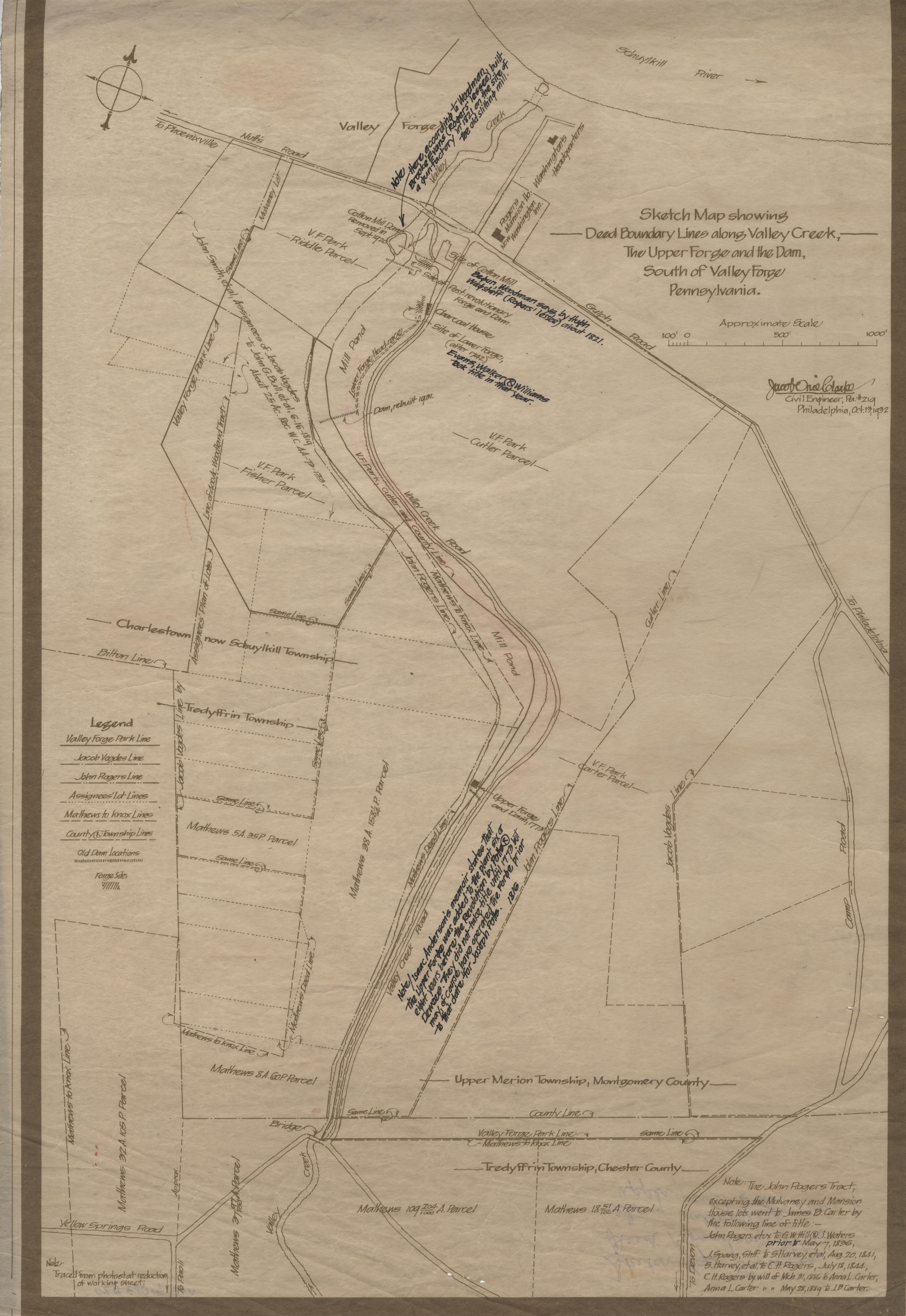
Upper Forge and Dam Excavations, Valley Forge Park
Jacob Orie Clarke Collection, D Series: Upper Forge/Middle Dam
MapId: 10A MapNo: D10A Material:Blueprint
U. S. National Park Service
Permission must be secured from the individual copyright owners to reproduce any copyrighted materials contained within this website.
Restrictions apply on use and/or reproduction
Valley Forge National Historical Park, Code: VAFO
11/03/1930
H 42.5, W 24.0"
Public Can View
Person: Curator
Organization: US National Park Service
Address: Valley Forge National Historic Park, King of Prussia PA
Friday, September 29, 2017 1:01:17 PM
Friday, September 29, 2017 1:01:17 PM
VAFO 61083 D 20 Deed Boundary Lines.jpg
Monday, January 1, 0001 12:00:00 AM
1.9 MB