Select Item below to DOWNLOAD - Once item is selected, right click and choose 'save as'
cd7aaf58-6dfe-4147-8db5-5ec6f4e050a8
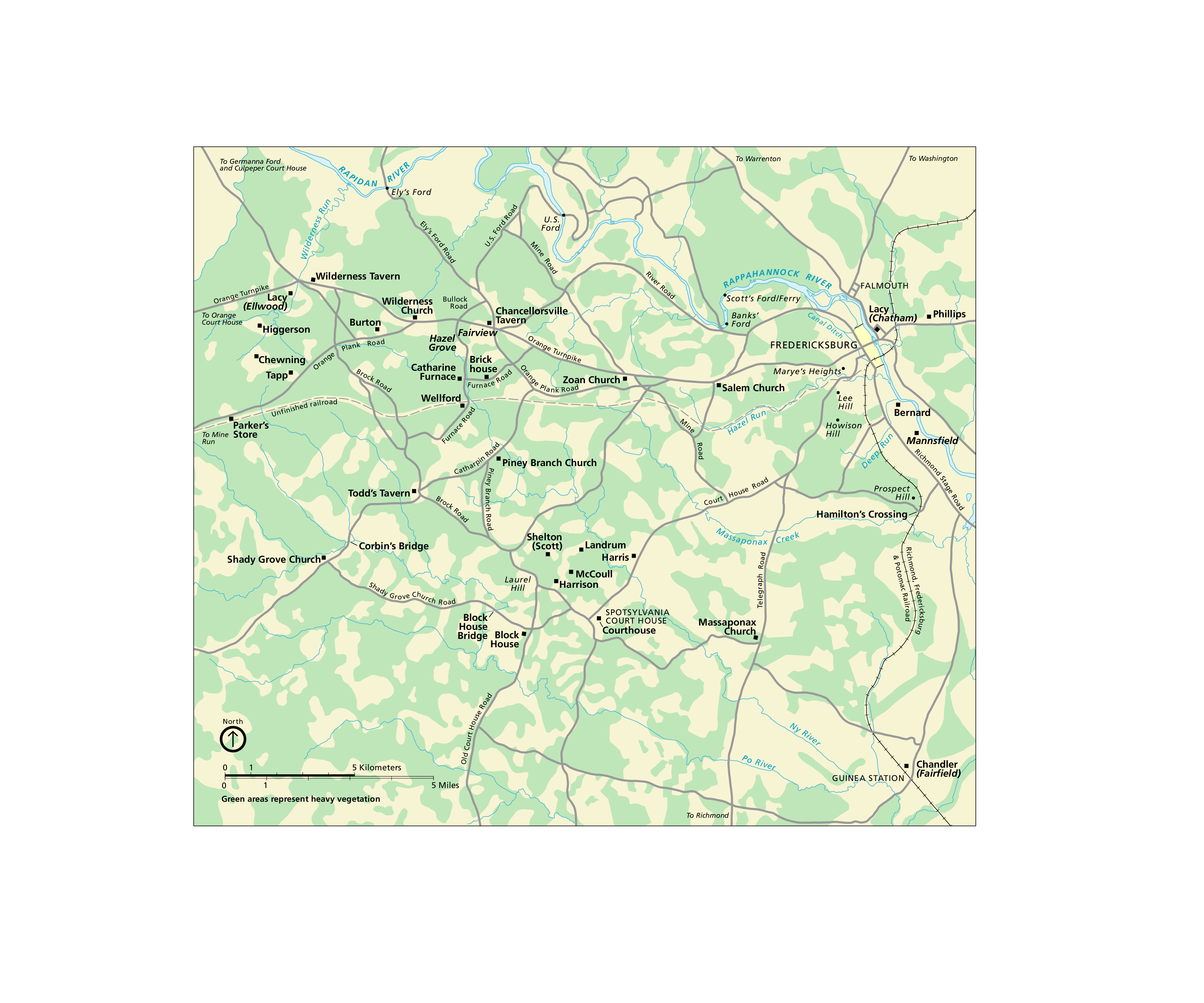
Historical Map (18611865) - Fredericksburg and Spotsylvania National Military Park
Historical map of Fredericksburg and Spotsylvania National Military Park in Virginia. The land is a mottled mix of tan and green. Roads are represented by gray lines and landmarks by small black squares.
Screen-viewable file; Adobe print production files can be downloaded from the Compressed zip Version link
Map Projection: Other; Map Type: unassigned
U.S. National Park Service
The National Park Service maps are government produced and are in the public domain. Anyone may, without restriction under U.S. copyright laws: Reproduce the work in print or digital form; Create derivative works; Perform the work publicly; Display the work; Distribute copies or digitally transfer the work to the public by sale or other transfer of ownership, or by rental, lease, or lending. Please note, a user who modifies and/or republishes National Park Service maps are responsible for any problems encountered with the maps, due to their change or modification.
Public domain
Document
Fredericksburg and Spotsylvania National Military Park, Code: FRSP
Fredericksburg and Spotsylvania National Military Park, Virginia
Latitude: 38.2948608398438, Longitude: -77.7218475341797
Latitude: 38.2948608398438, Longitude: -77.7218475341797
2010-12-09
Public Can View
Person: Harpers Ferry Center
Organization: US National Park Service
Address: Harpers Ferry Center, Harpers Ferry, WV
Email: HFC_Cartography@nps.gov
Organization: US National Park Service
Address: Harpers Ferry Center, Harpers Ferry, WV
Email: HFC_Cartography@nps.gov
Tuesday, April 26, 2022 1:54:53 PM
Friday, September 26, 2025 11:35:17 PM
FRSPmap3.pdf
pdf
375.0 kB
Map