Select Item below to DOWNLOAD - Once item is selected, right click and choose 'save as'
a11f03af-9da2-4c0e-817c-83f1fe893275
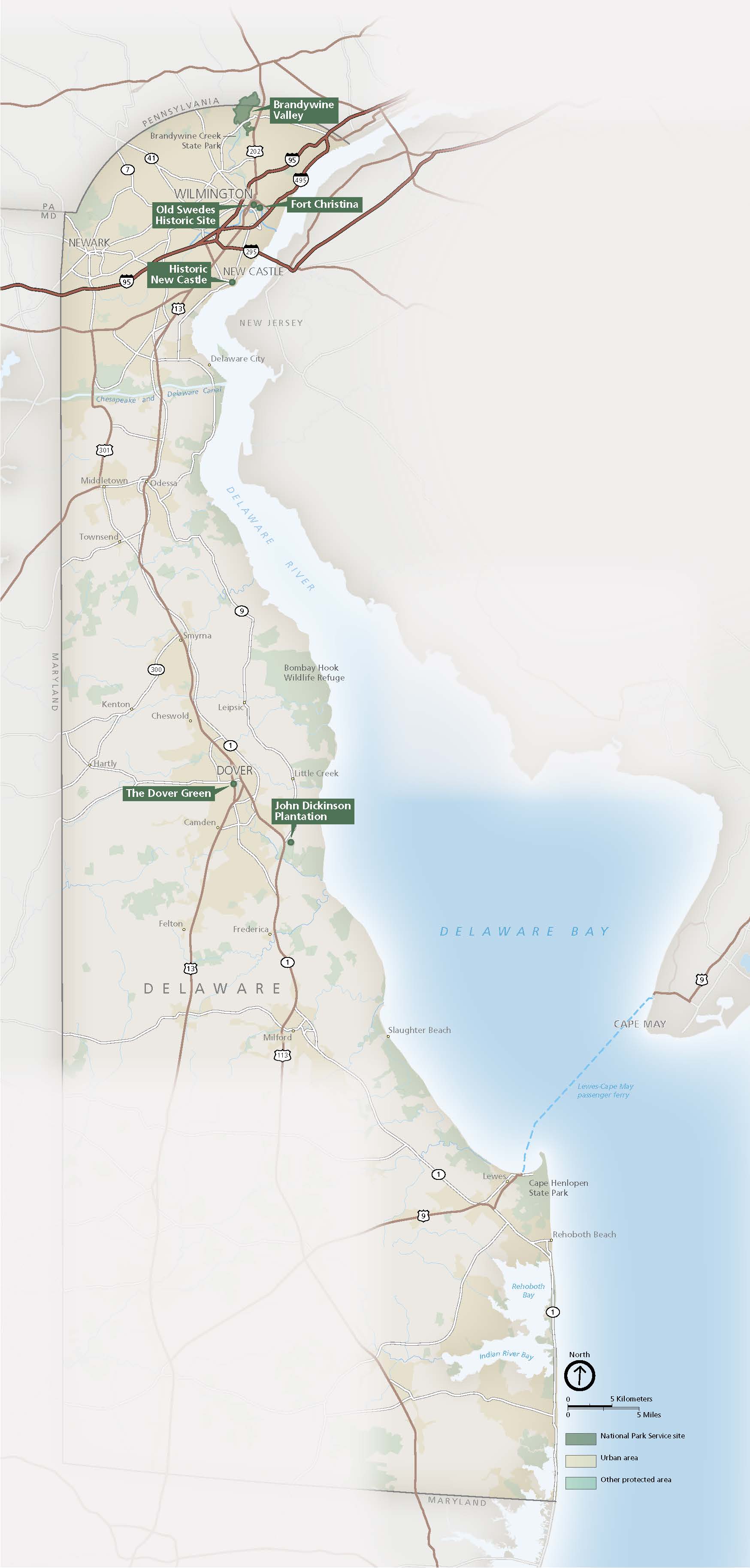
Park Map - First State National Historical Park
Map of First State National Historical Park in Delaware. The entire state of Delaware is shown in tan with neighboring states labeled and outlined in gray. Landmarks are represented by dark green dots and labels or light green shading. Roads and highways are represented by brown lines.
Screen-viewable file; Adobe print production files can be downloaded from the Compressed zip Version link
Map Projection: WM; Map Type: park map
U.S. National Park Service
The National Park Service maps are government produced and are in the public domain. Anyone may, without restriction under U.S. copyright laws: Reproduce the work in print or digital form; Create derivative works; Perform the work publicly; Display the work; Distribute copies or digitally transfer the work to the public by sale or other transfer of ownership, or by rental, lease, or lending. Please note, a user who modifies and/or republishes National Park Service maps are responsible for any problems encountered with the maps, due to their change or modification.
Public domain
Document
First State National Historical Park, Code: FRST
First State National Historical Park, New Castle County, Delaware
Latitude: 39.6598739624023, Longitude: -75.5637283325195
Latitude: 39.6598739624023, Longitude: -75.5637283325195
2022/02/01
Public Can View
Person: Harpers Ferry Center
Organization: US National Park Service
Address: Harpers Ferry Center, Harpers Ferry, WV
Email: HFC_Cartography@nps.gov
Organization: US National Park Service
Address: Harpers Ferry Center, Harpers Ferry, WV
Email: HFC_Cartography@nps.gov
Tuesday, April 26, 2022 1:54:20 PM
Friday, September 26, 2025 11:35:19 PM
FRSTmap1.pdf
pdf
27.3 MB
Map