Select Item below to DOWNLOAD - Once item is selected, right click and choose 'save as'
4f4e09dd-9518-4e51-8ee5-0edeea8827e2
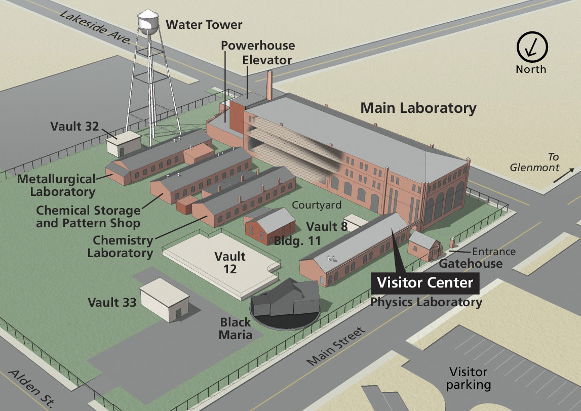
Laboratory Map - Thomas Edison National Historical Park
3D map of the Main Laboratory and surrounding buildings at the Thomas Edison National Historical Park in New Jersey. The Main Laboratory is a red, three-story building that spans nearly a city block. Other buildings stretch mostly perpendicularly in front of it.
Screen-viewable file; Adobe print production files can be downloaded from the Compressed zip Version link
Map Projection: Other; Map Type: unassigned
U.S. National Park Service
The National Park Service maps are government produced and are in the public domain. Anyone may, without restriction under U.S. copyright laws: Reproduce the work in print or digital form; Create derivative works; Perform the work publicly; Display the work; Distribute copies or digitally transfer the work to the public by sale or other transfer of ownership, or by rental, lease, or lending. Please note, a user who modifies and/or republishes National Park Service maps are responsible for any problems encountered with the maps, due to their change or modification.
Public domain
Document
Thomas Edison National Historical Park, Code: EDIS
Thomas Edison National Historical Park, Essex County, New Jersey
Latitude: 40.7859992980957, Longitude: -74.2397994995117
Latitude: 40.7859992980957, Longitude: -74.2397994995117
2014-06-16
Public Can View
Person: Harpers Ferry Center
Organization: US National Park Service
Address: Harpers Ferry Center, Harpers Ferry, WV
Email: HFC_Cartography@nps.gov
Organization: US National Park Service
Address: Harpers Ferry Center, Harpers Ferry, WV
Email: HFC_Cartography@nps.gov
Tuesday, April 26, 2022 1:51:20 PM
Friday, September 26, 2025 11:34:56 PM
EDISMap1.pdf
pdf
1.9 MB
Map