Select Item below to DOWNLOAD - Once item is selected, right click and choose 'save as'
b33bd45b-7e9a-4e4c-91f4-59594f0be686
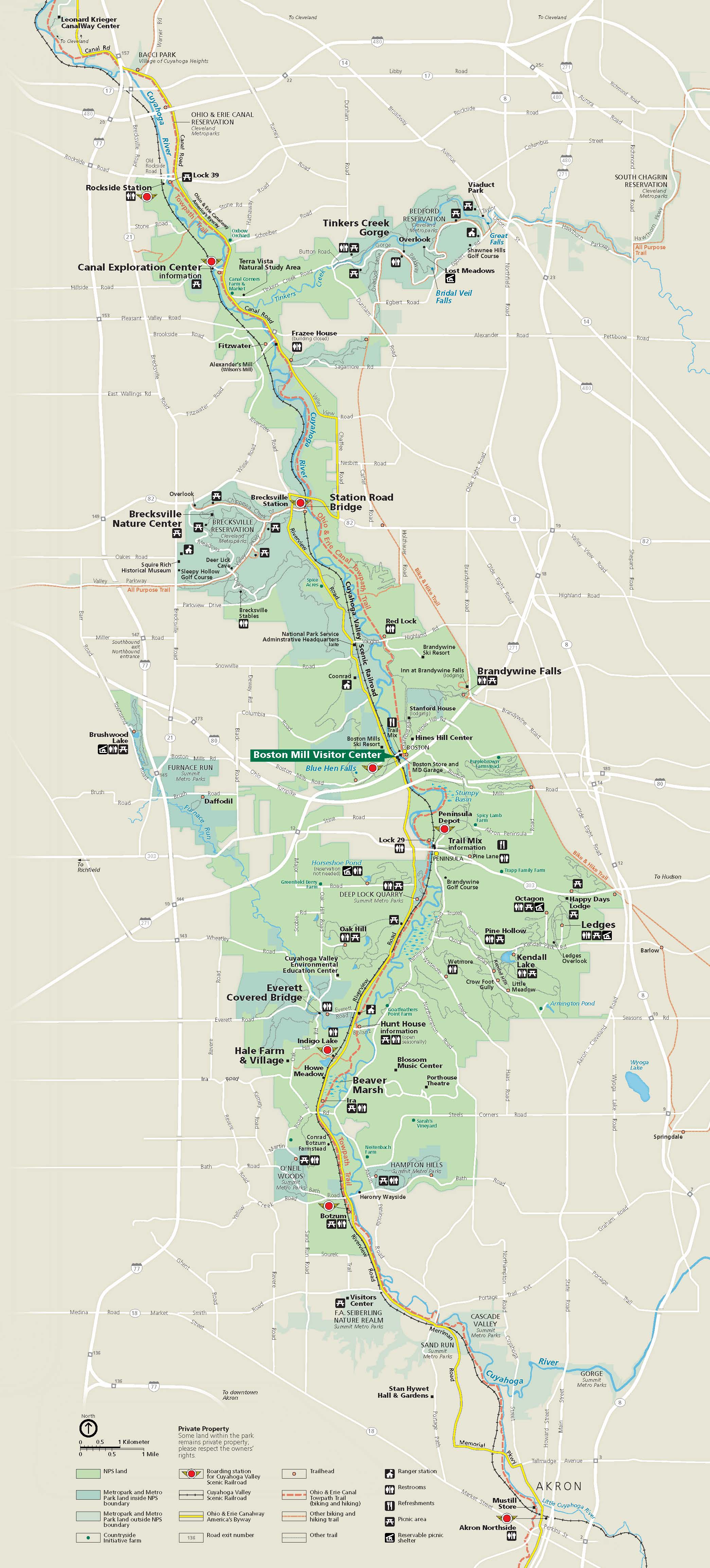
Park Map - Cuyahoga Valley National Park
Map of Cuyahoga Valley National Park in Ohio. The long, roughly teardrop-shaped park is shown in light green and surrounding areas in tan. Roads are mostly shown as white lines, and a byway through the park is yellow.
Screen-viewable file; Adobe print production files can be downloaded from the Compressed zip Version link
Map Projection: WM; Map Type: park map
U.S. National Park Service
The National Park Service maps are government produced and are in the public domain. Anyone may, without restriction under U.S. copyright laws: Reproduce the work in print or digital form; Create derivative works; Perform the work publicly; Display the work; Distribute copies or digitally transfer the work to the public by sale or other transfer of ownership, or by rental, lease, or lending. Please note, a user who modifies and/or republishes National Park Service maps are responsible for any problems encountered with the maps, due to their change or modification.
Public domain
Document
Cuyahoga Valley National Park, Code: CUVA
Cuyahoga Valley National Park, Ohio
Latitude: 41.1502799987793, Longitude: -81.5678787231445
Latitude: 41.1502799987793, Longitude: -81.5678787231445
2021/11/01
Public Can View
Person: Harpers Ferry Center
Organization: US National Park Service
Address: Harpers Ferry Center, Harpers Ferry, WV
Email: HFC_Cartography@nps.gov
Organization: US National Park Service
Address: Harpers Ferry Center, Harpers Ferry, WV
Email: HFC_Cartography@nps.gov
Monday, April 25, 2022 4:26:27 PM
Friday, September 26, 2025 11:34:49 PM
CUVAParkMap.pdf
pdf
17.0 MB
Map