Select Item below to DOWNLOAD - Once item is selected, right click and choose 'save as'
9f7bdfc9-a247-4d3a-ab03-f40b23c7e416
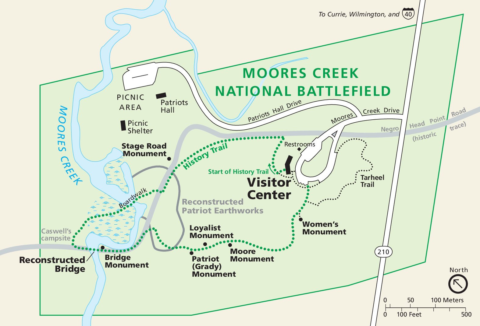
Park Map - Moores Creek National Battlefield
Park map of Moores Creek National Battlefield in North Carolina. The park is outlined and shaded green, and the surrounding area is tan. Green dotted and black dotted lines represent trails.
Screen-viewable file; Adobe print production files can be downloaded from the Compressed zip Version link
Map Projection: Other; Map Type: unassigned
U.S. National Park Service
The National Park Service maps are government produced and are in the public domain. Anyone may, without restriction under U.S. copyright laws: Reproduce the work in print or digital form; Create derivative works; Perform the work publicly; Display the work; Distribute copies or digitally transfer the work to the public by sale or other transfer of ownership, or by rental, lease, or lending. Please note, a user who modifies and/or republishes National Park Service maps are responsible for any problems encountered with the maps, due to their change or modification.
Public domain
Document
Moores Creek National Battlefield, Code: MOCR
Moores Creek National Battlefield, Pender County, North Carolina
Latitude: 34.4581985473633, Longitude: -78.1102981567383
Latitude: 34.4581985473633, Longitude: -78.1102981567383
2015-04-28
Public Can View
Person: Harpers Ferry Center
Organization: US National Park Service
Address: Harpers Ferry Center, Harpers Ferry, WV
Email: HFC_Cartography@nps.gov
Organization: US National Park Service
Address: Harpers Ferry Center, Harpers Ferry, WV
Email: HFC_Cartography@nps.gov
Wednesday, April 27, 2022 8:21:22 PM
Friday, September 26, 2025 11:36:36 PM
MOCRmap1.pdf
pdf
68.2 kB
Map