Select Item below to DOWNLOAD - Once item is selected, right click and choose 'save as'
The National Park Service is committed to making its electronic and information technologies accessible to individuals with disabilities.
If you require assistance or wish to report an issue related to the accessibility of any content on this website, please email NPGallery@nps.gov
If you require assistance or wish to report an issue related to the accessibility of any content on this website, please email NPGallery@nps.gov
896a5b98-90e0-4902-adf4-3ec8c3bab200
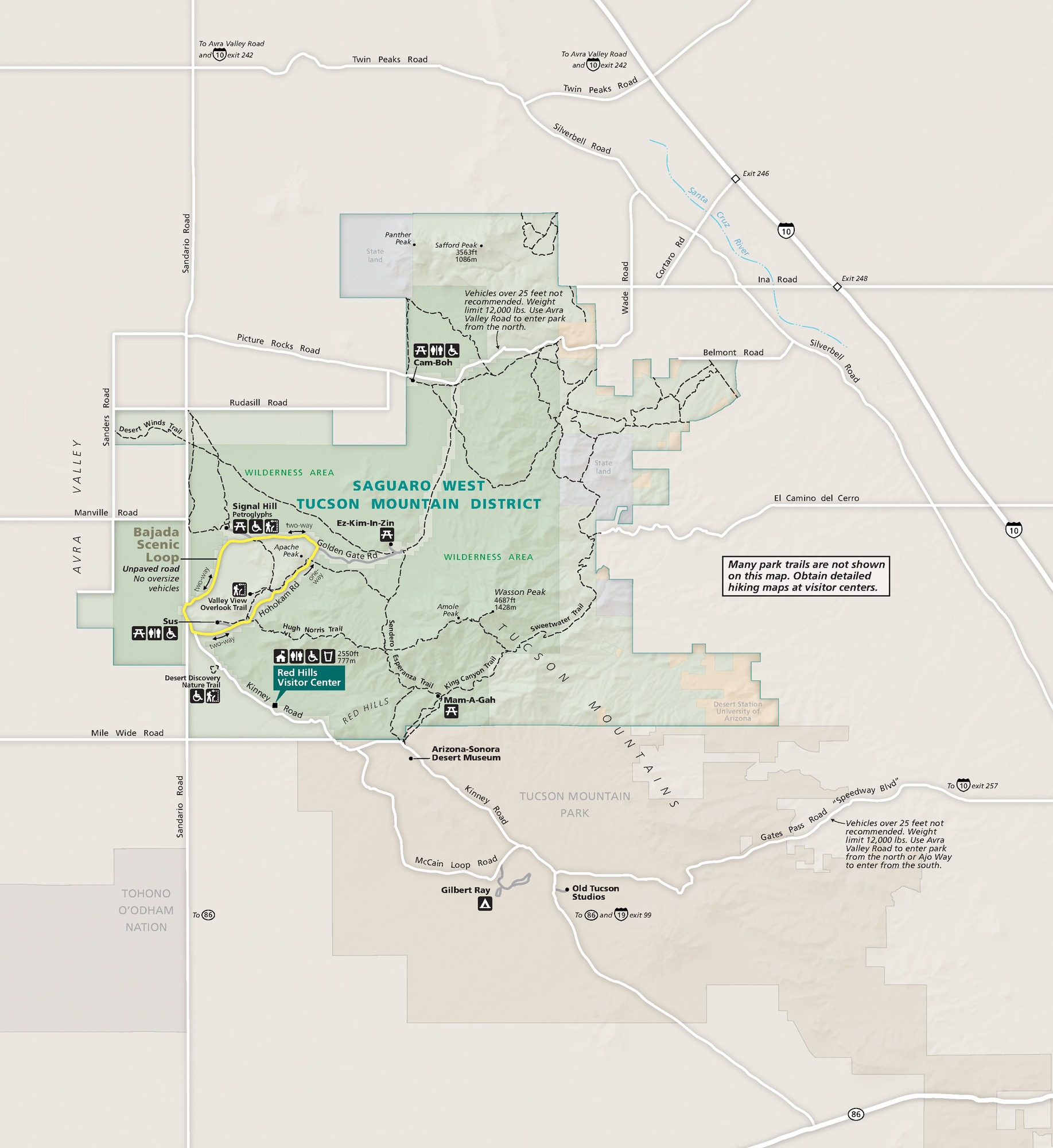
Park Map, West Unit - Saguaro National Park
Map of Saguaro West Tucson Mountain District, the western unit of Saguaro National Park in Arizona. The park is roughly square but with boxy, deeply stepped edges. Park lands are shown in varying shades of pale green, and surrounding areas are tan.
Screen-viewable file; Adobe print production files can be downloaded from the Compressed zip Version link
Map Projection: WM; Map Type: park map
U.S. National Park Service
The National Park Service maps are government produced and are in the public domain. Anyone may, without restriction under U.S. copyright laws: Reproduce the work in print or digital form; Create derivative works; Perform the work publicly; Display the work; Distribute copies or digitally transfer the work to the public by sale or other transfer of ownership, or by rental, lease, or lending. Please note, a user who modifies and/or republishes National Park Service maps are responsible for any problems encountered with the maps, due to their change or modification.
Public domain
Document
Saguaro National Park, Code: SAGU
Saguaro National Park, Pima County, Arizona
Latitude: 32.1789016723633, Longitude: -110.608001708984
Latitude: 32.1789016723633, Longitude: -110.608001708984
2023/09/01
09/01/2023
Public Can View
Person: Harpers Ferry Center
Organization: US National Park Service
Address: Harpers Ferry Center, Harpers Ferry, WV
Email: HFC_Cartography@nps.gov
Organization: US National Park Service
Address: Harpers Ferry Center, Harpers Ferry, WV
Email: HFC_Cartography@nps.gov
Tuesday, September 17, 2024 7:58:10 PM
Friday, September 26, 2025 11:37:24 PM
SAGUmap2.pdf
pdf
12.1 MB
Map