Select Item below to DOWNLOAD - Once item is selected, right click and choose 'save as'
65dd37c5-1d4b-4d32-b5be-4947230cbbaf
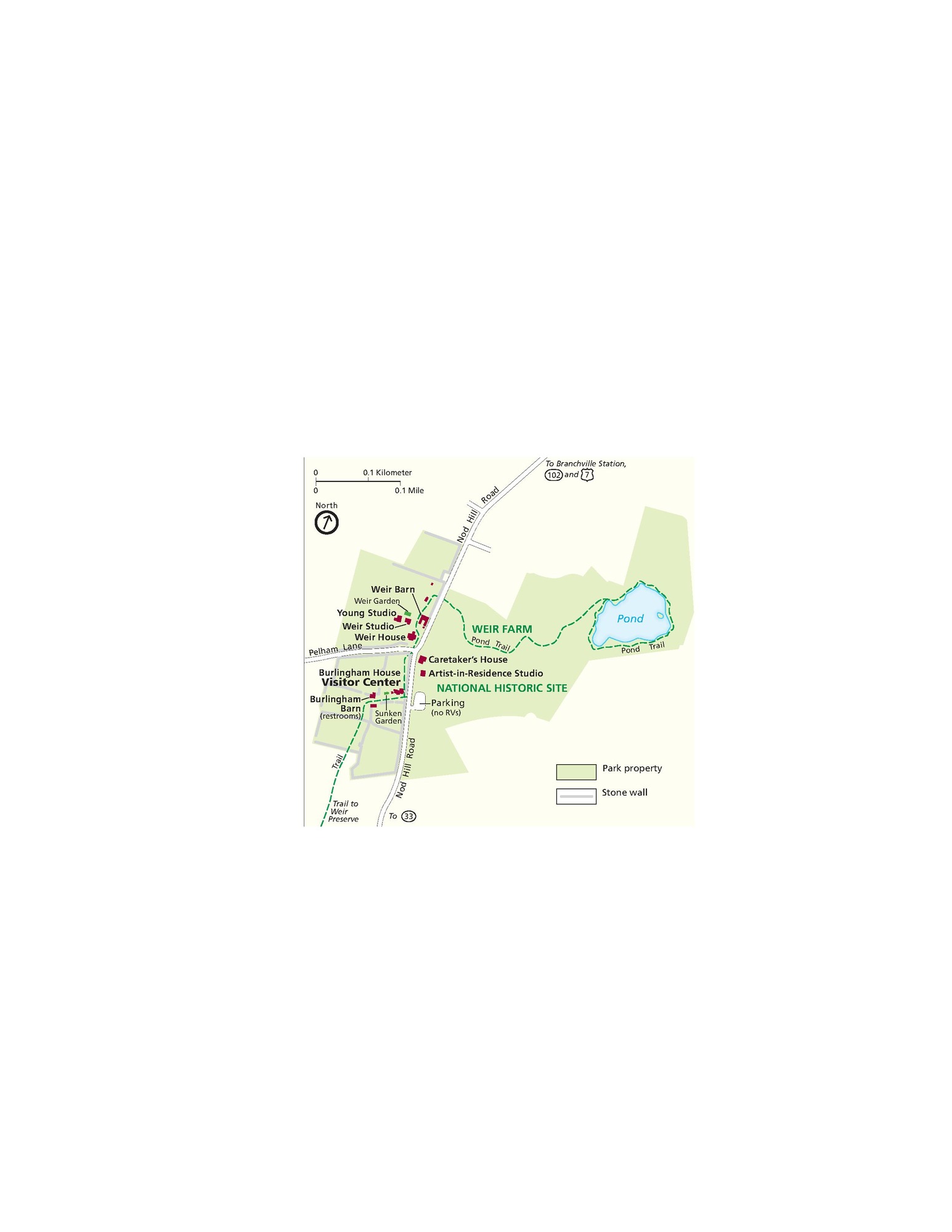
Park Map - Weir Farm National Historical Park
Map of Weir Farm National Historic Site in Connecticut. Park property is indicated in green and the surrounding areas in tan.
Screen-viewable file; Adobe print production files can be downloaded from the Compressed zip Version link
Map Projection: Other; Map Type: park map
U.S. National Park Service
The National Park Service maps are government produced and are in the public domain. Anyone may, without restriction under U.S. copyright laws: Reproduce the work in print or digital form; Create derivative works; Perform the work publicly; Display the work; Distribute copies or digitally transfer the work to the public by sale or other transfer of ownership, or by rental, lease, or lending. Please note, a user who modifies and/or republishes National Park Service maps are responsible for any problems encountered with the maps, due to their change or modification.
Public domain
Document
Weir Farm National Historical Park, Code: WEFA
Weir Farm National Historical Park, Connecticut
Weir Farm National Historical Park, Fairfield County, Connecticut
Latitude: 41.2568016052246, Longitude: -73.4564971923828
Weir Farm National Historical Park, Fairfield County, Connecticut
Latitude: 41.2568016052246, Longitude: -73.4564971923828
2018-06-25
Public Can View
Person: Harpers Ferry Center
Organization: US National Park Service
Address: Harpers Ferry Center, Harpers Ferry, WV
Email: HFC_Cartography@nps.gov
Organization: US National Park Service
Address: Harpers Ferry Center, Harpers Ferry, WV
Email: HFC_Cartography@nps.gov
Monday, May 2, 2022 11:06:24 PM
Friday, September 26, 2025 11:38:11 PM
WEFAmap1.pdf
pdf
655.4 kB
Map