Select Item below to DOWNLOAD - Once item is selected, right click and choose 'save as'
3adeec16-0448-4fd4-939d-c9dacfd135fe
Bay Forts Map - Fort Point National Historic Site
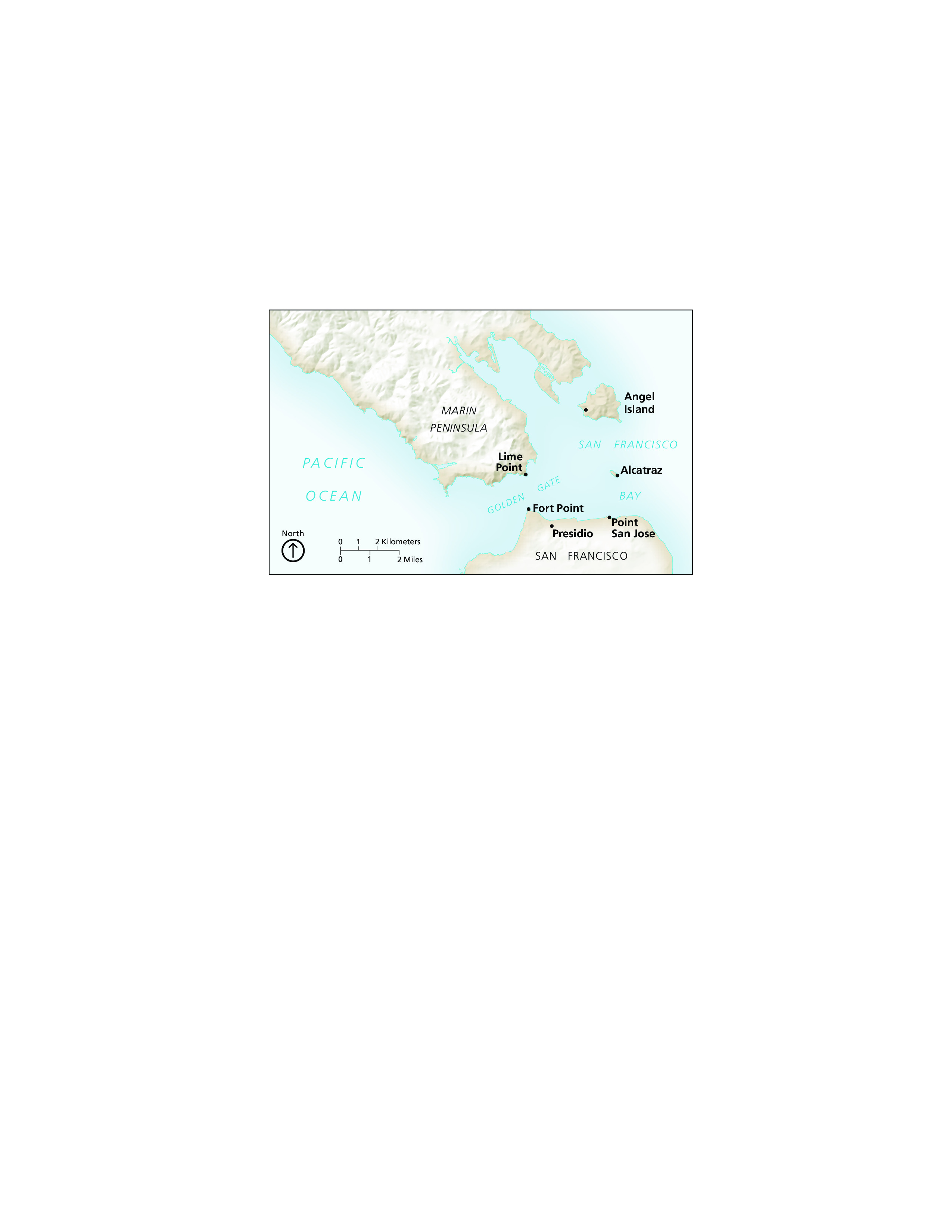
Map of Bay Forts for Fort Point National Historic Site in California. The map shows the Marin Peninsula as a long, textured gray mass of land coming in diagonally from the top left corner and San Francisco as a mound on the bottom. Several forts are labeled around the San Francisco Bay.
Screen-viewable file; Adobe print production files can be downloaded from the Compressed zip Version link
Map Projection: Other; Map Type: unassigned
U.S. National Park Service
The National Park Service maps are government produced and are in the public domain. Anyone may, without restriction under U.S. copyright laws: Reproduce the work in print or digital form; Create derivative works; Perform the work publicly; Display the work; Distribute copies or digitally transfer the work to the public by sale or other transfer of ownership, or by rental, lease, or lending. Please note, a user who modifies and/or republishes National Park Service maps are responsible for any problems encountered with the maps, due to their change or modification.
Public domain
Document
Fort Point National Historic Site, Code: FOPO
Fort Point National Historic Site, San Francisco County, California
Latitude: 37.8084983825684, Longitude: -122.473999023438
Latitude: 37.8084983825684, Longitude: -122.473999023438
2012-03-21
Public Can View
Person: Harpers Ferry Center
Organization: US National Park Service
Address: Harpers Ferry Center, Harpers Ferry, WV
Email: HFC_Cartography@nps.gov
Organization: US National Park Service
Address: Harpers Ferry Center, Harpers Ferry, WV
Email: HFC_Cartography@nps.gov
Tuesday, April 26, 2022 1:57:49 PM
Friday, September 26, 2025 11:35:10 PM
FOPOmap1.pdf
pdf
3.1 MB
Map