Select Item below to DOWNLOAD - Once item is selected, right click and choose 'save as'
25a41ab8-49ab-43c7-9e3f-a7bdc02df091
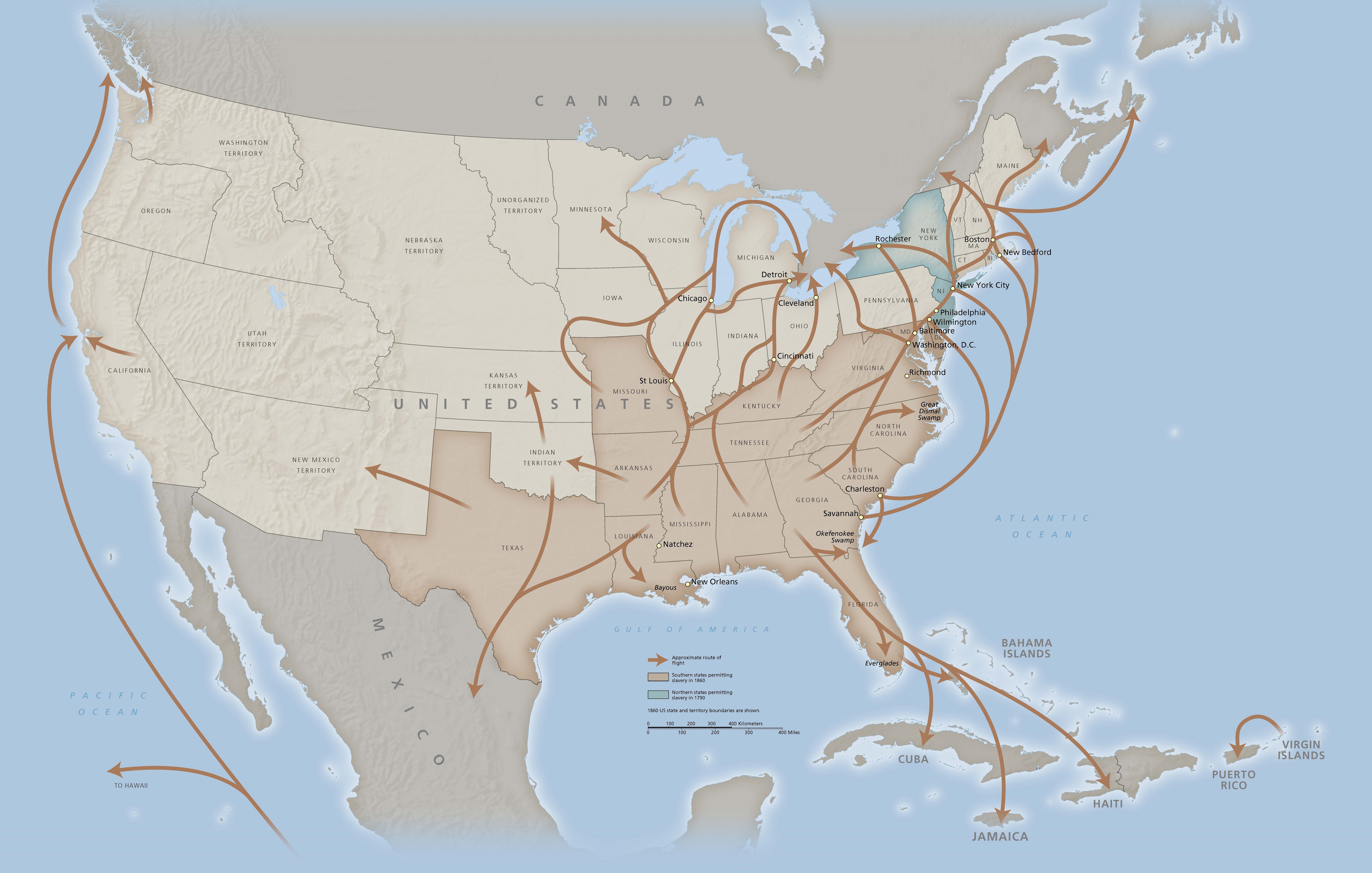
Network to Freedom Brochure Map - National Underground Railroad Network to Freedom Program
Map of the United States in 1860 with routes from southern to northern states indicated with arrows to represent the Underground Railroad. Most of the map is light or dark brown, and two states in the northeast are shaded with blue.
Screen-viewable file; Adobe print production files can be downloaded from the Compressed zip Version link
Map Projection: Albers; Map Type: park map
U.S. National Park Service
The National Park Service maps are government produced and are in the public domain. Anyone may, without restriction under U.S. copyright laws: Reproduce the work in print or digital form; Create derivative works; Perform the work publicly; Display the work; Distribute copies or digitally transfer the work to the public by sale or other transfer of ownership, or by rental, lease, or lending. Please note, a user who modifies and/or republishes National Park Service maps are responsible for any problems encountered with the maps, due to their change or modification.
Public domain
Document
National Underground Railroad Network to Freedom Program, Code: UGRR
National Underground Railroad Network to Freedom Program, District of Columbia , District of Columbia
2025/02/11
Public Can View
Person: Harpers Ferry Center
Organization: US National Park Service
Address: Harpers Ferry Center, Harpers Ferry, WV
Email: HFC_Cartography@nps.gov
Organization: US National Park Service
Address: Harpers Ferry Center, Harpers Ferry, WV
Email: HFC_Cartography@nps.gov
Wednesday, February 12, 2025 2:14:14 PM
Friday, September 26, 2025 11:37:55 PM
UGRRmap5.pdf
pdf
38.8 MB
Map