Select Item below to DOWNLOAD - Once item is selected, right click and choose 'save as'
18131bda-34be-4d1f-963a-e84b5e4500ee
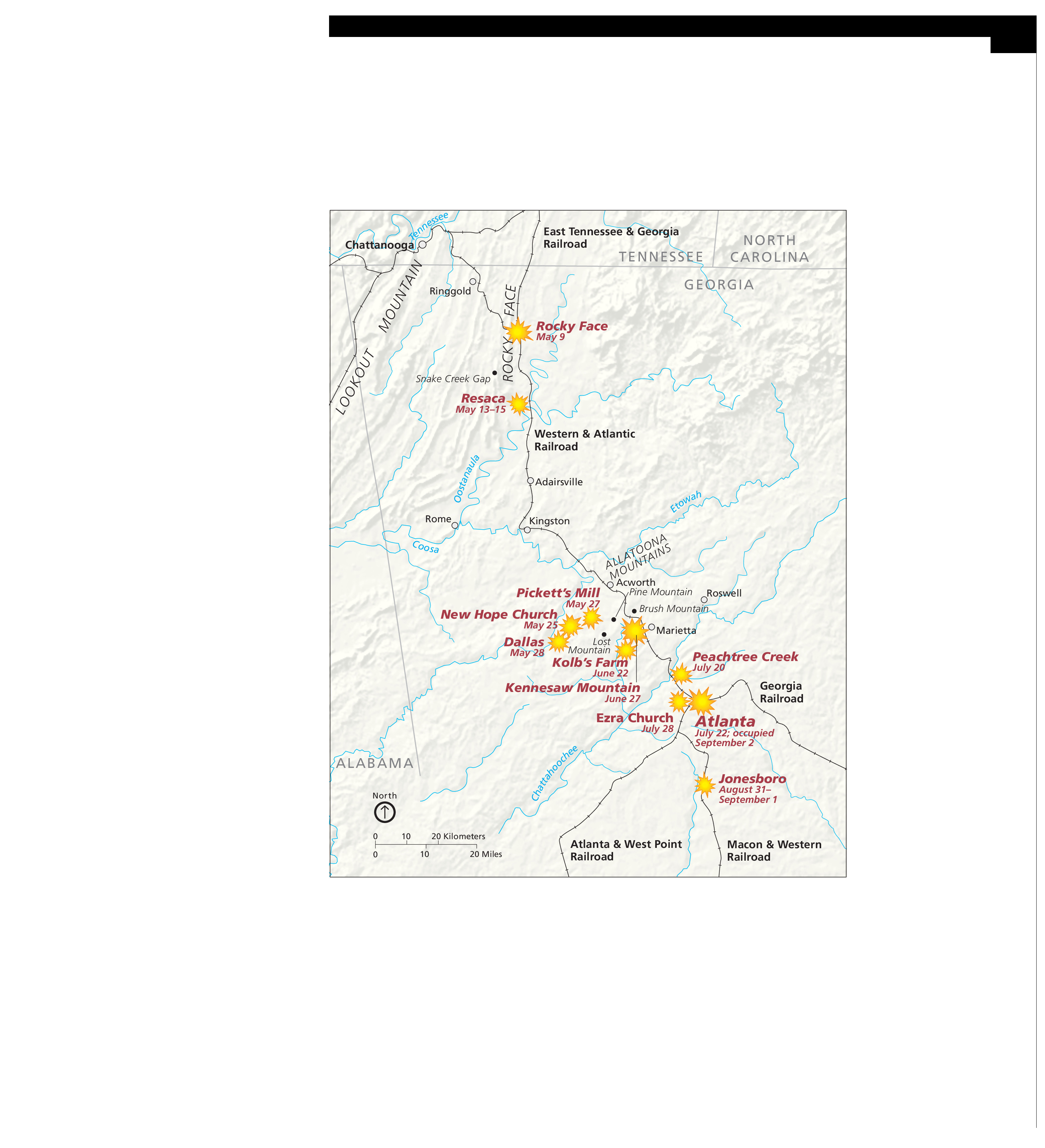
The Atlanta Campaign Map - Kennesaw Mountain National Battlefield Park
Map showing the battle locations during the Atlanta Campaign in Kennesaw Mountain National Battlefield Park in Georgia. The map is tan with states outlined and labeled in gray. Battles are represented by orange starbursts, railroad lines by notched black lines, and towns by white dots.
Screen-viewable file; Adobe print production files can be downloaded from the Compressed zip Version link
Map Projection: Other; Map Type: unassigned
U.S. National Park Service
The National Park Service maps are government produced and are in the public domain. Anyone may, without restriction under U.S. copyright laws: Reproduce the work in print or digital form; Create derivative works; Perform the work publicly; Display the work; Distribute copies or digitally transfer the work to the public by sale or other transfer of ownership, or by rental, lease, or lending. Please note, a user who modifies and/or republishes National Park Service maps are responsible for any problems encountered with the maps, due to their change or modification.
Public domain
Document
Kennesaw Mountain National Battlefield Park, Code: KEMO
Kennesaw Mountain National Battlefield Park, Cobb County, Georgia
Latitude: 33.9772987365723, Longitude: -84.5789031982422
Latitude: 33.9772987365723, Longitude: -84.5789031982422
2012-08-09
Public Can View
Person: Harpers Ferry Center
Organization: US National Park Service
Address: Harpers Ferry Center, Harpers Ferry, WV
Email: HFC_Cartography@nps.gov
Organization: US National Park Service
Address: Harpers Ferry Center, Harpers Ferry, WV
Email: HFC_Cartography@nps.gov
Tuesday, April 26, 2022 9:47:48 PM
Friday, September 26, 2025 11:36:11 PM
KEMOmap2.pdf
pdf
1.2 MB
Map