Select Item below to DOWNLOAD - Once item is selected, right click and choose 'save as'
14ac743e-560f-412b-8943-ae485f9324e5
Park Map - Natchez Trace National Scenic Trail
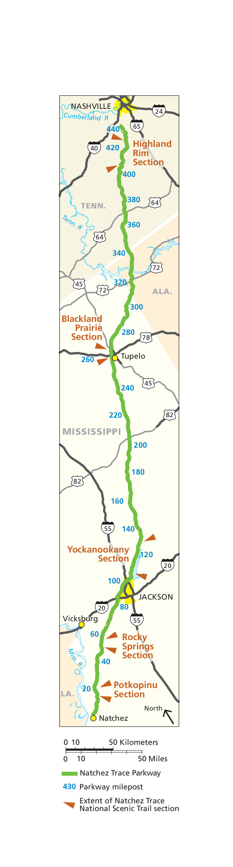
Map of Natchez Trace National Scenic Trail in Mississippi, Alabama, and Tennessee. Represented as a green line, the Natchez Trace Parkway curves down the map vertically from Interstate 40 at the top to Natchez at the bottom.
Screen-viewable file; Adobe print production files can be downloaded from the Compressed zip Version link
Map Projection: Other; Map Type: unassigned
U.S. National Park Service
The National Park Service maps are government produced and are in the public domain. Anyone may, without restriction under U.S. copyright laws: Reproduce the work in print or digital form; Create derivative works; Perform the work publicly; Display the work; Distribute copies or digitally transfer the work to the public by sale or other transfer of ownership, or by rental, lease, or lending. Please note, a user who modifies and/or republishes National Park Service maps are responsible for any problems encountered with the maps, due to their change or modification.
Public domain
Document
Natchez Trace National Scenic Trail, Code: NATT
Mississippi ; Tennessee, Natchez Trace National Scenic Trail, Alabama
2012-08-27
Public Can View
Person: Harpers Ferry Center
Organization: US National Park Service
Address: Harpers Ferry Center, Harpers Ferry, WV
Email: HFC_Cartography@nps.gov
Organization: US National Park Service
Address: Harpers Ferry Center, Harpers Ferry, WV
Email: HFC_Cartography@nps.gov
Wednesday, April 27, 2022 9:10:32 PM
Friday, September 26, 2025 11:36:44 PM
NATTmap1.pdf
pdf
1.0 MB
Map