Select Item below to DOWNLOAD - Once item is selected, right click and choose 'save as'
347a3e92-ecd8-44bf-8336-b333ce152801
Subsidence
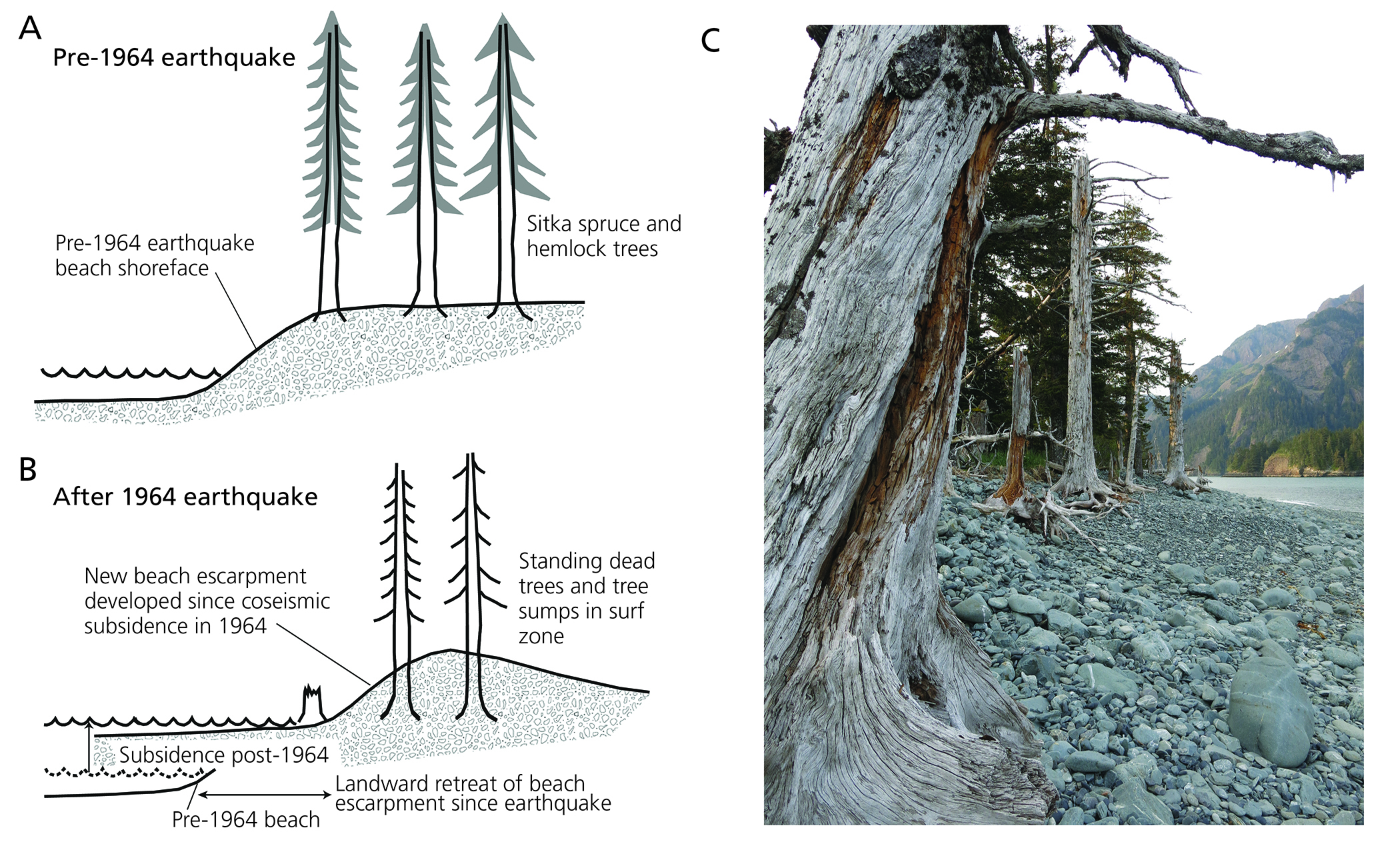
Two sketches and one photograph showing the process of subsidence and ghost forest formation during the 1964 Great Alaska Earthquake. One sketch shows pre-earthquake conditions with Sitka spruce and hemlock trees above a beach shoreface. The other sketch shows post-earthquake conditions with post-earthquake subsidence, landward retreat of the beach escarpment and standing dead trees and stumps now in the surf zone.
Sketches and photograph showing the process of subsidence and ghost forest formation during the 1964
Great Alaska Earthquake. A: Coast position and coastal forests before the earthquake. B: Coast position and ghost
forests after the earthquake. C: Photograph of ghost forests still visible on the coast of the Kenai Peninsula today.
Figure modified from Kelsey et al. (2015).
Permission must be secured from the individual copyright owners to reproduce any copyrighted materials contained within this website. Digital assets without any copyright restrictions are public domain.
NPS photograph by Chad Hults.
Public domain:Full Granting Rights
Image
Kenai Fjords National Park, Code: KEFJ
Kenai Fjords National Park, Kenai Peninsula Borough, Alaska
Latitude: 59.9532012939453, Longitude: -149.88200378418
Latitude: 59.9532012939453, Longitude: -149.88200378418
10/09/2017
10/09/2017
Public Can View
Monday, August 16, 2021 1:55:35 PM
Monday, August 16, 2021 4:00:35 PM
Fig_35_drowned forests-01.jpg
Monday, October 9, 2017 5:07:36 PM
jpg
3.3 MB
Scenic