Select Item below to DOWNLOAD - Once item is selected, right click and choose 'save as'
b1aa8c2df9d248fe94f4cc4aa9cca42b
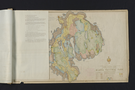
Master plan, Land Status Document sheet, p. 3
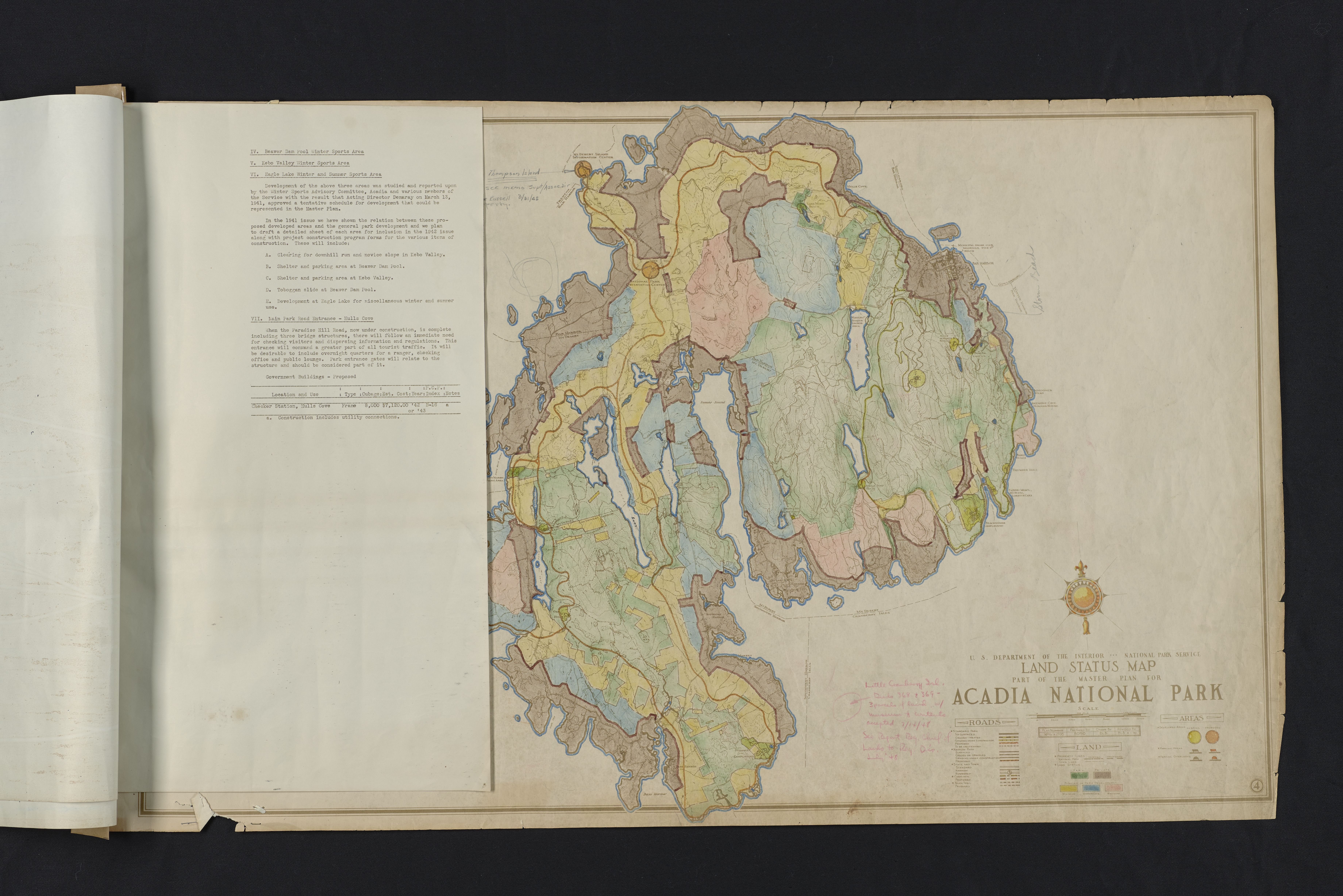
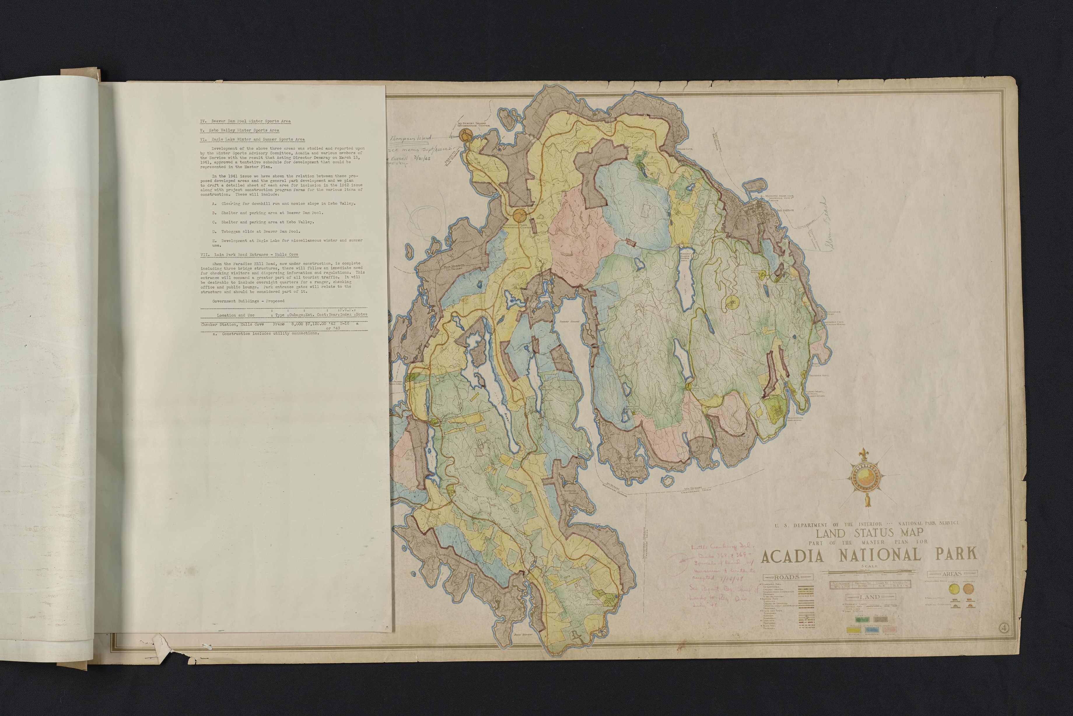
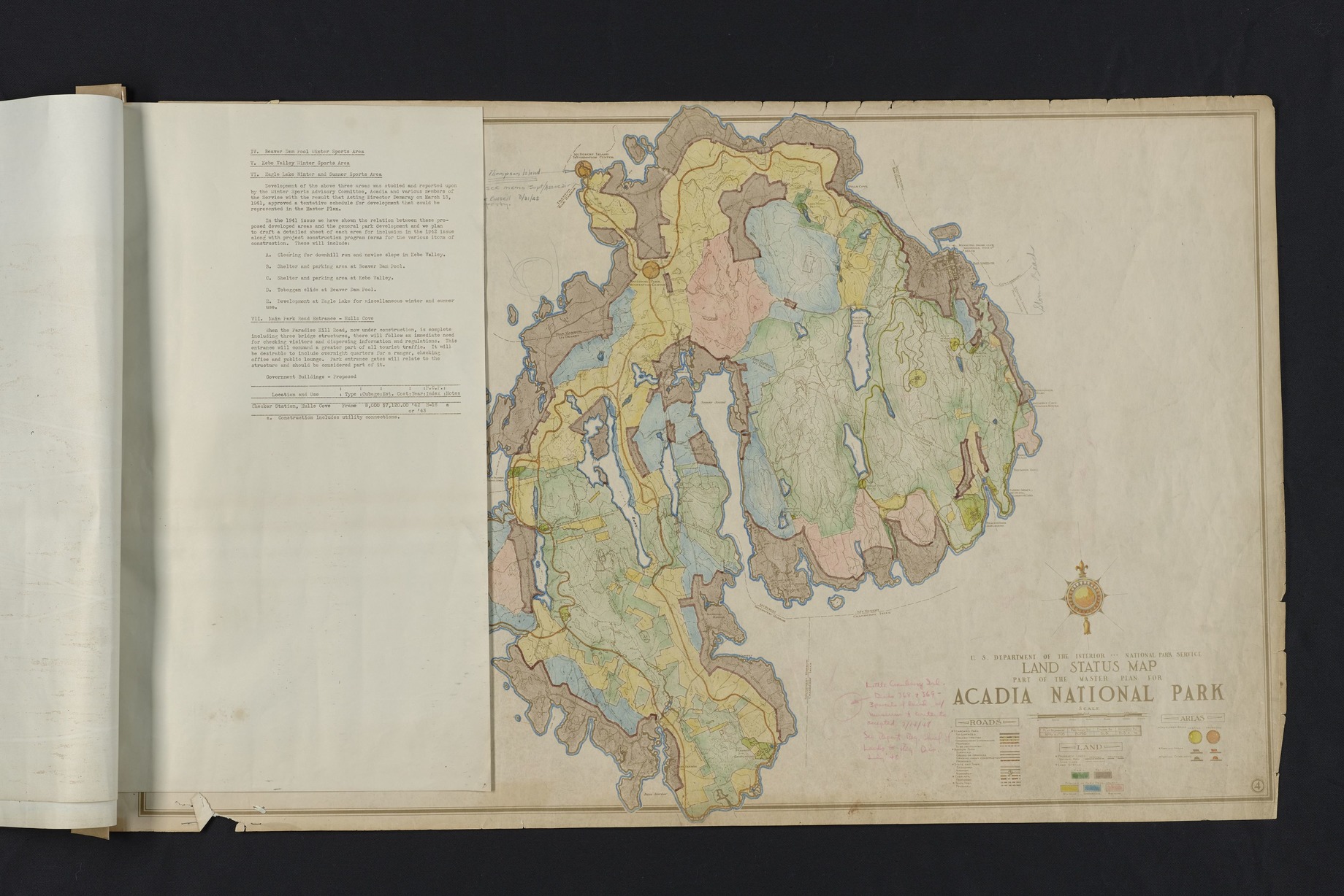
Document sheet attached to hand colored map of Mount Desert Island. Map is titled, "U.S. Department of the Interior National Park Service Land Status Map Part of the Master Plan for Acadia National Park". See entry, "U.S. Department of the Interior National Park Service Land Status Map Part of the Master Plan for Acadia National Park" for more information on the map. Document sheet describes development plans by the Winter Sports Advisory Committee, Acadia National Park, and other National Park Service members for Beaver Dam Pool Winter Sports Area, Kebo Valley Winter Sports Area, Eagle Lake Winter, Summer Sports Area, Hulls Cove, and Paradise Hill road. Acting Director Arthur Edward Demaray approved a tentative development schedule for this development area. Building details include: location, use, type, cubage, year built, condition, and notes for existing and proposed buildings. ; Plan Number: NPAca2695
CollectionNbr: 4000 ; SeriesNbr: 012.002.001 ;
U. S. National Park Service
Permission must be secured from the individual copyright owners to reproduce any copyrighted materials contained within this website.
Restrictions apply on use and/or reproduction
Image
Acadia National Park, Code: ACAD
Eagle Lake
Acadia National Park, Maine
Latitude: 44.3593788146973, Longitude: -68.2397308349609
Acadia National Park, Maine
Latitude: 44.3593788146973, Longitude: -68.2397308349609
1940s
01/01/1940 - 12/30/1949
Paper ; Physical Characteristics: Good/Fair - Hand colored, script, and typed text. Moderate/severe tears and creases. ; Extent: 1 Each
HQ/R5/U2/S3, HQ/R7, HQ/R8
Public Can View
Person: Curator
Organization: US National Park Service
Address: Acadia National Park, Bar Harbor ME
Email: Acadia_Collections@nps.gov
Organization: US National Park Service
Address: Acadia National Park, Bar Harbor ME
Email: Acadia_Collections@nps.gov
Wednesday, October 17, 2018 8:03:19 AM
Wednesday, October 17, 2018 8:03:19 AM
Master Plan, Land Status Map & Doc Page 3.tif
tif
216.9 MB
Historic