Select Item below to DOWNLOAD - Once item is selected, right click and choose 'save as'
9397bfe7-8285-4f84-a5b7-5e2b4b4e9e81
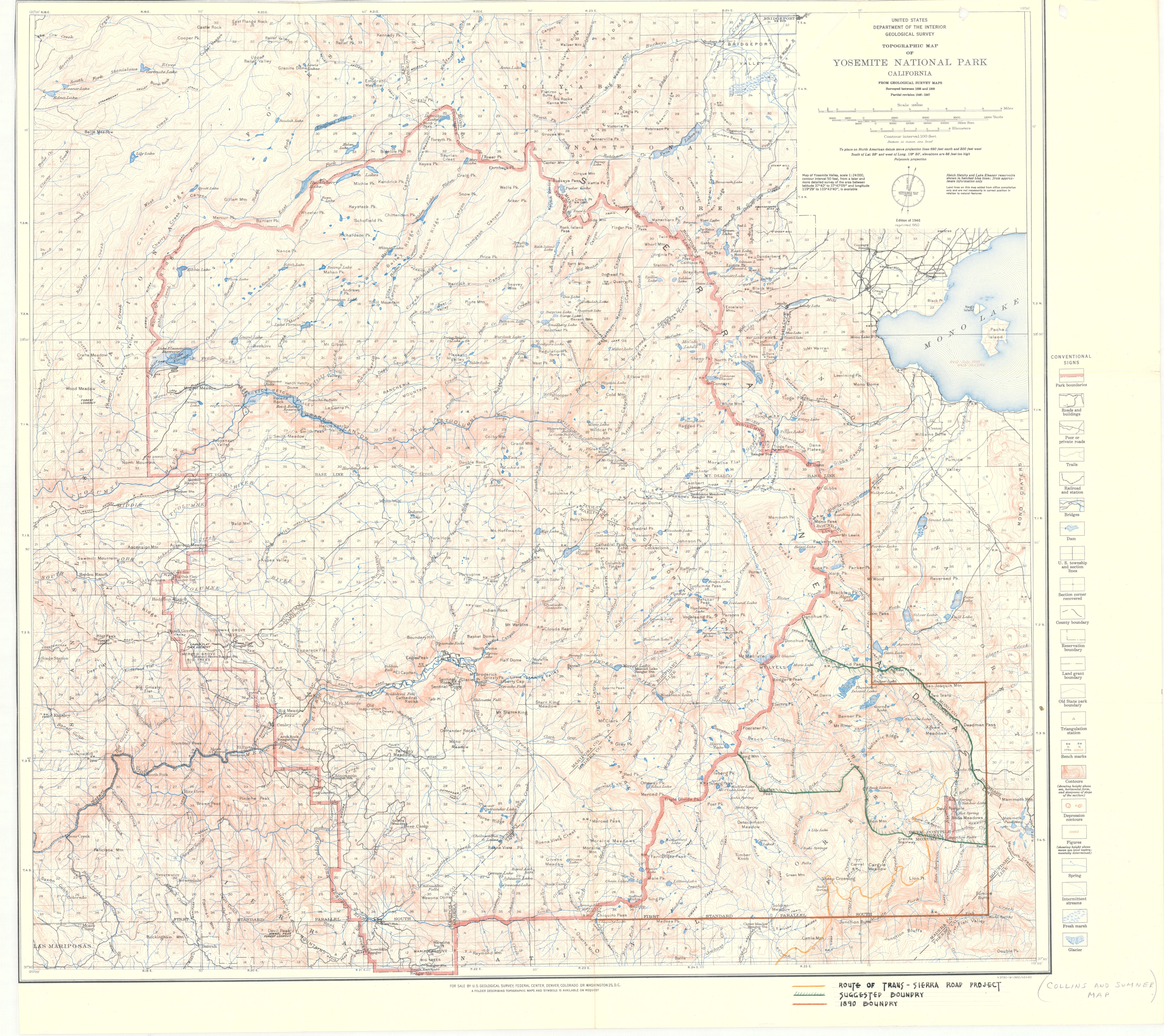
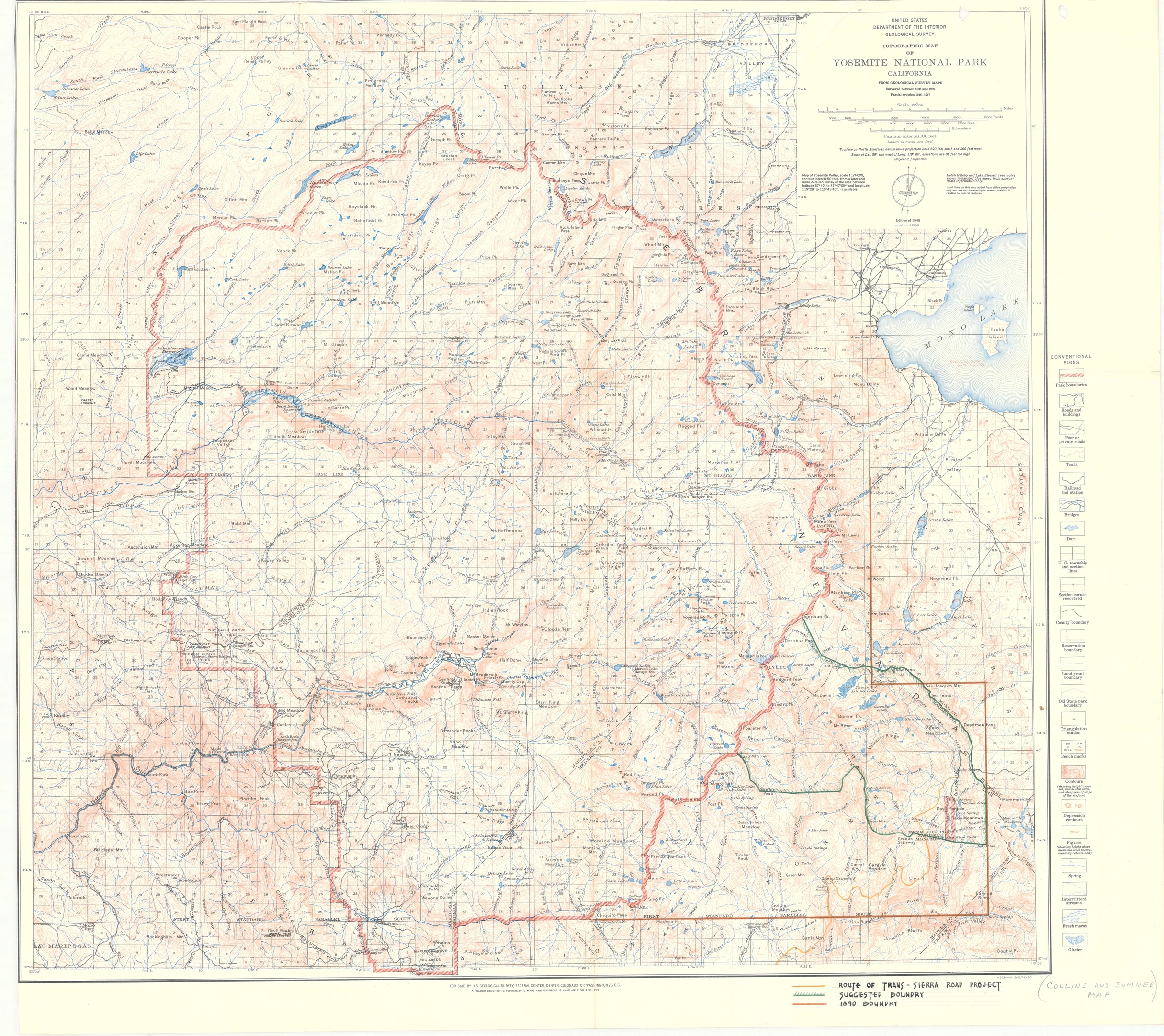
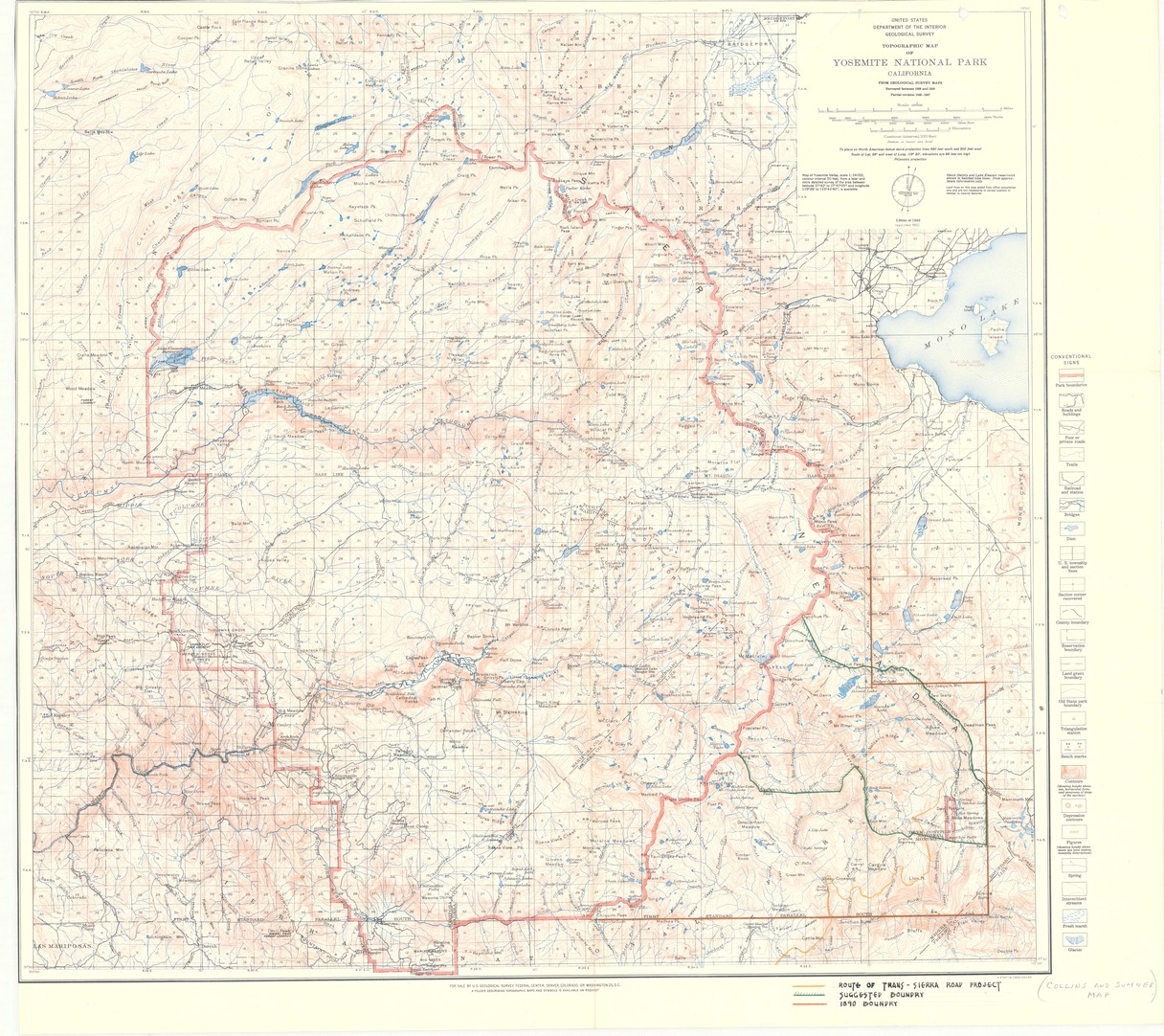
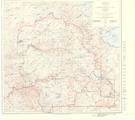
Topographic Map of Yosemite National Park, California
Topographic Map of Yosemite National Park, California
Aerial topographic grid map of Yosemite National Park showing proposed route of Trans-Sierra Roads Project
Item Number: YOSEAR000666F; AlternateId: 1002-007-F0009
Contact Yosemite National Park for more copyright information and use
Public domain:This digital asset is in the public domain. When using this asset for any purpose, including online, credit:'Courtesy U.S. National Parks'
Image
Yosemite National Park, Code: YOSE
Yosemite National Park, California
Latitude: 37.8399200439453, Longitude: -119.540397644043
Latitude: 37.8399200439453, Longitude: -119.540397644043
1950
01/01/1950 - 12/30/1950
Type: paper; Dimensions: 30 x 35; Condition: good
YOSE Location: E2 DR1 F8
Public Can View
Person: Archivist
Organization: US National Park Service
Address: Yosemite National Park Archives, PO Box 700-W, El Portal, CA 95318
Email: yose_archives@nps.gov
Organization: US National Park Service
Address: Yosemite National Park Archives, PO Box 700-W, El Portal, CA 95318
Email: yose_archives@nps.gov
Monday, July 25, 2022 10:29:53 PM
Monday, July 25, 2022 10:29:53 PM
YOSEAR000666F.tif
tif
150.5 MB
Scenic
,
Map