Select Item below to DOWNLOAD - Once item is selected, right click and choose 'save as'
4cb5faa5-08f7-41ee-ab40-ce2818e221cb
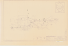
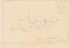
Tuolumne Meadows Vicinity: Part of the Master Plan
Tuolumne Meadows Vicinity: Part of the Master Plan
Map of proposed development in Tuolumne Meadows, with reference numbers in pen
Item Number: YOSEAR001330, AlternateId: 01-C-017.03, NP-YOS-2105, NP-YOS-2105-G, Sheet 1/1
Contact Yosemite National Park for more copyright information and use
Public domain:This digital asset is in the public domain. When using this asset for any purpose, including online, credit:'Courtesy U.S. National Parks'
Image
Yosemite National Park, Code: YOSE
Yosemite National Park, California
Yosemite National Park, California
Latitude: 37.8399200439453, Longitude: -119.540397644043
Yosemite National Park, California
Latitude: 37.8399200439453, Longitude: -119.540397644043
nd
nd
Type:paper diazo, Dimensions: 22 x 36, Condition: good
YOSE Location: E4 DR3 F3
Public Can View
Person: Archivist
Organization: US National Park Service
Address: Yosemite National Park Archives, PO Box 700-W, El Portal, CA 95318
Email: yose_archives@nps.gov
Organization: US National Park Service
Address: Yosemite National Park Archives, PO Box 700-W, El Portal, CA 95318
Email: yose_archives@nps.gov
Monday, August 7, 2023 6:54:08 PM
Monday, August 7, 2023 6:54:08 PM
YOSEAR001330.tif
tif
924.7 MB
Historic
,
Map