Select Item below to DOWNLOAD - Once item is selected, right click and choose 'save as'
ea311768-6ffe-4dd5-8da1-fd149c1cdf00
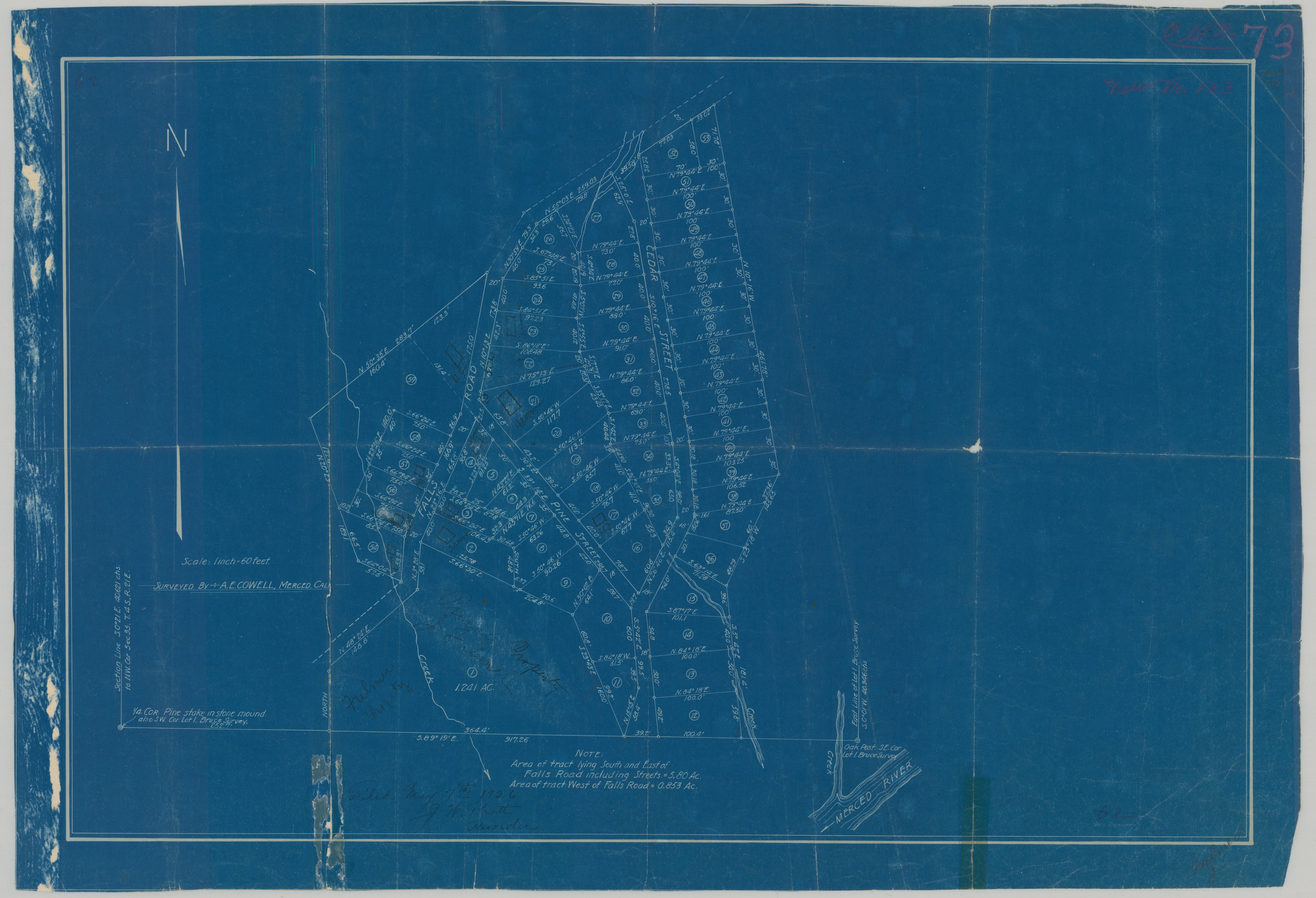
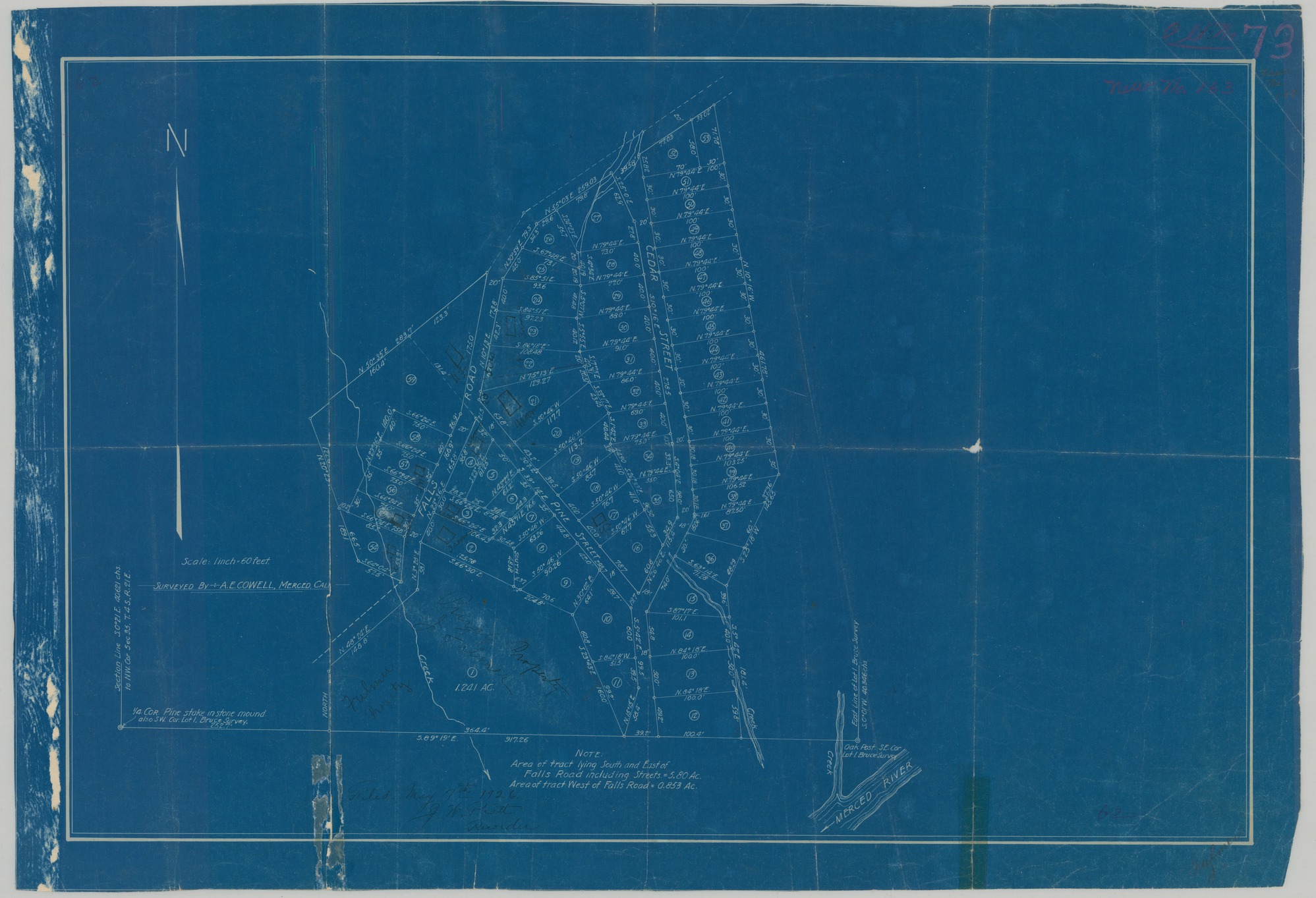
Wawona - South, East, and West of Falls Road
Wawona - South, East, and West of Falls Road
Map of land tracts including Merced River, Pine Street, Cedar Street, and Falls Road
Item Number YOSEMCA0163, Scan Number: YOSE_MCA_-0003
Contact Yosemite National Park for more copyright information and use
Restrictions apply on use and/or reproduction
Image
Yosemite National Park, Code: YOSE
Yosemite National Park, California
Yosemite National Park, California
Latitude: 37.8399200439453, Longitude: -119.540397644043
Yosemite National Park, California
Latitude: 37.8399200439453, Longitude: -119.540397644043
1926/05/07
05/07/1926
Type: Blueprint, Dimensions: 26 x 18
Public Can View
Person: Archivist
Organization: US National Park Service
Address: Yosemite National Park Archives, PO Box 700-W, El Portal, CA 95318
Email: yose_archives@nps.gov
Organization: US National Park Service
Address: Yosemite National Park Archives, PO Box 700-W, El Portal, CA 95318
Email: yose_archives@nps.gov
Wednesday, April 9, 2025 12:05:44 AM
Wednesday, April 9, 2025 12:05:44 AM
YOSEMCA0163.tif
tif
523.6 MB
Events
,
Map