Select Item below to DOWNLOAD - Once item is selected, right click and choose 'save as'
d91690f4-9f5b-4054-9ad6-6a86dc39f951
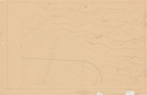
Topographic Map, Bridle Veil Area
Topographic Map, Bridle Veil Area
Portion of a topographic map of the Bridal Veil Area, marked with pen
Item Number: YOSEAR001407, AlternateId: 02-A-023.04, Sheet 5/10, Y8-40-20, 104/41317
Contact Yosemite National Park for more copyright information and use
Public domain:This digital asset is in the public domain. When using this asset for any purpose, including online, credit:'Courtesy U.S. National Parks'
104/41317, (YOSE TIC Number)
Image
Yosemite National Park, Code: YOSE
Yosemite National Park, California
Yosemite National Park, California
Latitude: 37.8399200439453, Longitude: -119.540397644043
Yosemite National Park, California
Latitude: 37.8399200439453, Longitude: -119.540397644043
nd
nd
Type:paper diazo, Dimensions: 24 x 36, Condition: needs preservation
YOSE Location: E4 DR4 F3
Public Can View
Person: Archivist
Organization: US National Park Service
Address: Yosemite National Park Archives, PO Box 700-W, El Portal, CA 95318
Email: yose_archives@nps.gov
Organization: US National Park Service
Address: Yosemite National Park Archives, PO Box 700-W, El Portal, CA 95318
Email: yose_archives@nps.gov
Monday, August 7, 2023 4:45:38 PM
Monday, August 7, 2023 4:45:38 PM
YOSEAR001407.tif
tif
899.6 MB
Historic
,
Map