Latitude: 37.8399200439453, Longitude: -119.540397644043
Organization: US National Park Service
Address: Yosemite National Park Archives, PO Box 700-W, El Portal, CA 95318
Email: yose_archives@nps.gov
Aerial photograph of Half Dome from flight over park.
Aerial photograph of Half Dome from flight over park.
Aerial photograph of flight over park, Half Dome.
Half Dome. Aerial Photograph of flight over park.
Half Dome from Rocky Point.
Cloud over Half Dome.
Ranger & Mrs. B. T. Campbell of Blue Ridge Parkway in foreground.
Half Dome & Merced River in the Fall.
Auto tour. Half Dome from Tioga Road.
Clouds over Half Dome.
Clouds over Half Dome.
Half Dome in the Fall.
Half Dome & Merced River from Sentinel Hotel.
Half Dome & Tenaya Canyon.
Clouds over Half Dome.
Upper End of Valley from Rocky Point.
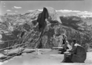
From Glacier Point.
Half Dome from Glacier Pt.
From Glacier Point.
From Ledge Trail.
From near Curry, Oaks in foreground during winter.
Telephoto from Sentinel Bridge.
From Sentinel Ridge, near dome.
Blossom Festival Caravan. Half Dome in Clouds.
Blossom Festival Caravan. Half Dome in Clouds.
From Glacier Pt.
View of Valley from top of Half Dome.
From Washburn Turn near Glacier Point.
YOSE RL_00617
Half Dome, Clouds Rest & North Dome from Rocky Point.
From Rocky Point.
From Rocky Point.
From Stoneman Bridge.
Half Dome from Mt. Watkins in late p.m. with clouds.
Half Dome from Snow Creek, above Teneya zigzags.
YOSE RL_00625
Half Dome, oak, and models in autumn.
Half Dome & fall color on road to Mirror Lk.
Half dome & oak tree in autumn.
Half Dome in autumn.
Half Dome and Washington Column in autumn.
From Sentinel Bridge.
Half Dome & Clouds.
Half Dome & Clouds. Miss Schmidt of The Washington office in foreground. Copy Neg: 1995, Leroy Radanovich.
From Washburn Turn.
From Glacier Pt.
From Washburn Turn.
From Glacier Pt.
From Glacier Point. Miss Schmidt of the Washington office in foregound.
Telephoto of Half Dome from Glacier Point.
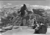
Tourists looking off Glacier Pt.
From Glacier Pt.
Ranger & Mrs. B.T. Campbell, Blue Ridge Pkwy, Va, in foreground.
YOSE RL_00646
Half Dome with interested visitor.
Half Dome & Clouds with Azalea bushes.
Half Dome from Columbia Point.
Valley from Columbia Point. Wide Angle.
Valley from Columbia Point. Wide Angles.
Valley looking east from Columbia Pt.
Half Dome from Olmsted Overlook.
Half Dome through autumn foliage.
People on bicycles with Half Dome in background. For publicity.
Auto Tour illustration
Auto Tour illustration
Auto Tour illustration
Auto Tour illustration
YOSE RL_00664
Half Dome & clouds.
Half Dome & clouds.
Half Dome & Lincoln Zephyr.
Half Dome from point near 11 mile trail.
Half Dome from Sentinel Bridge.
Half Dome & Merced River.
Half Dome & Merced River.
Group on bird walk as seen from Sentinel Bridge.
YOSE RL_00676
YOSE RL_00677
Half Dome & people on beach near Lodge.
Half Dome near Camp 6.
YOSE RL_00681
View across site of old elk paddock.
View across site of old elk paddock.
YOSE RL_00684
Half Dome with herd of deer.
Half Dome from second story of Sentinel Hotel.
Half Dome and meadow flowers.
Half Dome from Sentinel Bridge.
Telephoto of Half Dome showing face contours.
Telephoto of Half Dome showing face contours.
Telephoto of Half Dome showing face contours.
Telephoto of Half Dome showing face contours.
YOSE RL_00693
Half Dome & Vernal, Neavda from Glacier Point. Copy Neg: Leroy Radanovich, February 2004.
Valley from Columbia Point.
YOSE RL_01122
YOSE RL_01123
Merced River and Half Dome
Half Dome and meadow flowers.
Panorama Cliffs & trails, with Half Dome in the background & Illilouette Fall in the foreground.
Half Dome and road in Yosemite Valley.
Half Dome and road in Yosemite Valley.
Half Dome, Yosemite, California. (01 - 74-F - 15) (12-8-25-1 P) (12-1,000). Purpose: Research. Requested by Moffett on 1/24/40. Photocopied by Schwenk on 1/26/40. From Order 2419.
YOSE RL_12542
YOSE RL_12603
Copy Neg: Mike Floyd, 1992. CCC workes replacing the Half Dome cables.
YOSE RL_14420
Copied from the photo album of Robert Lindsey, who worked on the Yosemite Valley survey as a civil enginner. 1903 - 1905. Copied October 1983 by Michael Dixon.
Infared photo of Half Dome from Glacier Point. Copied from Art Holmes album (NPS employee). Copied September 1983 by Michael Dixon.
YOSE RL_15690
South Dome. Wildflowers in meadow. Evening primroses.
View of Half Dome from Glacier Pt.
YOSE RL_16286
Flooded Merced River in foreground with Half Dome in background. Notation on bottom edge of print: "North Dome, Yosemite, CAL; C. R. Savage, Salt Lake". Original print in Yosemite Collections, cat. no. 21,950. This is a copy neg. made by Michael Dixon from
YOSE RL_17015
Copy Neg: Leroy Radanovich, October 2001. Stereview. 1248 Tisayack, from Mount Waiya (Pine Mountain). Valley of the Yosemite. Illustrated by Muybridge. Published by Bradley & Rulofson. Note: Pine Mountain was an early name for Mt. Watkins.
Copy Neg: Michael Dixon, September 1981. Summit of Half Dome from northeast.