Select Item below to DOWNLOAD - Once item is selected, right click and choose 'save as'
d2189749-98c5-4723-b713-339b9a2b4c3c
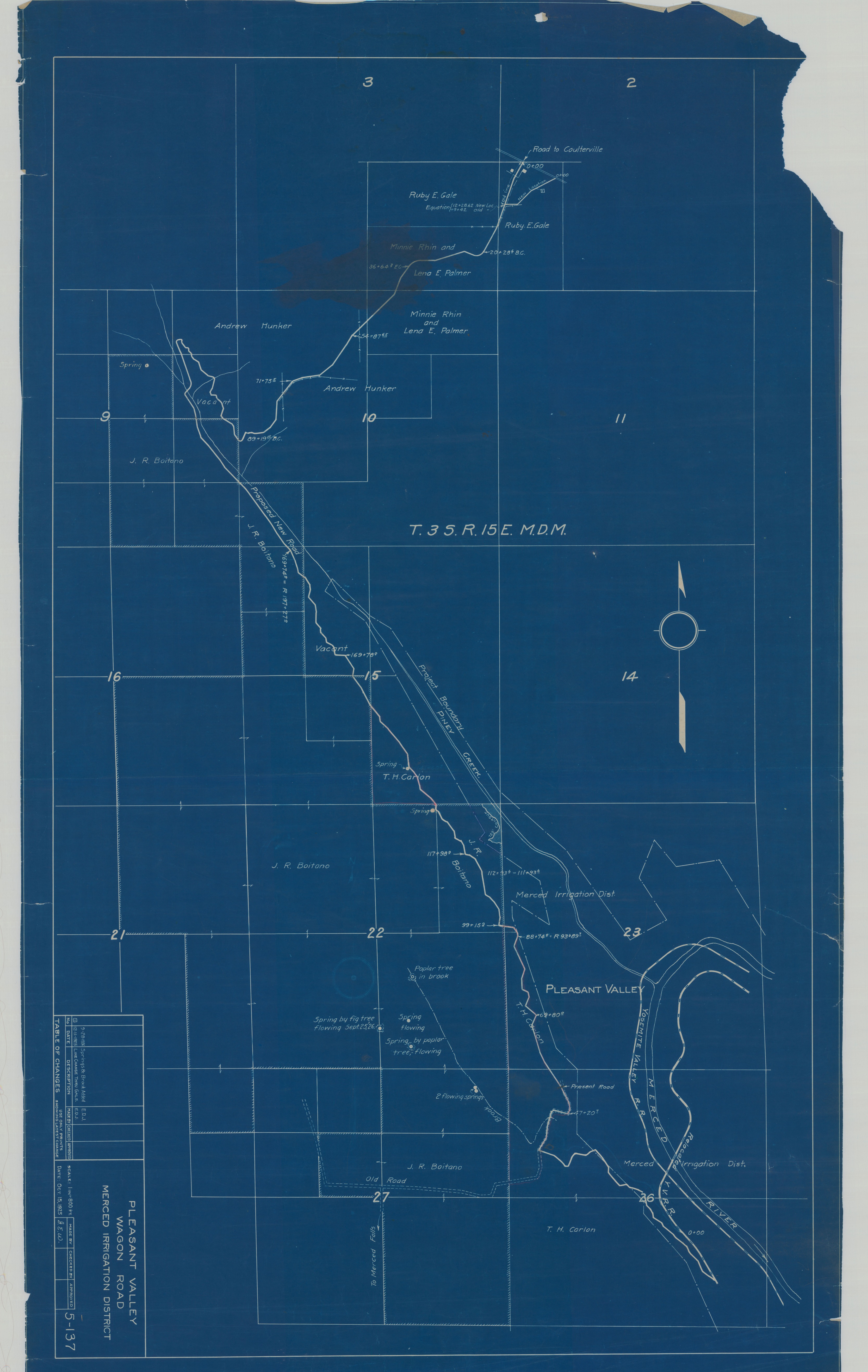
Pleasant Valley Wagon Road, Merced Irrigation District
Pleasant Valley Wagon Road, Merced Irrigation District
Blueprint showing map of wagon road in T.3S. R.15E. M.D.M., including the following updates: line change thru gale, and springs & brooks added, and including the following features and lands: T. H. Carlon, Yosemite Valley Railroad and relocated YVRR, Merced River, J. R. Boitano, springs, Merced Irrigation District, Piney Creek, Andrew Hunker, Minnie Rhin and Lena E. Palmer, Ruby E. Gale, Road to Coulterville
Item Number YOSEMCA1118, Scan Number: YOSE_MCA_-0016
Contact Yosemite National Park for more copyright information and use
Restrictions apply on use and/or reproduction
Image
Yosemite National Park, Code: YOSE
Yosemite National Park, California
Yosemite National Park, California
Latitude: 37.8399200439453, Longitude: -119.540397644043
Yosemite National Park, California
Latitude: 37.8399200439453, Longitude: -119.540397644043
1926/09/28
09/28/1926
Type: Blueprint, Dimensions: 21 x 36
Public Can View
Person: Archivist
Organization: US National Park Service
Address: Yosemite National Park Archives, PO Box 700-W, El Portal, CA 95318
Email: yose_archives@nps.gov
Organization: US National Park Service
Address: Yosemite National Park Archives, PO Box 700-W, El Portal, CA 95318
Email: yose_archives@nps.gov
Tuesday, April 8, 2025 8:21:35 PM
Tuesday, April 8, 2025 8:21:35 PM
YOSEMCA1118.tif
tif
842.1 MB
Events
,
Map