, Structures-Maps, Plans, Drawings, (Yosemite Series Description)
Latitude: 37.8399200439453, Longitude: -119.540397644043
Organization: US National Park Service
Address: Yosemite National Park Archives, PO Box 700-W, El Portal, CA 95318
Email: yose_archives@nps.gov
Copy photos of GS map of Yose. Valley showing small section around Gov't Center.
Map of Yosemite from contour map
Ansel Hall's relief map of Yosemite Valley. Photo unknown, map by Ansel Hall
Section of the Floor of the Valley map.
Sewer map of Yosemite Valley
Copy of map of the upper end of the valley.
Map of Yosemite National Park
YOSE RL_12765
Copied from an information circular for a Museum exhibit. Copied on January 20, 1944 by Ralph H. Anderson
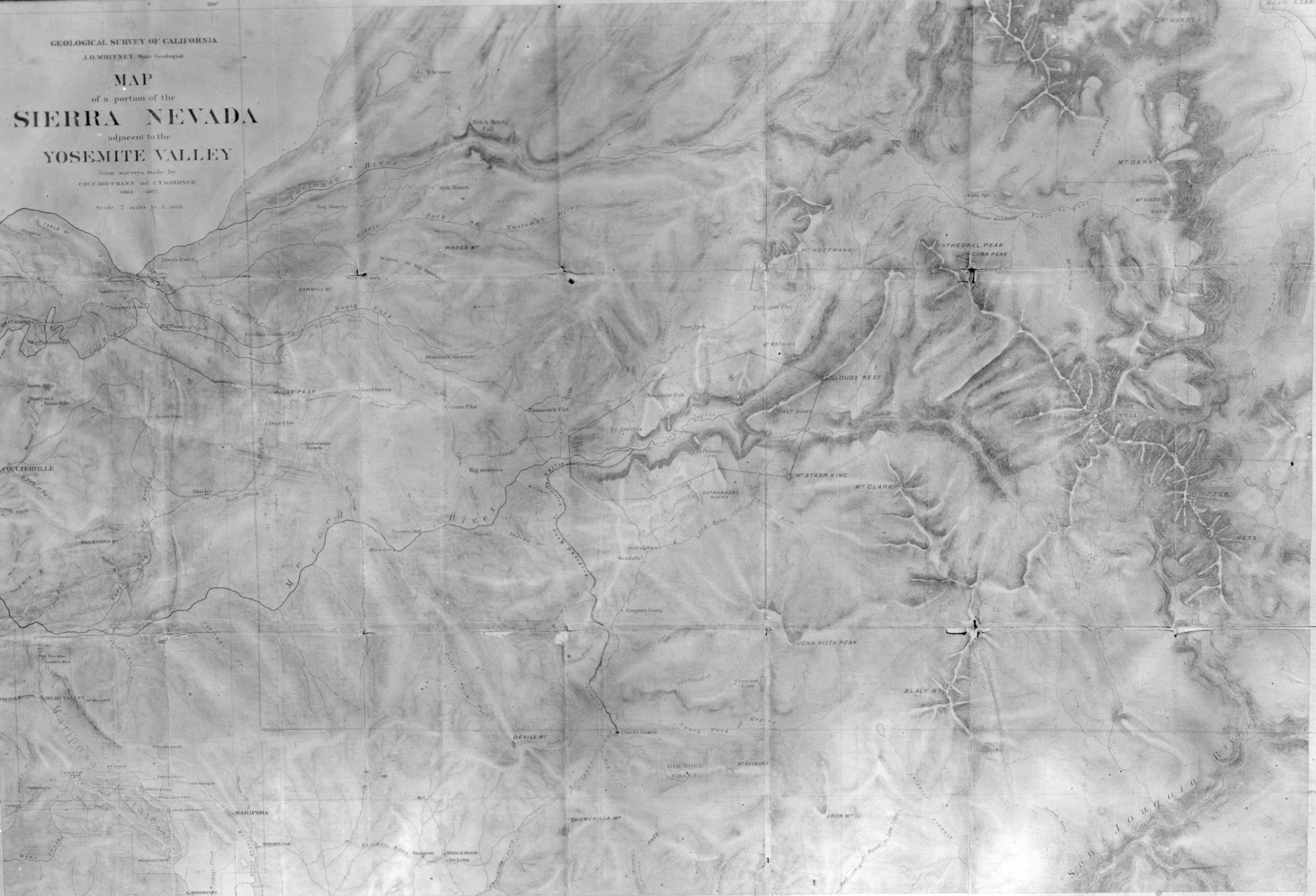
Map of Yosemite area. From surveys done by Hoffman & Gardner, 1863-1867. Copied by Michael Dixon, June, 1981.
A cartograph of Yosemite Valley. Copied from Art Holmes album (NPS employee). Copied September 1983 by Michael Dixon.
1865 Map of Yosemite Valley by C. King and J.T. Gardner. Copied October 1980 by Michael Dixon.
Copy Neg: Leroy Radanovich, January 2003. Section of the 1938 Guide Map.
Copy Neg: Michael Dixon, 1985. Map of Yosemite Grant survey - 1883. Yosemite & Big Trees Grant,