Select Item below to DOWNLOAD - Once item is selected, right click and choose 'save as'
594f5345524f434b2022020181129011
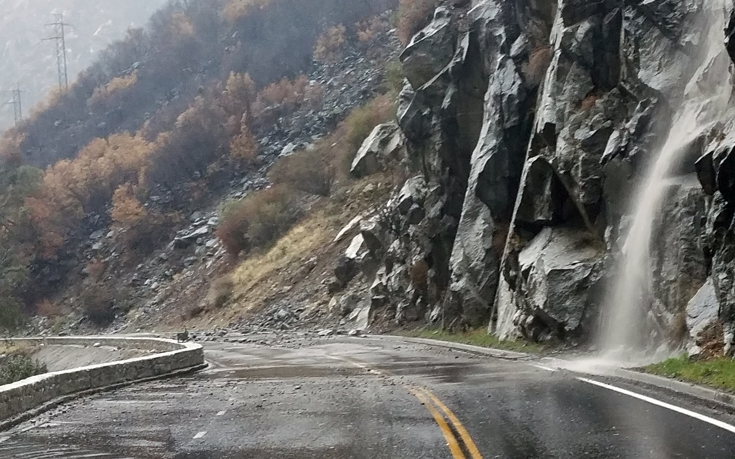
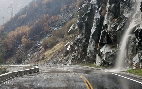
2018 El Portal Road debris flow | debris slide
Water rushing down a rock slope and pooling on the road with rock debris, sand and silt across both lanes.
During a period of high intensity rainfall (0.6 cm/hour) there were several small debris slides and debris flows onto the El Portal Road within the area burned by the Ferguson Fire. Several small rocks fell onto the road at Parkline, and about 5 separate small debris flows came onto the road between Cookie Cliff and Arch Rock. These debris flows consisted of sand and silt.
UTM East: 257531; UTM North: 4173691; Elevation: 748
U.S. National Park Service
To the best of our knowledge we believe this image to be copyright free and in the public domain. When using this asset for any purpose, including online, credit: 'Courtesy U.S. National Parks'
NPS Photographer
Public domain
image
Yosemite National Park, Code: YOSE
Merced River Gorge
Latitude: 37.6783973273819, Longitude: -119.74945588
El Portal Road
Yosemite National Park, California
Latitude: 37.8399200439453, Longitude: -119.540397644043
Latitude: 37.6783973273819, Longitude: -119.74945588
El Portal Road
Yosemite National Park, California
Latitude: 37.8399200439453, Longitude: -119.540397644043
20181129
11/29/2018
Public Can View
Organization: Yosemite NP
Position: Park Geologist
Address: El Portal, CA 95318
Email: greg_stock@nps.gov
Position: Park Geologist
Address: El Portal, CA 95318
Email: greg_stock@nps.gov
Wednesday, May 11, 2022 11:43:51 PM
Tuesday, August 9, 2022 5:48:29 PM
2018112901_1_NPS.jpg
jpg
2.8 MB
Events