Select Item below to DOWNLOAD - Once item is selected, right click and choose 'save as'
594f5345524f434b2022020160107012
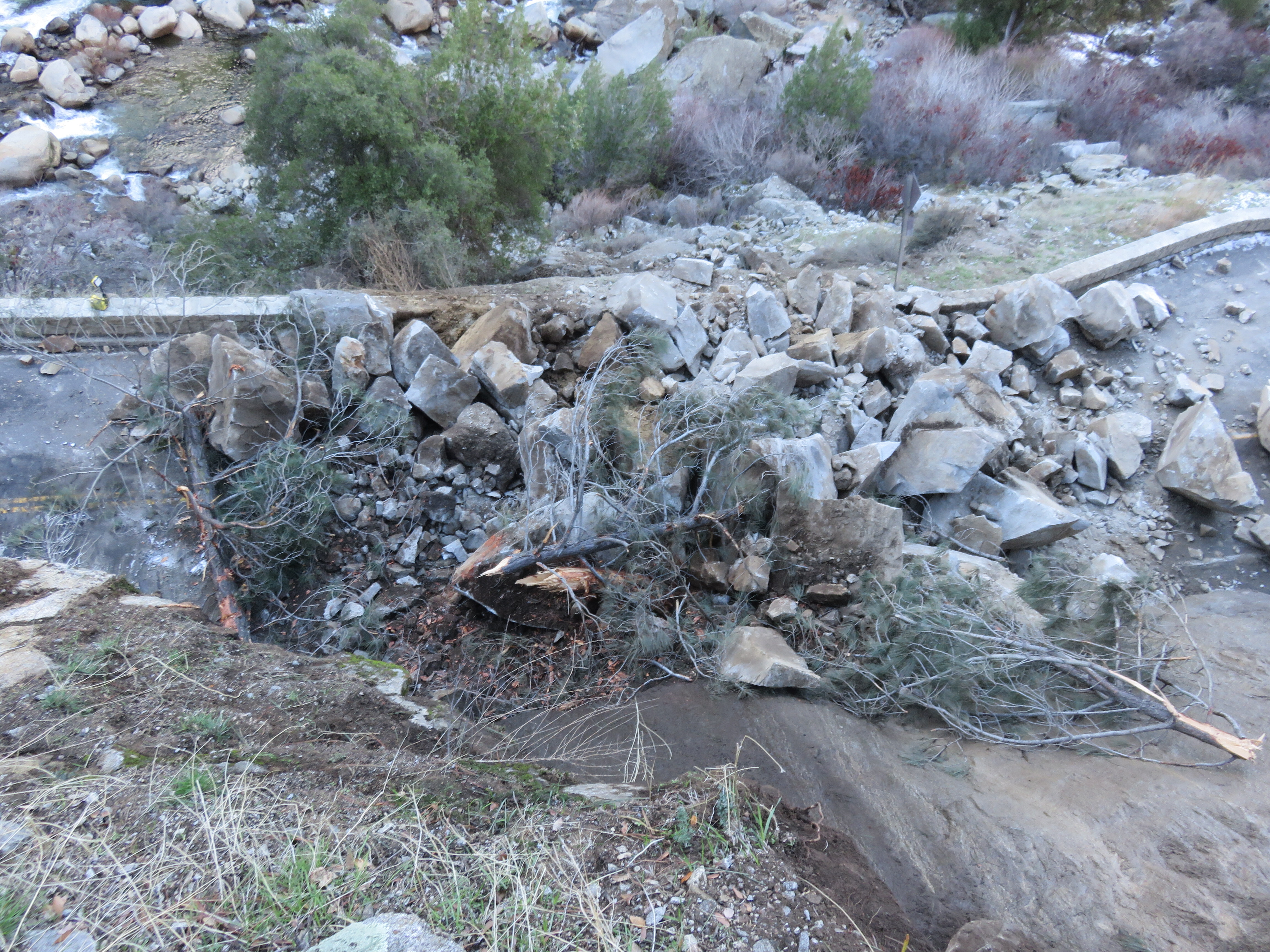
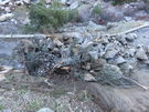
2016 Dog Rock rock slide
View from above looking down at fresh boulders and downed trees covering both lanes of a road and debris extending down the slope below.
A substantial debris flow blocked both lanes of El Portal Road at Little Windy Point. Both lanes were covered by rock debris and boulders. The rock mass slid down the lower slab and landed on the road, depositing rock blocks across both lanes of Hwy 140. The rock slide destabilized a 10 m tall tree that came to rest with its roots on the rock slide deposit and crown leaning against the source area.
UTM East: 257597; UTM North: 4173638; Elevation: 743
U.S. National Park Service
To the best of our knowledge we believe this image to be copyright free and in the public domain. When using this asset for any purpose, including online, credit: 'Courtesy U.S. National Parks'
Brian Collins / USGS
Public domain
image
Yosemite National Park, Code: YOSE
Merced River Gorge
Latitude: 37.6779376081453, Longitude: -119.74869065
El Portal Road
Dog Rock
Yosemite National Park, California
Latitude: 37.8399200439453, Longitude: -119.540397644043
Latitude: 37.6779376081453, Longitude: -119.74869065
El Portal Road
Dog Rock
Yosemite National Park, California
Latitude: 37.8399200439453, Longitude: -119.540397644043
20160108
01/07/2016
Public Can View
Organization: Yosemite NP
Position: Park Geologist
Address: El Portal, CA 95318
Email: greg_stock@nps.gov
Position: Park Geologist
Address: El Portal, CA 95318
Email: greg_stock@nps.gov
Wednesday, May 11, 2022 11:49:59 PM
Tuesday, August 9, 2022 6:10:27 PM
2016010701_2_USGS_Brian_Collins.jpg
jpg
5.9 MB
Events