Select Item below to DOWNLOAD - Once item is selected, right click and choose 'save as'
594f5345524f434b2022020140208051
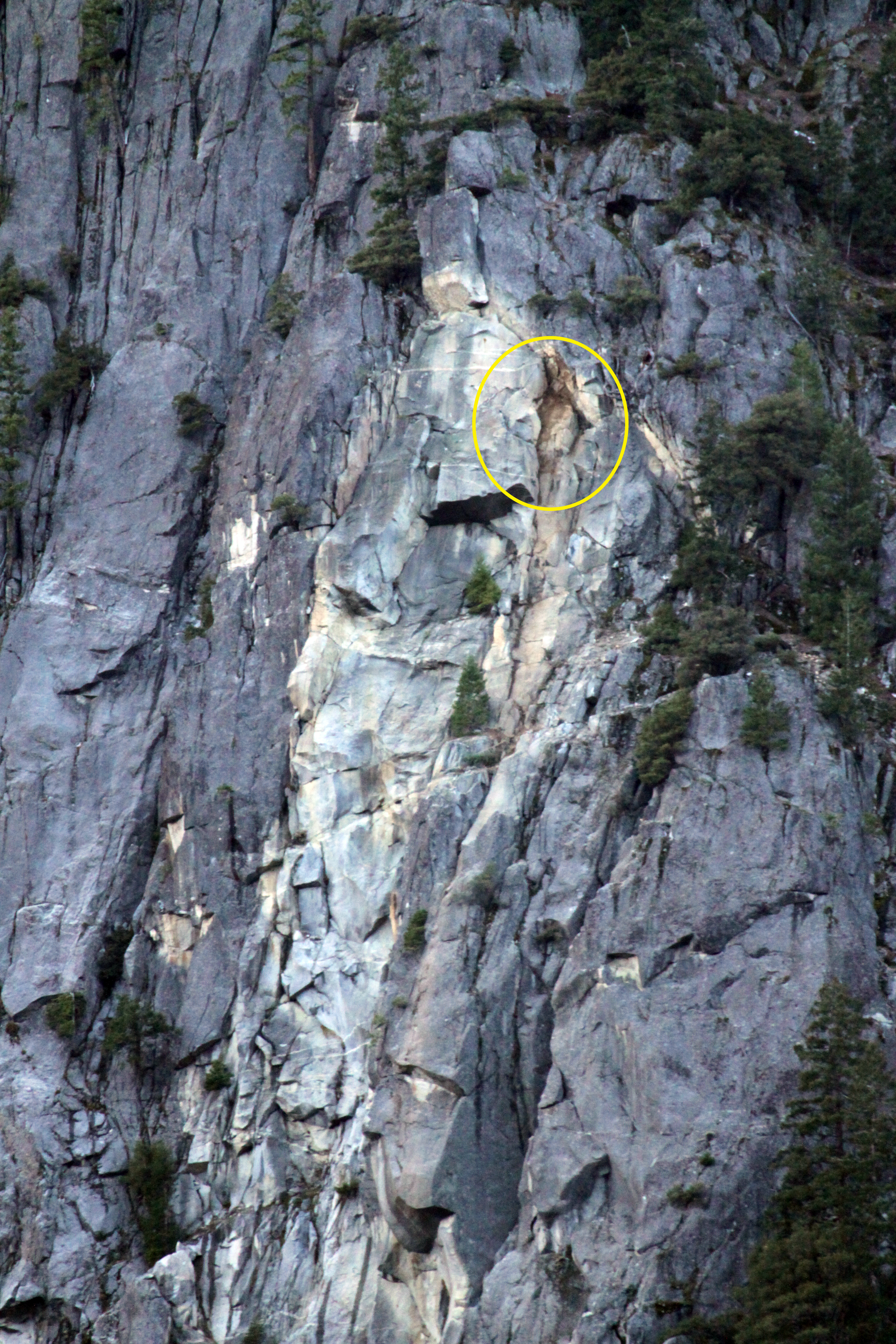
2014 LeConte Gully rock fall
Rock fall source area, circled in yellow, on the side of a larger rock fall scar.
A rock fall from the west wall of LeConte Gully below Glacier Point, producing rock fall sounds lasting approximately 15 seconds. A block about 13 meters tall, 10 meters wide, and up to 3 m thick, fell from the right side of an existing rock fall scar.
UTM East: 272341; UTM North: 4179786; Elevation: 1651
U.S. National Park Service
To the best of our knowledge we believe this image to be copyright free and in the public domain. When using this asset for any purpose, including online, credit: 'Courtesy U.S. National Parks'
NPS Photographer
Public domain
image
Yosemite National Park, Code: YOSE
Glacier Point
Latitude: 272341, Longitude: 4179786
Le Conte Gully
Yosemite National Park, California
Latitude: 37.8399200439453, Longitude: -119.540397644043
Latitude: 272341, Longitude: 4179786
Le Conte Gully
Yosemite National Park, California
Latitude: 37.8399200439453, Longitude: -119.540397644043
20140208
02/08/2014
Public Can View
Organization: Yosemite NP
Position: Park Geologist
Address: El Portal, CA 95318
Email: greg_stock@nps.gov
Position: Park Geologist
Address: El Portal, CA 95318
Email: greg_stock@nps.gov
Thursday, July 21, 2022 4:51:35 PM
Wednesday, November 30, 2022 7:46:49 PM
2014020801_1_NPS.jpg
jpg
10.1 MB
Events