Select Item below to DOWNLOAD - Once item is selected, right click and choose 'save as'
594f5345524f434b2022020080228011
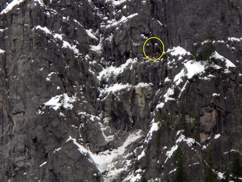
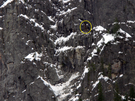
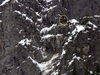
2008 LeConte Gully rock fall
A close perspective of source area on cliff, circled in yellow.
Arock fall was clearly heard in Curry and Yosemite Villages, and the subsequent investigation at sunrise revealed dust and rock debris on the snow in lower LeConte Gully, below the junction with the Ledge Trail. The rock fall originated from the cliff forming the west wall of LeConte Gully, slid down a short bedrock chute, and then free-fell over 100 m into LeConte Gully with some debris then sliding on snow down the gully.
UTM East: 272536; UTM North: 4179419; Elevation: 1959
U.S. National Park Service
To the best of our knowledge we believe this image to be copyright free and in the public domain. When using this asset for any purpose, including online, credit: 'Courtesy U.S. National Parks'
NPS Photographer
Public domain
image
Yosemite National Park, Code: YOSE
Glacier Point
Latitude: 37.7338163749308, Longitude: -119.58126086
LeConte Gully
Yosemite National Park, California
Latitude: 37.8399200439453, Longitude: -119.540397644043
Latitude: 37.7338163749308, Longitude: -119.58126086
LeConte Gully
Yosemite National Park, California
Latitude: 37.8399200439453, Longitude: -119.540397644043
20080101
02/28/2008
Public Can View
Organization: Yosemite NP
Position: Park Geologist
Address: El Portal, CA 95318
Email: greg_stock@nps.gov
Position: Park Geologist
Address: El Portal, CA 95318
Email: greg_stock@nps.gov
Thursday, May 12, 2022 12:01:41 AM
Thursday, July 28, 2022 7:59:38 PM
2008022801_1_NPS.jpg
jpg
1.6 MB
Events