Select Item below to DOWNLOAD - Once item is selected, right click and choose 'save as'
486beef4-67de-42c8-9f5c-85ccb9556d46
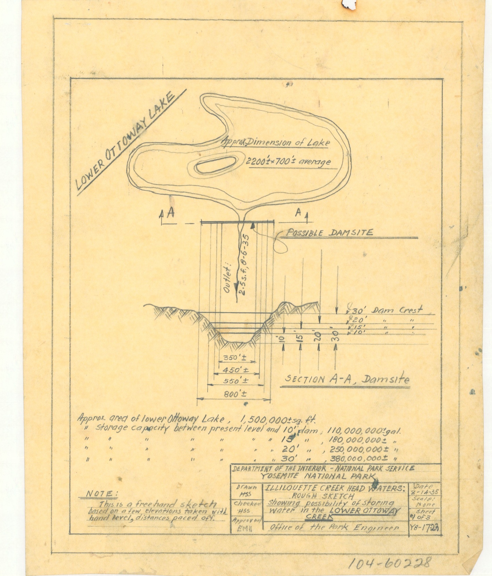
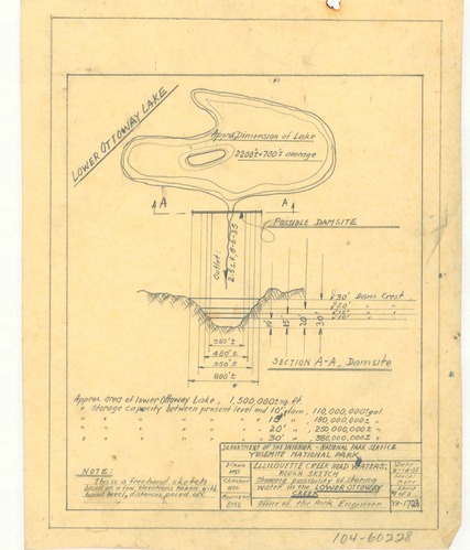
Illilouette Creek Head Waters: Rough Sketch Showing Possibility of Storage of Water in the Lower Ottoway Creek
Illilouette Creek Head Waters: Rough Sketch Showing Possibility of Storage of Water in the Lower Ottoway Creek
Sketch of Illilouette Creek Head Waters showing the possibility of storage water in the Lower Ottoway Creek
Item Number: YOSEAR000929A; AlternateId: 104-60228, Y8-17-23, Sheet 1 of 3
Contact Yosemite National Park for more copyright information and use
Public domain:This digital asset is in the public domain. When using this asset for any purpose, including online, credit:'Courtesy U.S. National Parks'
Image
Yosemite National Park, Code: YOSE
Yosemite National Park, California
Latitude: 37.8399200439453, Longitude: -119.540397644043
Latitude: 37.8399200439453, Longitude: -119.540397644043
1935
01/01/1935 - 12/30/1935
Type: tracing paper; Dimensions: 10.5 x 8; Condition: good
YOSE Location: E3 DR1 F1
Public Can View
Person: Archivist
Organization: US National Park Service
Address: Yosemite National Park Archives, PO Box 700-W, El Portal, CA 95318
Email: yose_archives@nps.gov
Organization: US National Park Service
Address: Yosemite National Park Archives, PO Box 700-W, El Portal, CA 95318
Email: yose_archives@nps.gov
Monday, July 25, 2022 3:49:17 PM
Monday, July 25, 2022 3:49:17 PM
YOSEAR000929A.tif
tif
20.0 MB
Scenic
,
Map