Select Item below to DOWNLOAD - Once item is selected, right click and choose 'save as'
48319228-bbfb-48f5-902f-ddbb0c4d441b
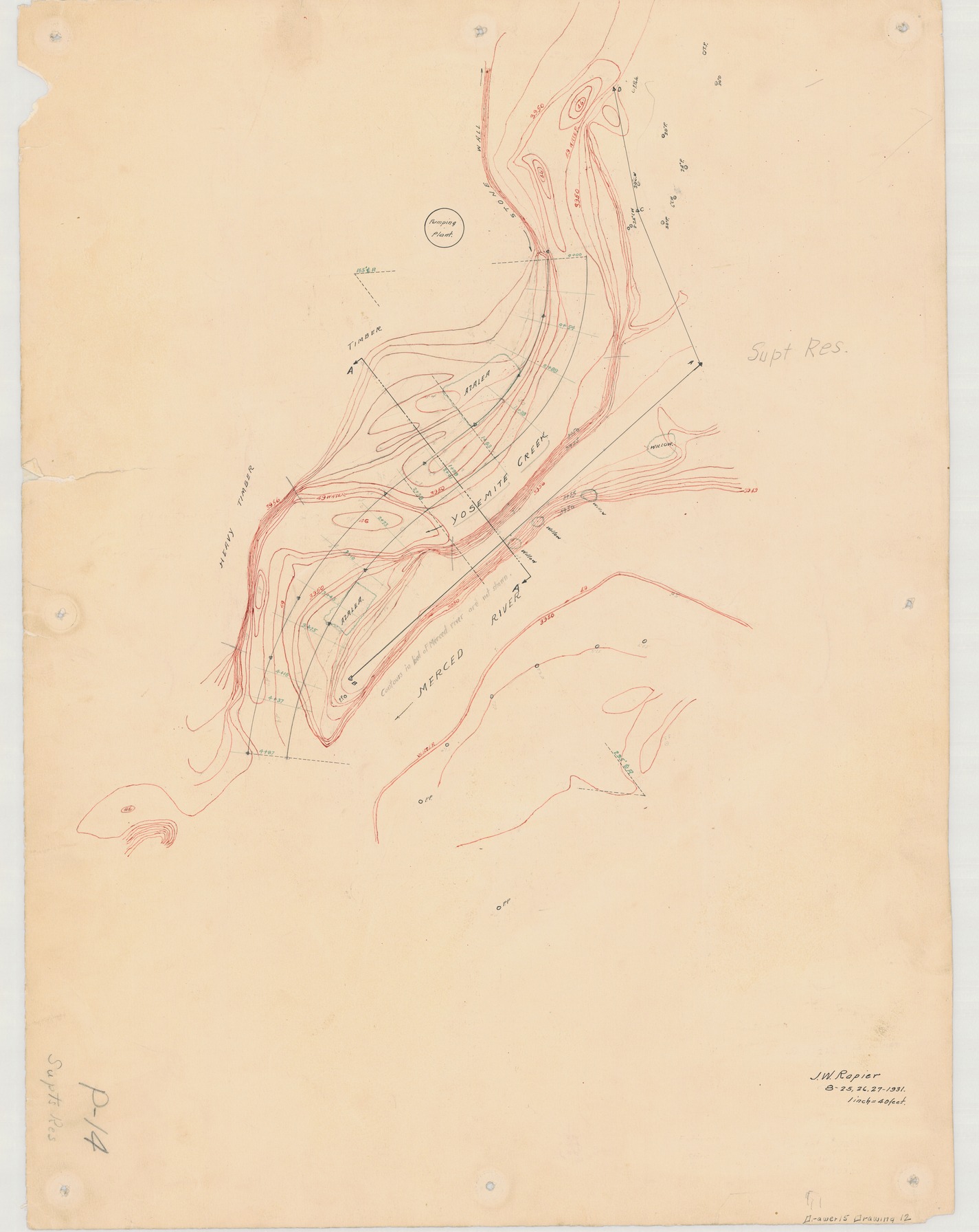
Topographic map of Yosemite Creek and Merced River Area
Topographic map of Yosemite Creek and Merced River Area
Topographic map of Yosemite Creek and Merced River Area, with Azaleas, and pumping plant
Item Number: YOSEAR001423, AlternateId: 02-A-018, P-14, Drawer #15, Drawing #12
Contact Yosemite National Park for more copyright information and use
Public domain:This digital asset is in the public domain. When using this asset for any purpose, including online, credit:'Courtesy U.S. National Parks'
Image
Yosemite National Park, Code: YOSE
Yosemite National Park, California
Yosemite National Park, California
Latitude: 37.8399200439453, Longitude: -119.540397644043
Yosemite National Park, California
Latitude: 37.8399200439453, Longitude: -119.540397644043
1931
01/01/1931 - 12/30/1931
Type:drawing paper, Dimensions: 24 x 18, Condition: good
YOSE Location: E4 DR4 F2
Public Can View
Person: Archivist
Organization: US National Park Service
Address: Yosemite National Park Archives, PO Box 700-W, El Portal, CA 95318
Email: yose_archives@nps.gov
Organization: US National Park Service
Address: Yosemite National Park Archives, PO Box 700-W, El Portal, CA 95318
Email: yose_archives@nps.gov
Monday, August 7, 2023 4:26:04 PM
Monday, August 7, 2023 4:26:04 PM
YOSEAR001423.tif
tif
490.9 MB
Historic
,
Map