Select Item below to DOWNLOAD - Once item is selected, right click and choose 'save as'
48288c16-6765-4a75-aced-1cc55e531970
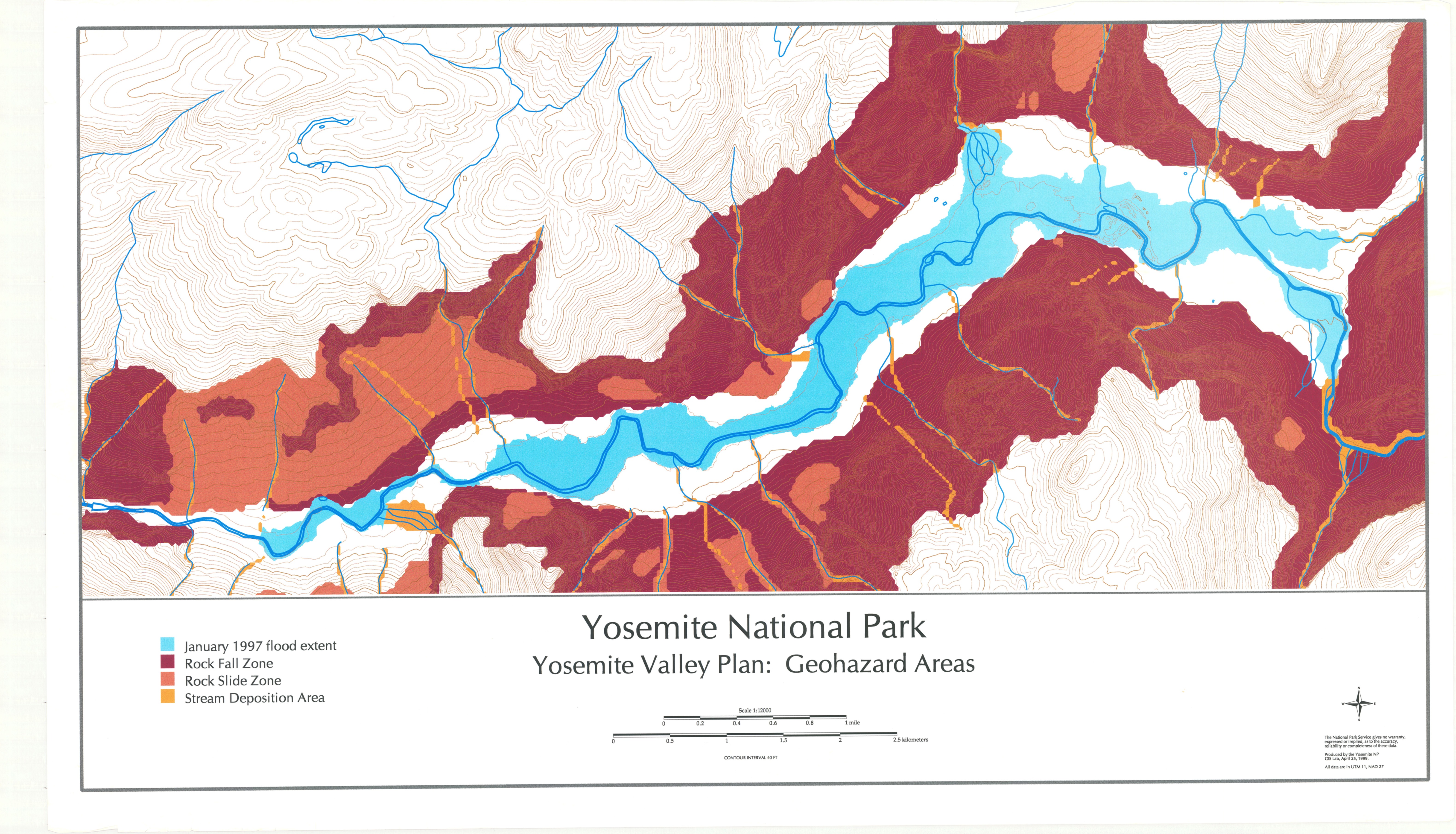
Yosemite National Park Yosemite Valley Plan: Geohazard Areas
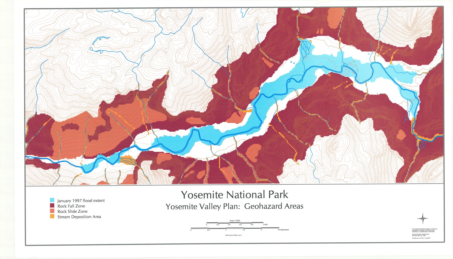
Yosemite National Park Yosemite Valley Plan: Geohazard Areas
Topographic map of Yosemite Valley with flood extent, rock fall and slide zones, and stream deposition areas marked
Item Number: YOSEAR000897C
Contact Yosemite National Park for more copyright information and use
Public domain:This digital asset is in the public domain. When using this asset for any purpose, including online, credit:'Courtesy U.S. National Parks'
Image
Yosemite National Park, Code: YOSE
Yosemite National Park, California
Latitude: 37.8399200439453, Longitude: -119.540397644043
Latitude: 37.8399200439453, Longitude: -119.540397644043
1999
01/01/1999 - 12/30/1999
Type: paper; Dimensions: 24 x 41; Condition: good
YOSE Location: E2 DR10 F5
Public Can View
Person: Archivist
Organization: US National Park Service
Address: Yosemite National Park Archives, PO Box 700-W, El Portal, CA 95318
Email: yose_archives@nps.gov
Organization: US National Park Service
Address: Yosemite National Park Archives, PO Box 700-W, El Portal, CA 95318
Email: yose_archives@nps.gov
Monday, July 25, 2022 8:23:56 PM
Monday, July 25, 2022 8:23:56 PM
YOSEAR000897C.tif
tif
127.0 MB
Scenic
,
Map