Select Item below to DOWNLOAD - Once item is selected, right click and choose 'save as'
267a7560-8955-4122-b3c8-1b6ae7879539
Vehicle Travel Plan
Vehicle Travel Plan
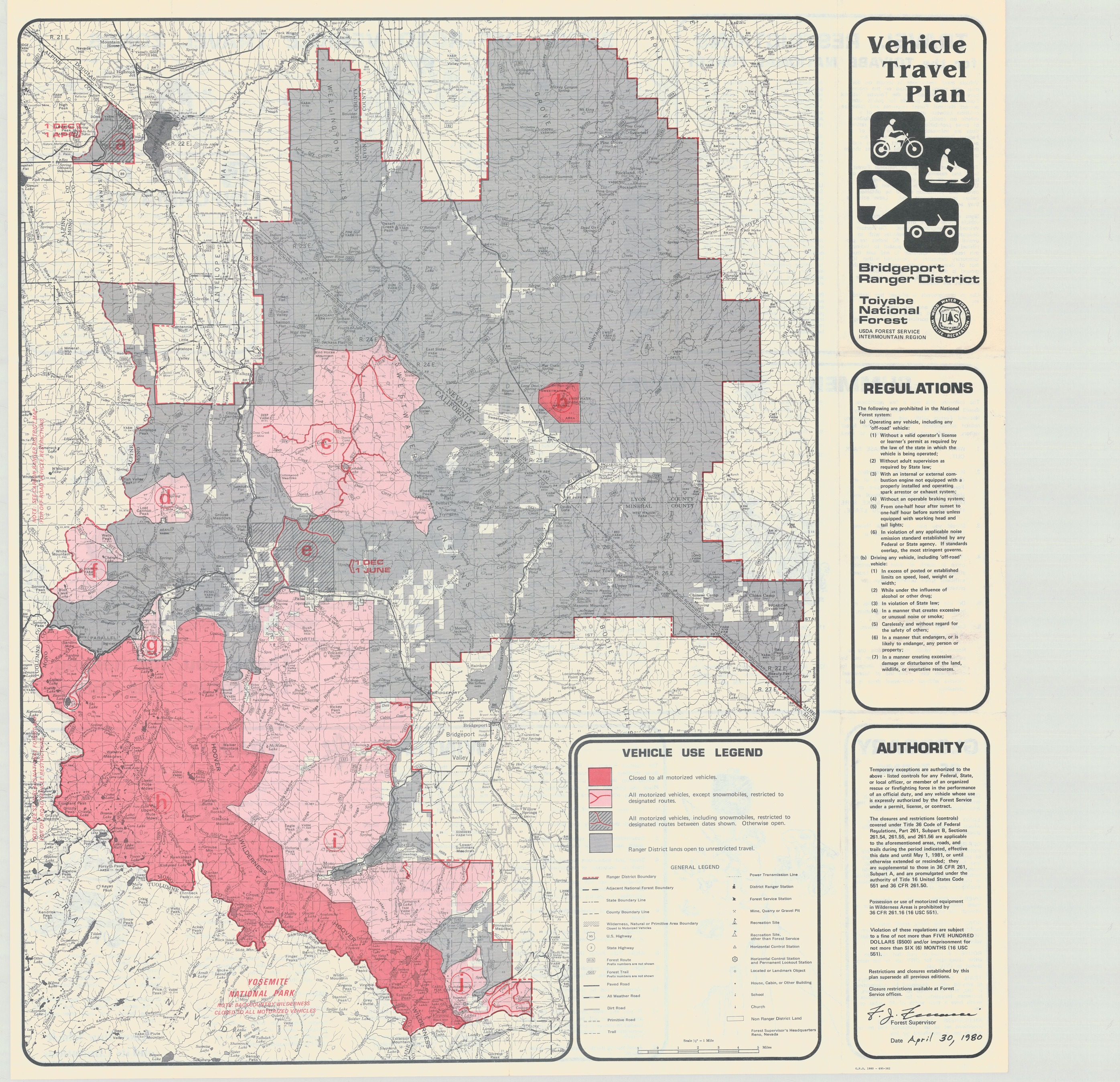
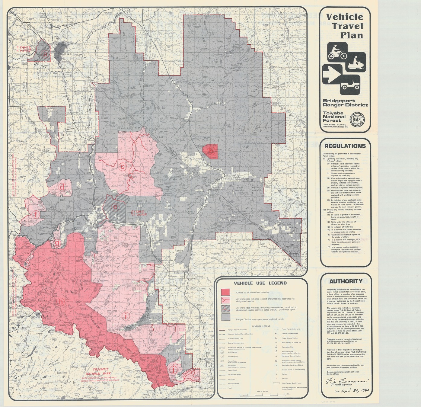
Map of Yosemite National Park showing areas closed to various types of vehicles and list of regulations
Item Number: YOSEAR000771Ai; AlternateId: 1002-007-F0896, G.P.O. 1980-695-382
Contact Yosemite National Park for more copyright information and use
Public domain:This digital asset is in the public domain. When using this asset for any purpose, including online, credit:'Courtesy U.S. National Parks'
Image
Yosemite National Park, Code: YOSE
Yosemite National Park, California
Latitude: 37.8399200439453, Longitude: -119.540397644043
Latitude: 37.8399200439453, Longitude: -119.540397644043
1980
01/01/1980 - 12/30/1980
Type: paper; Dimensions: 27 x 24.5; Condition: good
YOSE Location: E2 DR5 F2
Public Can View
Person: Archivist
Organization: US National Park Service
Address: Yosemite National Park Archives, PO Box 700-W, El Portal, CA 95318
Email: yose_archives@nps.gov
Organization: US National Park Service
Address: Yosemite National Park Archives, PO Box 700-W, El Portal, CA 95318
Email: yose_archives@nps.gov
Monday, July 25, 2022 9:55:23 PM
Monday, July 25, 2022 9:55:23 PM
YOSEAR000771Ai.tif
tif
67.6 MB
Scenic
,
Map