Select Item below to DOWNLOAD - Once item is selected, right click and choose 'save as'
1bd8bd64-de5c-4f53-839d-798f66763127
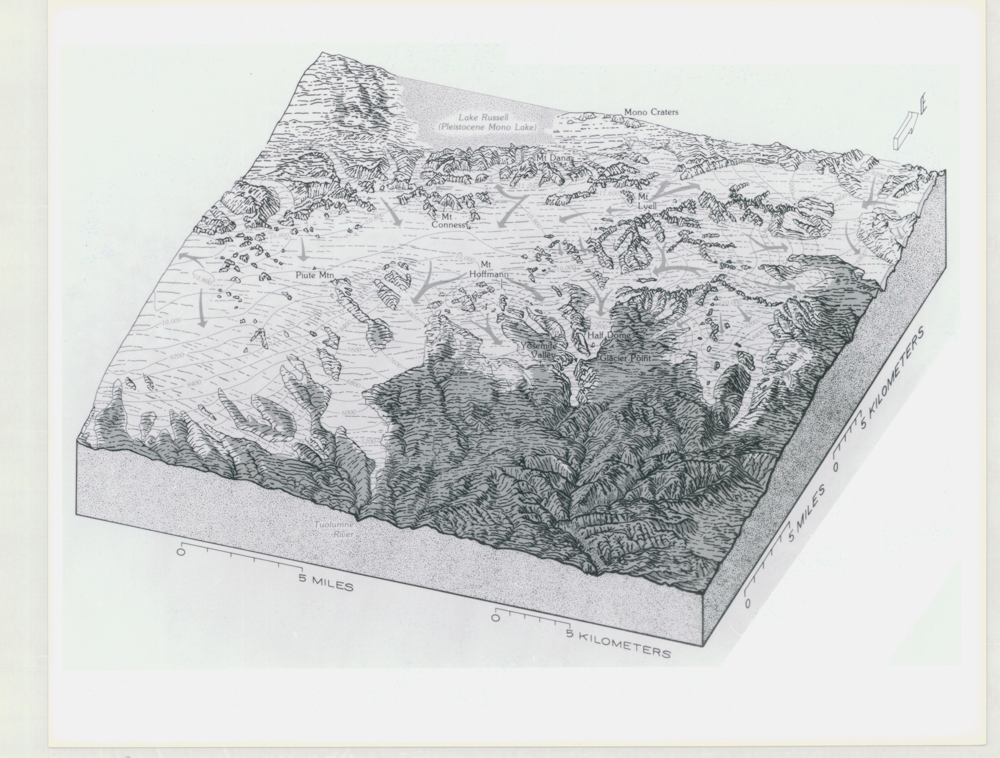
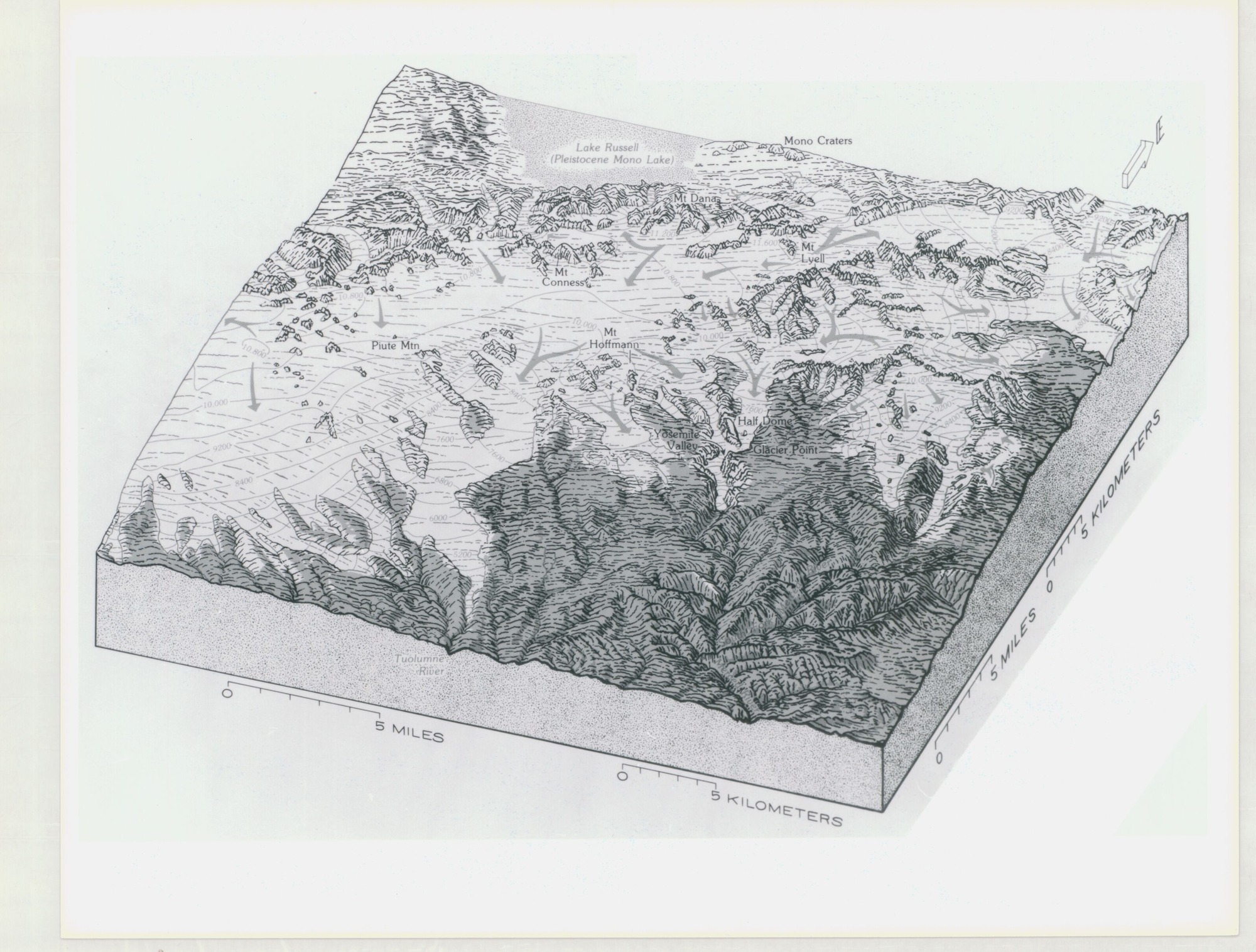
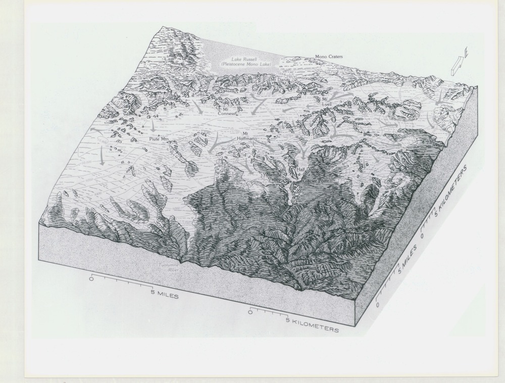
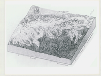
Topographic Map of Yosemite National Park with Arrows
Topographic Map of Yosemite National Park with Arrows
Topographic map of Yosemite National Park with points of interest marked and arrows
Item Number: YOSEAR000562G
Contact Yosemite National Park for more copyright information and use
Public domain:This digital asset is in the public domain. When using this asset for any purpose, including online, credit:'Courtesy U.S. National Parks'
Image
Yosemite National Park, Code: YOSE
Yosemite National Park, California
Latitude: 37.8399200439453, Longitude: -119.540397644043
Latitude: 37.8399200439453, Longitude: -119.540397644043
Undated
Type: photo paper; Dimensions: 8 x 10; Condition: good
YOSE Location: E1 DR19 F2
Public Can View
Person: Archivist
Organization: US National Park Service
Address: Yosemite National Park Archives, PO Box 700-W, El Portal, CA 95318
Email: yose_archives@nps.gov
Organization: US National Park Service
Address: Yosemite National Park Archives, PO Box 700-W, El Portal, CA 95318
Email: yose_archives@nps.gov
Tuesday, July 26, 2022 2:09:45 PM
Tuesday, July 26, 2022 2:09:45 PM
YOSEAR000562G.tif
tif
13.2 MB
Scenic
,
Map