Select Item below to DOWNLOAD - Once item is selected, right click and choose 'save as'
0f1b8ceb-b6af-41e9-bc37-0893e683764b
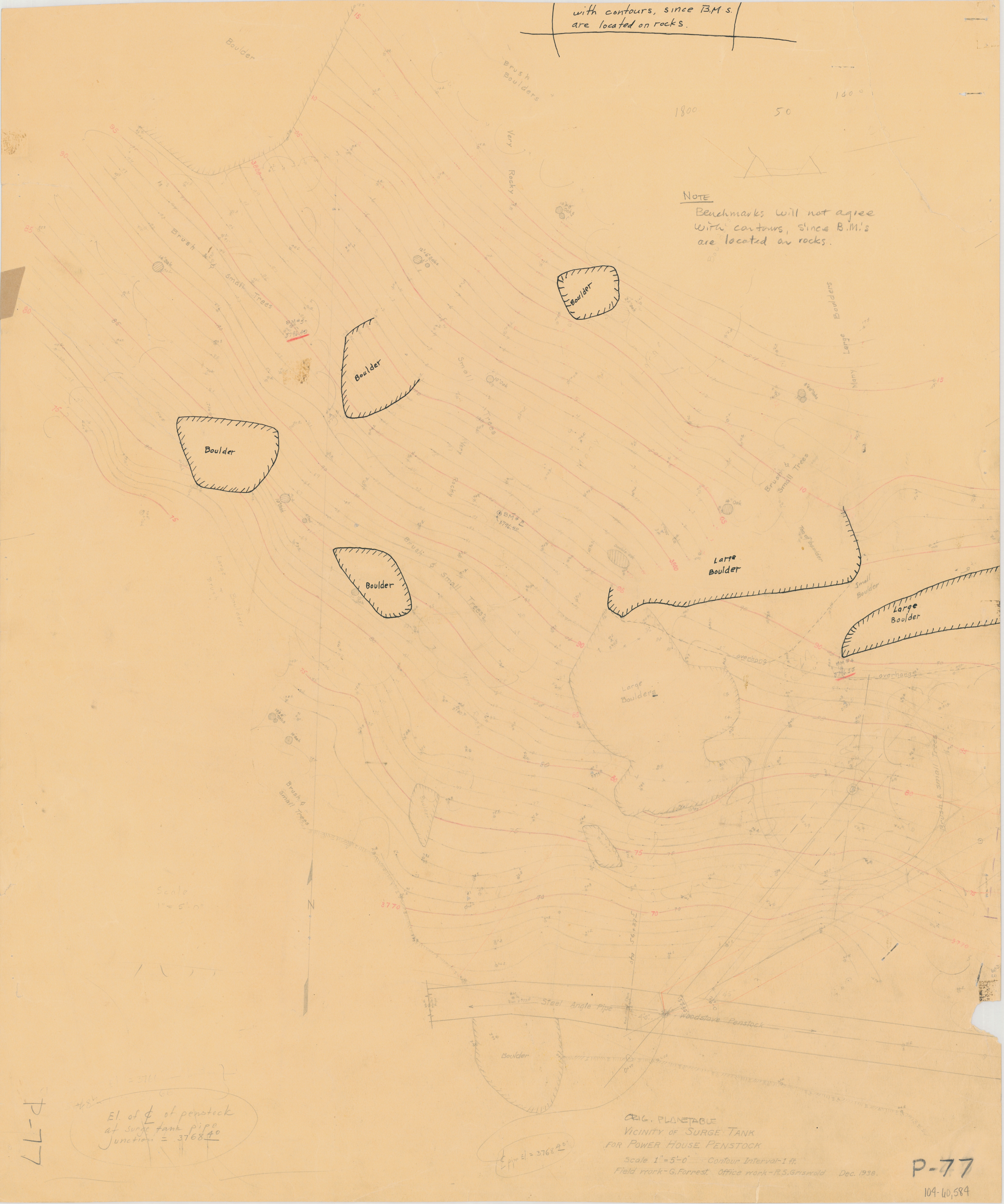
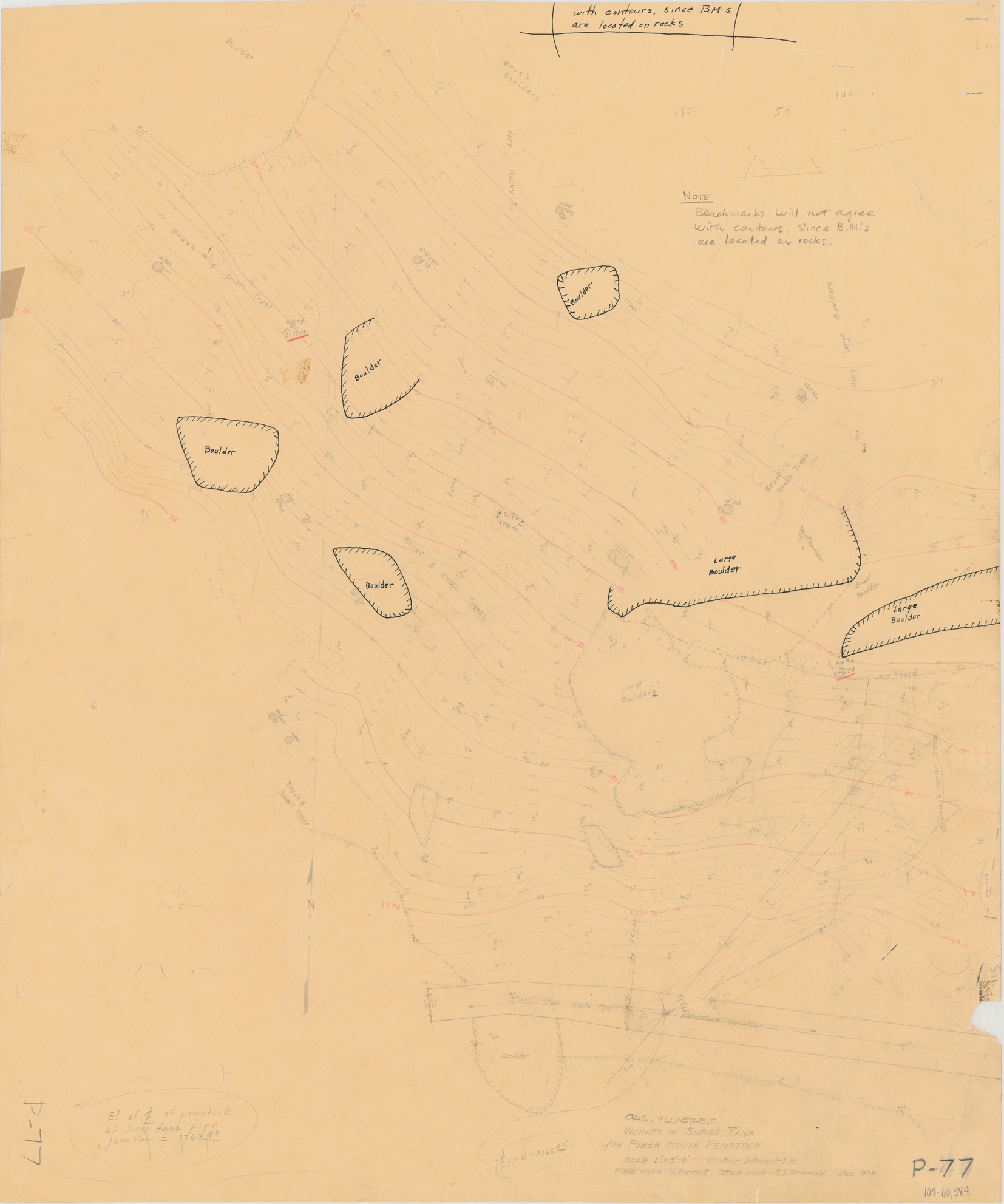
Orig. Plane Table Vicinity of Surge Tank for Power House Penstock
Orig. Plane Table Vicinity of Surge Tank for Power House Penstock
Topographic map of surge tank benchmarks, including boulders and pipes
Item Number: YOSEAR001371, AlternateId: 02-A-049, P-77, 104/60584
Contact Yosemite National Park for more copyright information and use
Public domain:This digital asset is in the public domain. When using this asset for any purpose, including online, credit:'Courtesy U.S. National Parks'
104/60584, (YOSE TIC Number)
Image
Yosemite National Park, Code: YOSE
Yosemite National Park, California
Yosemite National Park, California
Latitude: 37.8399200439453, Longitude: -119.540397644043
Yosemite National Park, California
Latitude: 37.8399200439453, Longitude: -119.540397644043
1938
01/01/1938 - 12/30/1938
Type:paper, Dimensions: 26 x 22, Condition: good
YOSE Location: E4 DR4 F5
Public Can View
Person: Archivist
Organization: US National Park Service
Address: Yosemite National Park Archives, PO Box 700-W, El Portal, CA 95318
Email: yose_archives@nps.gov
Organization: US National Park Service
Address: Yosemite National Park Archives, PO Box 700-W, El Portal, CA 95318
Email: yose_archives@nps.gov
Monday, August 7, 2023 6:00:45 PM
Monday, August 7, 2023 6:00:45 PM
YOSEAR001371.tif
tif
630.8 MB
Historic
,
Map