Select Item below to DOWNLOAD - Once item is selected, right click and choose 'save as'
02e3c30a699d4fd2931efd7d9c5eddfd
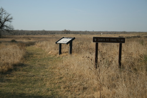
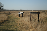
Wayside and NTIR Sign on the prairie at Middle Spring Site
A trail sign reading "SANTA FE TRAIL 1/4 MI" next to awayside in a grassy field.
Wayside and SAFE Non-NTIR Sign on cut path; Middle Spring is 8 miles north of Elkhart on Kansas Hwy 27, about 1 mile west on a dirt road to a small enclosed park. After Lower Spring, this was the next reliable water source, making it a major stopping point along the trail.; https://www.nps.gov/nr/feature/places/13000151.htm;
U.S. National Park Service
Permission must be secured from the individual copyright owners to reproduce any copyrighted materials contained within this website.
Public domain
Kansas, (SanteFe Trail State)
Image
Santa Fe National Historic Trail, Code: SAFE
Elkhart ; Cimarron National Grassland ; Middle Spring Site, Morton County, Kansas
Santa Fe National Historic Trail
Latitude: 37.9892997741699, Longitude: -99.3414993286133
Santa Fe National Historic Trail
Latitude: 37.9892997741699, Longitude: -99.3414993286133
20180428
04/28/2018
Shot On: Canon EOS DIGITAL REBEL XTi; Dimensions 2816 x 1880; Shot 1/500 sec. f/5.6 55mm; ISO 100; Size 2.1 MB
Public Can View
Organization: US National Park Service
Address: PO Box 728, Santa Fe, New Mexico 87504, Phone:(505) 988-6098
Email: ntir_information@NPS.gov
Address: PO Box 728, Santa Fe, New Mexico 87504, Phone:(505) 988-6098
Email: ntir_information@NPS.gov
Tuesday, November 3, 2020 3:28:17 PM
Tuesday, November 3, 2020 3:28:17 PM
SAFE_KS_Elkhart_MiddleSpringSiteCimarronNationalGrasslands_20180428_NPS_(02).JPG
jpg
2.2 MB
Scenic
,
Historic