Select Item below to DOWNLOAD - Once item is selected, right click and choose 'save as'
67252cf1c4c34066ad4cd09849a4cfb0
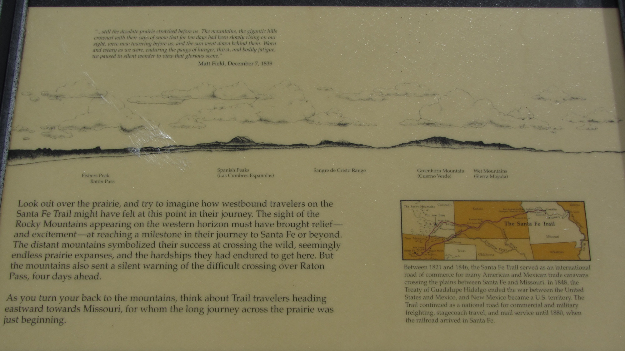
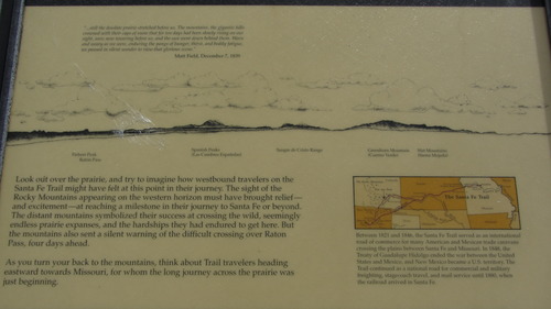
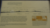
A history wayside at Comanche National Grassland
A wayside with a map on it.
Wayside with a story of the past; https://www.fs.usda.gov/recarea/psicc/recreation/recarea/?recid=12441&actid=104; General Location - 37.86152833; -103.7300998; 4420 feet
U.S. National Park Service
Permission must be secured from the individual copyright owners to reproduce any copyrighted materials contained within this website.
Public domain
Colorado, (SanteFe Trail State)
Image
Santa Fe National Historic Trail, Code: SAFE
La Junta ; Comanche Grassland ; Sierra Vista, Otero County, Colorado
Santa Fe National Historic Trail
Latitude: 37.9892997741699, Longitude: -99.3414993286133
Santa Fe National Historic Trail
Latitude: 37.9892997741699, Longitude: -99.3414993286133
20150528
05/28/2015
Shot On: Canon PowerShot SX 230 HS; Dimensions 4000 x 2248; Shot 1/1600 sec. f/4 5mm; ISO 100; Size 1.7 MB
Public Can View
Organization: US National Park Service
Address: PO Box 728, Santa Fe, New Mexico 87504, Phone:(505) 988-6098
Email: ntir_information@NPS.gov
Address: PO Box 728, Santa Fe, New Mexico 87504, Phone:(505) 988-6098
Email: ntir_information@NPS.gov
Tuesday, November 3, 2020 4:53:33 PM
Tuesday, November 3, 2020 4:53:33 PM
SAFE_CO_OteroCounty_LaJunta_ComancheNationalGrassland_SierraVista_20150528_NPS_(04).JPG
jpg
1.8 MB
Scenic
,
Historic