Select Item below to DOWNLOAD - Once item is selected, right click and choose 'save as'
7eaf51efc70c4719897a0dc7a5e754b1
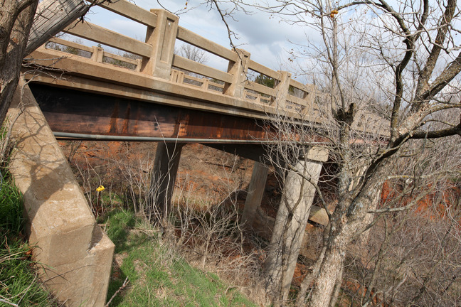
Steel Stringer on unnamed creek 1.4 mi. W. of the Bridgeport turnoff.
Steel Stringer on unnamed creek 1.4 mi. W. of the Bridgeport turnoff.
Steel Stringer with concrete guardrails (contains no FAP markers); Open to traffic
U.S. National Park Service
IN COPYRIGHT. This Item is protected by copyright and/or related rights. Copyright: Ross, Jim
Jim Ross
Restrictions apply on use and/or reproduction:Copyrighted material
Image
Route 66 Corridor Preservation Program, Code: ROSI
Caddo County, Oklahoma
Latitude: 35.536511, Longitude: -98.411893
Latitude: 35.536511, Longitude: -98.411893
20130329
01/01/1930
Public Can View
Organization: National Trails, US National Park Service
Address: Route 66 Corridor Preservation Program, PO Box 728 Santa Fe, NM 87505, Phone: (505) 988-6701
Email: IM_RT66@nps.gov
Address: Route 66 Corridor Preservation Program, PO Box 728 Santa Fe, NM 87505, Phone: (505) 988-6701
Email: IM_RT66@nps.gov
Thursday, May 28, 2020 8:06:20 AM
Thursday, May 28, 2020 8:06:20 AM
159-IMG_0183OK.jpg
jpg
13.8 MB
Inventory