Select Item below to DOWNLOAD - Once item is selected, right click and choose 'save as'
40239fa38dcf46f1b21b30599d921059
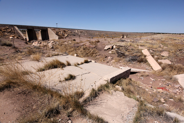
Two successive Low-water Crossings on the N. side of the RR at Prewitt (1926 route).
Two successive Low-water Crossings on the N. side of the RR at Prewitt (1926 route).
Concrete; Abandoned
U.S. National Park Service
IN COPYRIGHT. This Item is protected by copyright and/or related rights. Copyright: Ross, Jim
Jim Ross
Restrictions apply on use and/or reproduction:Copyrighted material
Image
Route 66 Corridor Preservation Program, Code: ROSI
McKinley County, New Mexico
Latitude: 35.373891, Longitude: -108.079425
Latitude: 35.373891, Longitude: -108.079425
20130424
Public Can View
Organization: National Trails, US National Park Service
Address: Route 66 Corridor Preservation Program, PO Box 728 Santa Fe, NM 87505, Phone: (505) 988-6701
Email: IM_RT66@nps.gov
Address: Route 66 Corridor Preservation Program, PO Box 728 Santa Fe, NM 87505, Phone: (505) 988-6701
Email: IM_RT66@nps.gov
Thursday, May 28, 2020 8:54:24 AM
Thursday, May 28, 2020 8:54:24 AM
44b-IMG_0947NM.JPG
jpg
12.2 MB
Inventory