Select Item below to DOWNLOAD - Once item is selected, right click and choose 'save as'
2068a61102334a98ab34f06f3909b531
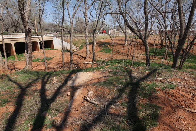
Lost bridge on Short Creek on 1926 route in Sayre at curve to old river bridge.
Lost bridge on Short Creek on 1926 route in Sayre at curve to old river bridge.
Type Unknown; GONE; replaced with nearby drain on Main St. after the 1958 realignment
U.S. National Park Service
IN COPYRIGHT. This Item is protected by copyright and/or related rights. Copyright: Ross, Jim
Jim Ross
Restrictions apply on use and/or reproduction:Copyrighted material
Image
Route 66 Corridor Preservation Program, Code: ROSI
Beckham County, Oklahoma
Latitude: 35.290998, Longitude: -99.645294
Latitude: 35.290998, Longitude: -99.645294
20130330
Public Can View
Organization: National Trails, US National Park Service
Address: Route 66 Corridor Preservation Program, PO Box 728 Santa Fe, NM 87505, Phone: (505) 988-6701
Email: IM_RT66@nps.gov
Address: Route 66 Corridor Preservation Program, PO Box 728 Santa Fe, NM 87505, Phone: (505) 988-6701
Email: IM_RT66@nps.gov
Thursday, May 28, 2020 7:56:24 AM
Thursday, May 28, 2020 7:56:24 AM
192-IMG_0444OK.jpg
jpg
11.4 MB
Inventory