Select Item below to DOWNLOAD - Once item is selected, right click and choose 'save as'
d719bea7-4dbc-414a-b783-b511a3954591
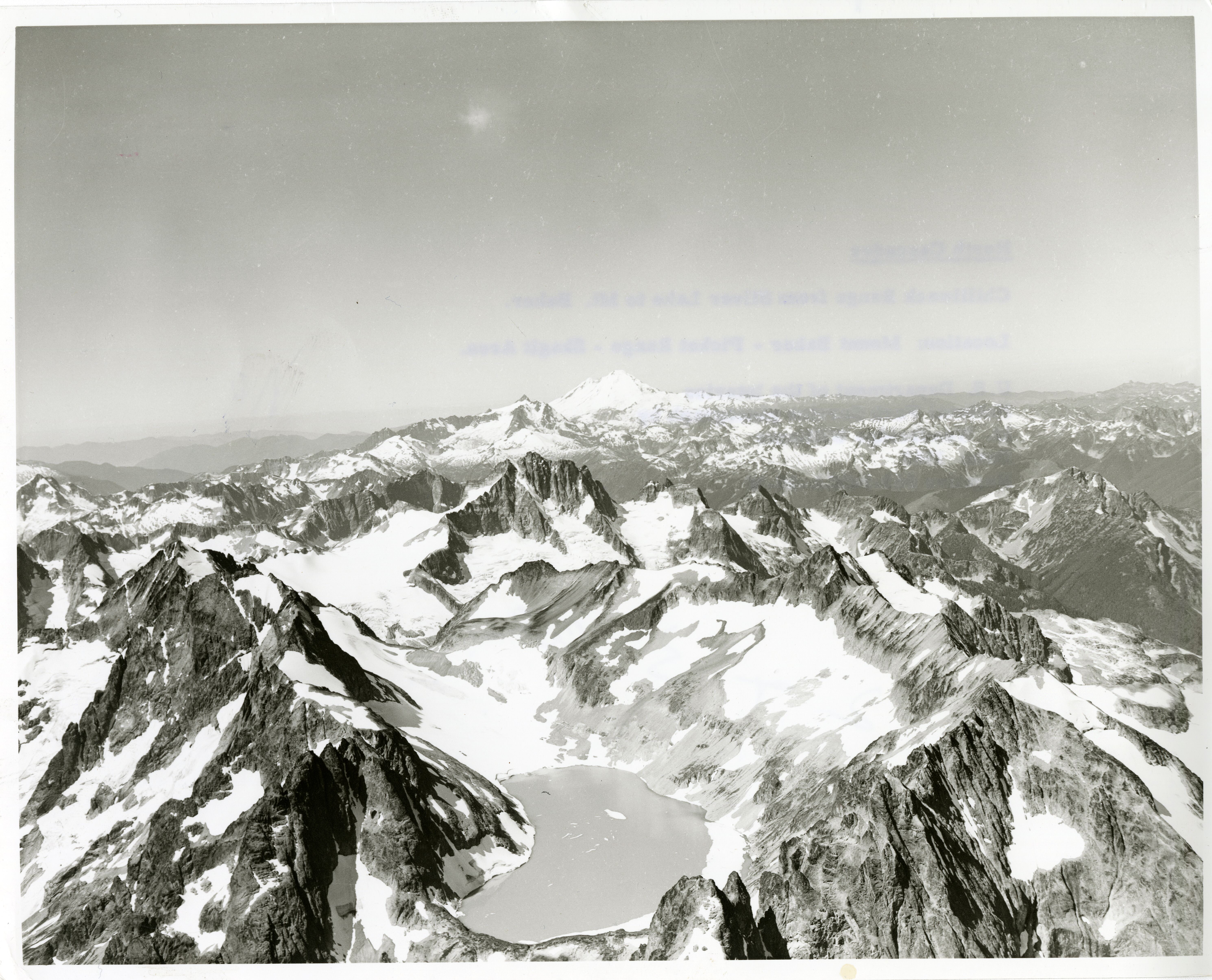
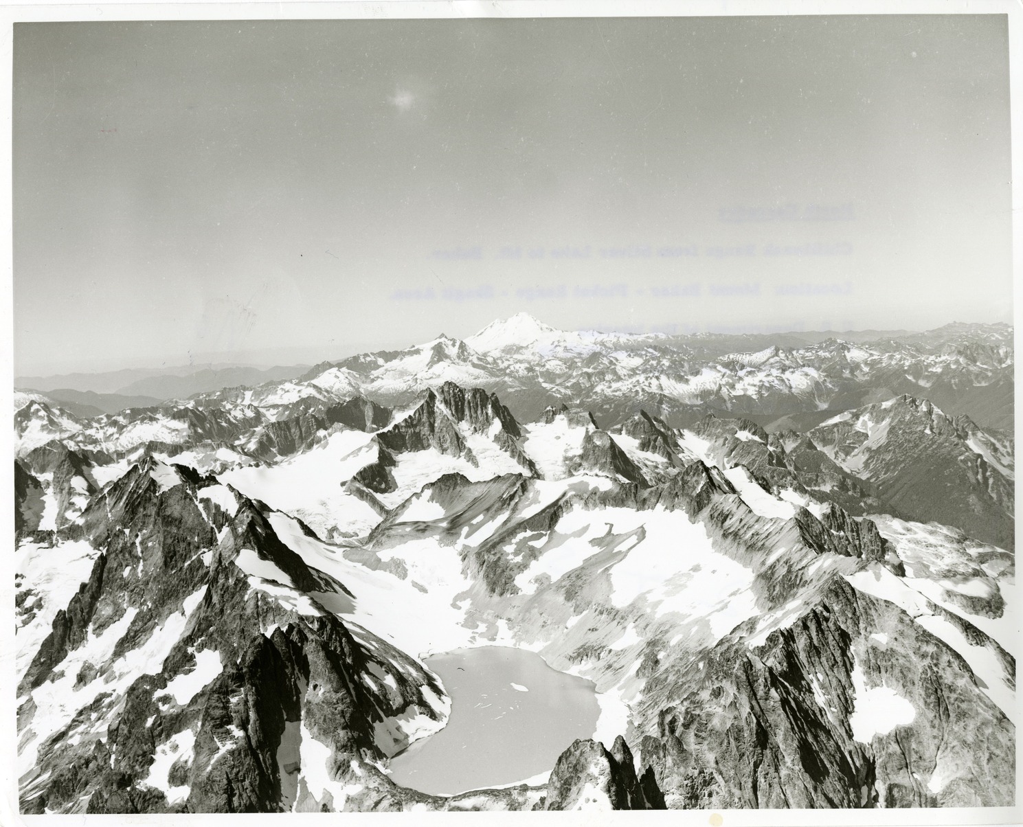
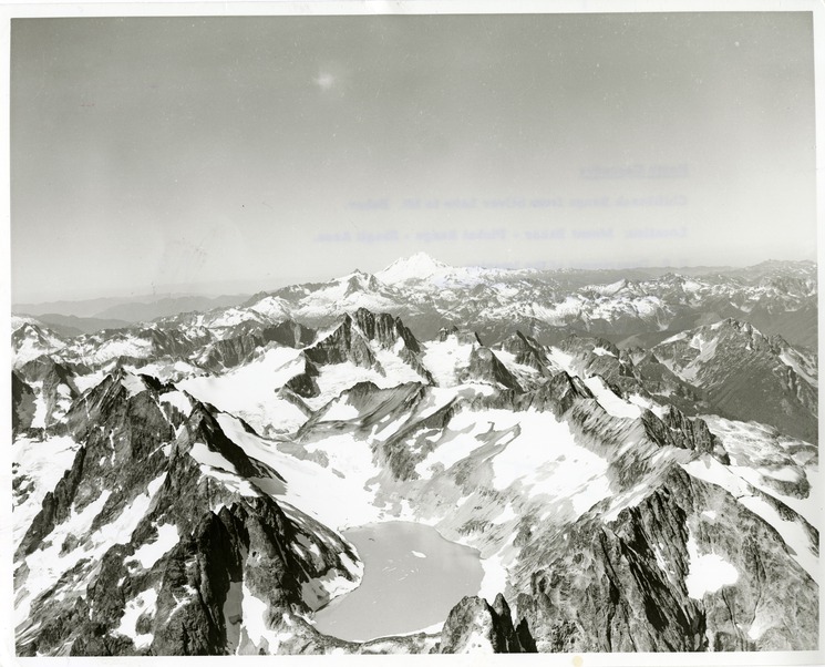
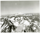
Mount Spickard, Silver Lake, Mount Redoubt, Mount Shuksan, Mount Baker and Custer Ridge
Aerial view of a mountain range. The closest mountain has a lake at the peak. Glaciers, ice and snow can be seen on most mountain tops.
From left to right, oblique aerial view of Mount Spikard, Silver Lake, Mount Redoubt, Mount Shuksan, Mount Baker and Custer Ridge. Many glaciers present. (North Cascades NPS Complex Museum Collection, NOCA.0002 Assembled Collections, Series V: 1963 NPS North Cascades Survey Photographs, Subseries A: Prints and Negatives, File 108)
U.S. National Park Service
This digital asset is in the public domain. When using this asset for any purpose, including online, credit: 'Courtesy of North Cascades NPS Complex Museum Collection, 1963 NPS North Cascades Survey Collection.'
NPS Photo
Public domain
Image
North Cascades National Park, Code: NOCA
North Cascades National Park, Washington
Latitude: 48.8278884887695, Longitude: -121.35050201416
Mount Spickard
Latitude: 48.8278884887695, Longitude: -121.35050201416
Mount Spickard
ICMS Archives Module : NOCA.0002.05.01
2022/06/14
01/01/1963 - 12/30/1963
B/W photographic print
Marblemount Curation Facility
Public Can View
William Woodbridge
Person: NOCA Curator
Organization: North Cascades NPS Complex
Position: Museum Curator
Address: 7280 Ranger Station Road, Marblemount, WA 98267
Email: NOCA_Curator@nps.gov.
Organization: North Cascades NPS Complex
Position: Museum Curator
Address: 7280 Ranger Station Road, Marblemount, WA 98267
Email: NOCA_Curator@nps.gov.
Monday, June 9, 2025 5:13:12 PM
Monday, June 9, 2025 5:13:12 PM
0002.05.01.108.tif
tif
172.3 MB
Historic
,
Inventory