Select Item below to DOWNLOAD - Once item is selected, right click and choose 'save as'
c2253a66-2f7f-41a7-8fce-7bfec165b1c3
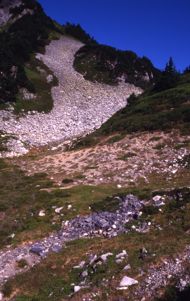
Cascade Pass 1993 Nill Map Features, site TR2, 9/10/1996, 1 of 3
A rocky slope surrounded by trees and grass that comes down onto a grassy hill with bare dirt patches and more rocks.
Cascade Pass, Revegetation Site "TR2", revegetation monitoring photograph. Text on slide frame reads: "REV/CAS/TR2-3, TR2 at 70 degrees magnetic north, Part of Millers' Rawmark? Millers' Rawmark (from back toward trail), BS, O, 9/10/96." (North Cascades NPS Complex Museum Collection, NOCA.0013 Revegetation Program Records, Series XI: Photographs, File 001 - Cascade Pass, Vicinity Impacts and Revegetation Sites, 1970-2004)
U.S. National Park Service
This digital asset is in the public domain. When using this asset for any purpose, including online, credit: 'Courtesy of North Cascades NPS Complex Museum Collection, Revegetation Program Records.'
NPS Photo
Public domain
Native Plant Restoration, (North Cascades Program)
, Cascade Pass, (North Cascades Locality)
, Revegetation, (North Cascades Activity)
, Cascade Pass, (North Cascades Locality)
, Revegetation, (North Cascades Activity)
Image
North Cascades National Park, Code: NOCA
North Cascades National Park, Washington
Latitude: 48.8278884887695, Longitude: -121.35050201416
Cascade Pass
Latitude: 48.8278884887695, Longitude: -121.35050201416
Cascade Pass
ICMS Archives Module : NOCA.0013.11.001
2024/01/27
09/10/1996
slide transparency
Curation Facility
Public Can View
Person: NOCA Curator
Organization: North Cascades NPS Complex
Position: Museum Curator
Address: 7280 Ranger Station Road, Marblemount, WA 98267
Email: NOCA_Curator@nps.gov.
Organization: North Cascades NPS Complex
Position: Museum Curator
Address: 7280 Ranger Station Road, Marblemount, WA 98267
Email: NOCA_Curator@nps.gov.
Thursday, January 30, 2025 5:53:40 PM
Thursday, January 30, 2025 5:53:40 PM
0013.11.001.0063.tif
tif
34.1 MB
Monitoring