Select Item below to DOWNLOAD - Once item is selected, right click and choose 'save as'
(Thermal images, Firehole Lake Drive)
Mark Wolf and Kiernan Folz-Donahue
July 13-21, 2023
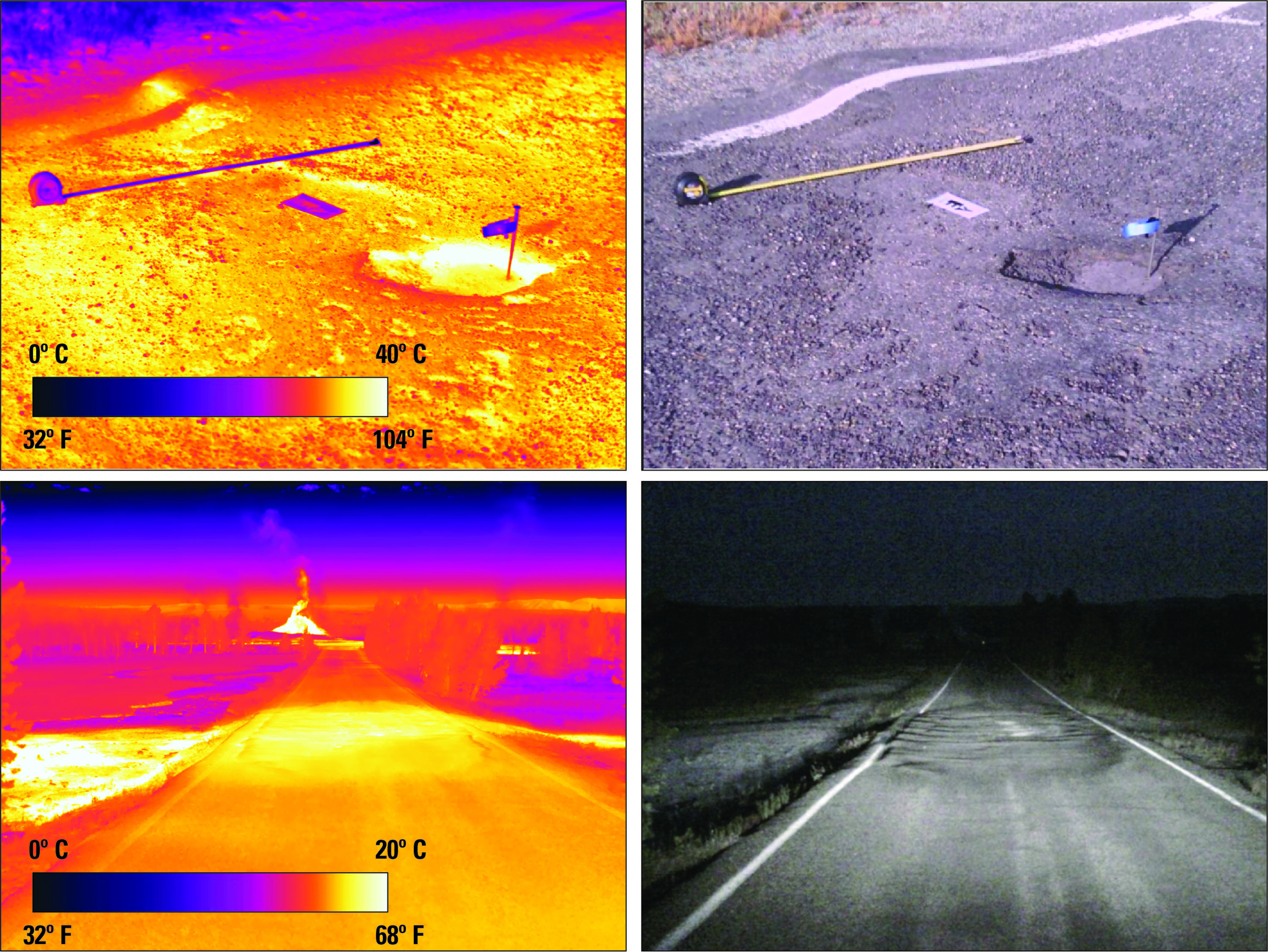
The top images depict a hot pothole and deflected asphalt near Firehole Spring in the Lower Geyser Basin. The bottom images show thermal road damage between Great Fountain Geyser and White Dome Geyser.
These images were collected by interpretive ranger Mark Wolf and physical science technician Kiernan Folz-Donahue for the Yellowstone Volcano Observatory. The Yellowstone Volcano Observatory is a consortium of nine state and federal agencies who provide timely monitoring and hazard assessment of volcanic, hydrothermal, and earthquake activity in the Yellowstone Plateau region.
United States Geological Survey (USGS) images
Mark Wolf and Kiernan Folz-Donahue
July 13-21, 2023
The top images depict a hot pothole and deflected asphalt near Firehole Spring in the Lower Geyser Basin. The bottom images show thermal road damage between Great Fountain Geyser and White Dome Geyser.
These images were collected by interpretive ranger Mark Wolf and physical science technician Kiernan Folz-Donahue for the Yellowstone Volcano Observatory. The Yellowstone Volcano Observatory is a consortium of nine state and federal agencies who provide timely monitoring and hazard assessment of volcanic, hydrothermal, and earthquake activity in the Yellowstone Plateau region.
United States Geological Survey (USGS) images