Select Item below to DOWNLOAD - Once item is selected, right click and choose 'save as'
06fa8bbb1c824452b5f4573251cd466d
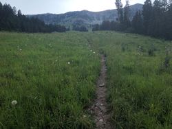
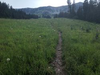
Bridger Bowl
Bridger Bowl
Site ID: 164430
U.S. National Park Service
Copyright protection may exist. Courtesy of College of Earth, Ocean, Atmospheric Sciences (CEOAS) GLOBE v-School
Restrictions apply on use and/or reproduction:Contact Lewis and Clark National Historic Trail for permission to use image.
Image
Lewis and Clark National Historic Trail, Code: LECL
Bridger Bowl, Montana
Latitude: 45.82, Longitude: -110.91
Lewis and Clark National Historic Trail
Latitude: 40.6641616821289, Longitude: -95.8320693969727
Latitude: 45.82, Longitude: -110.91
Lewis and Clark National Historic Trail
Latitude: 40.6641616821289, Longitude: -95.8320693969727
20190808
08/08/2019
Public Can View
Organization: Lewis and Clark National Historic Trail
Address: 601 Riverfront Dr. , Omaha, NE, USA, 68102, (402) 661-1804
Email: lecl_information@nps.gov
Address: 601 Riverfront Dr. , Omaha, NE, USA, 68102, (402) 661-1804
Email: lecl_information@nps.gov
Tuesday, December 10, 2019 2:34:53 PM
Tuesday, December 10, 2019 2:34:53 PM
BridgerBowl.jpg
jpg
9.3 kB
Scenic