Select Item below to DOWNLOAD - Once item is selected, right click and choose 'save as'
657a9a419eed47fe8dae2649396ee518
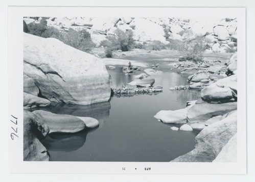
Barker Dam area
Black and white image of Barker Dam area
Low water line. Remains of Myers Dam. Showing as rock walls.
U.S. National Park Service
Permission must be secured from the individual copyright owners to reproduce any copyrighted materials contained within this website.
Public domain:Partial Granting Rights
Image
Joshua Tree National Park, Code: JOTR
Joshua Tree National Park, California
Latitude: 33.8270492553711, Longitude: -115.86009979248
Latitude: 33.8270492553711, Longitude: -115.86009979248
2020/12/14
04/22/1971
Film Size: 4 x 5
JOTR: Box 14; 1776
Public Can View
Organization: Joshua Tree National Park
Address: 74485 National Park Drive Twentynine Palms, CA 92277-3597, Phone: (760) 367-5500
Address: 74485 National Park Drive Twentynine Palms, CA 92277-3597, Phone: (760) 367-5500
Wednesday, May 12, 2021 8:14:42 AM
Wednesday, May 12, 2021 8:14:42 AM
1776.tif
tif
22.1 MB
Historic