Select Item below to DOWNLOAD - Once item is selected, right click and choose 'save as'
fbff5b14-6c1c-4f5e-bfbd-a4e7ea54b82b
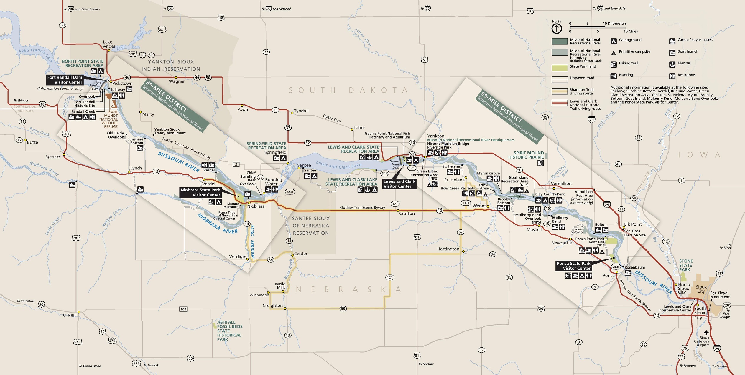
Park Map - Missouri National Recreational River
Map of Missouri National Recreational River in Nebraska. The park is highlighted in green and divided into two rectangular sections along the river, one on the right and one on the left. Major highways are represented by red lines, and the states are outlined in gray.
Screen-viewable file; Adobe print production files can be downloaded from the Compressed zip Version link
Map Projection: Other; Map Type: unassigned
U.S. National Park Service
The National Park Service maps are government produced and are in the public domain. Anyone may, without restriction under U.S. copyright laws: Reproduce the work in print or digital form; Create derivative works; Perform the work publicly; Display the work; Distribute copies or digitally transfer the work to the public by sale or other transfer of ownership, or by rental, lease, or lending. Please note, a user who modifies and/or republishes National Park Service maps are responsible for any problems encountered with the maps, due to their change or modification.
Public domain
Document
Missouri National Recreational River, Code: MNRR
South Dakota, Missouri National Recreational River, Nebraska
Latitude: 42.7671699523926, Longitude: -97.070686340332
Latitude: 42.7671699523926, Longitude: -97.070686340332
2017-05-30
Public Can View
Person: Harpers Ferry Center
Organization: US National Park Service
Address: Harpers Ferry Center, Harpers Ferry, WV
Email: HFC_Cartography@nps.gov
Organization: US National Park Service
Address: Harpers Ferry Center, Harpers Ferry, WV
Email: HFC_Cartography@nps.gov
Wednesday, April 27, 2022 8:21:26 PM
Friday, September 26, 2025 11:36:35 PM
MNRRmap1.pdf
pdf
3.9 MB
Map