Select Item below to DOWNLOAD - Once item is selected, right click and choose 'save as'
937db2d1d56342d6a11971adb07d4db0
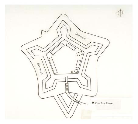
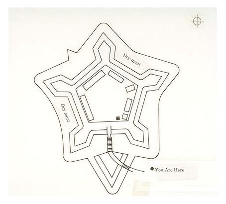
Plan view of the dry moat at Fort McHenry in 1814 (type affixed to base art).
Plan view of the dry moat at Fort McHenry in 1814 (type affixed to base art).
Abbr=WE
U.S. National Park Service
Reflective Art
Government owns art and all reproduction rights.
Public domain
Fortifications/Coastal Defenses, (HFC ArtTheme)
Image
Fort McHenry National Monument and Historic Shrine, Code: FOMC
Fort McHenry National Monument and Historic Shrine, Baltimore city, Maryland
Latitude: 39.2619018554688, Longitude: -76.5803985595703
Latitude: 39.2619018554688, Longitude: -76.5803985595703
Image Management System : IMS 04048
20190904
01/01/1982 - 12/30/1982
Exhibit 3/Graphic # 3-9
E8
Public Can View
Organization: Harpers Ferry Center
Address: Harpers Ferry Center, 67 Mather Place, Harpers Ferry, WV, 25425, 304-535-5050
Address: Harpers Ferry Center, 67 Mather Place, Harpers Ferry, WV, 25425, 304-535-5050
Monday, October 7, 2019 2:59:12 PM
Monday, October 7, 2019 2:59:12 PM
04048.jpg
jpg
26.5 kB
Museum