Select Item below to DOWNLOAD - Once item is selected, right click and choose 'save as'
8b01e66634d447c680ff75e5876c6ca8
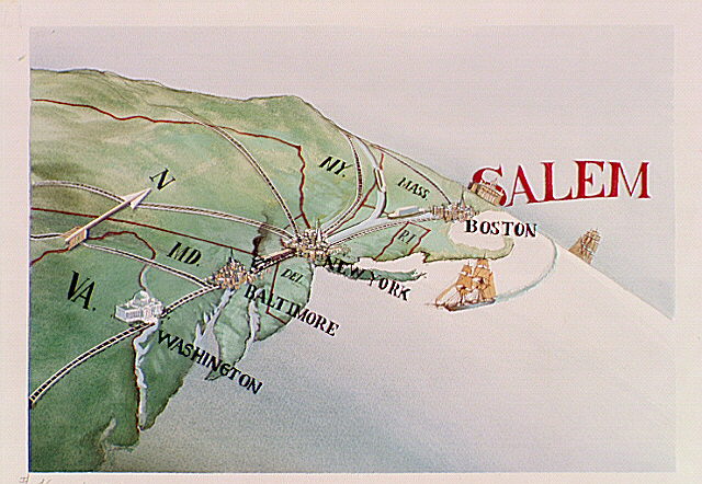
Map of Eastern seaboard depicts various ports. Salem is shown (in large letters) with Boston, New York, Baltimore, and Washington ports.
Map of Eastern seaboard depicts various ports. Salem is shown (in large letters) with Boston, New York, Baltimore, and Washington ports.
Abbr=AVA
U.S. National Park Service
Reflective Art
Government owns art and all reproduction rights.
Public domain
Image
Salem Maritime National Historical Park, Code: SAMA
Salem Maritime National Historical Park, Essex County, Massachusetts
Latitude: 42.5195999145508, Longitude: -70.8868026733398
Latitude: 42.5195999145508, Longitude: -70.8868026733398
Image Management System : IMS 01971
20190904
01/01/1982 - 12/30/1982
Image_Size=W: 15" x H: 11"; Metric_Size=W: 38.07CM X H: 27.92CM; AVA Project #1; Slide Show #334, Plate 46
D5
Public Can View
Organization: Harpers Ferry Center
Address: Harpers Ferry Center, 67 Mather Place, Harpers Ferry, WV, 25425, 304-535-5050
Address: Harpers Ferry Center, 67 Mather Place, Harpers Ferry, WV, 25425, 304-535-5050
Monday, October 7, 2019 3:03:44 PM
Monday, October 7, 2019 3:03:44 PM
01971.JPG
jpg
76.8 kB
Museum