Select Item below to DOWNLOAD - Once item is selected, right click and choose 'save as'
4e044330-65a8-4a34-8031-0892a2b47506
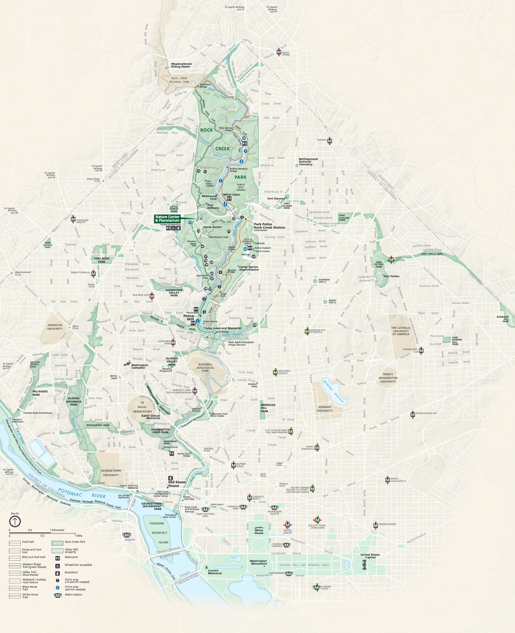
Park Map - Rock Creek Park
Map of Rock Creek Park and surrounding roads, sites, Metro stations, and parks in Washington, DC. Bodies of water are shown in blue, parks in green, streets with white lines, and the rest of the map is beige shaded lightly with gray to represent the topography.
Screen-viewable file; Adobe print production files can be downloaded from the Compressed zip Version link
Map Projection: WM; Map Type: park map
U.S. National Park Service
The National Park Service maps are government produced and are in the public domain. Anyone may, without restriction under U.S. copyright laws: Reproduce the work in print or digital form; Create derivative works; Perform the work publicly; Display the work; Distribute copies or digitally transfer the work to the public by sale or other transfer of ownership, or by rental, lease, or lending. Please note, a user who modifies and/or republishes National Park Service maps are responsible for any problems encountered with the maps, due to their change or modification.
Public domain
Document
Rock Creek Park, Code: ROCR
Maryland, Rock Creek Park, District of Columbia , District of Columbia
Latitude: 38.9151992797852, Longitude: -77.0815963745117
Latitude: 38.9151992797852, Longitude: -77.0815963745117
2019-04-08
Public Can View
Person: Harpers Ferry Center
Organization: US National Park Service
Address: Harpers Ferry Center, Harpers Ferry, WV
Email: HFC_Cartography@nps.gov
Organization: US National Park Service
Address: Harpers Ferry Center, Harpers Ferry, WV
Email: HFC_Cartography@nps.gov
Monday, May 2, 2022 9:38:18 PM
Friday, September 26, 2025 11:37:16 PM
ROCRmap1.pdf
pdf
167.3 MB
Map