Select Item below to DOWNLOAD - Once item is selected, right click and choose 'save as'
49678b03-460c-416d-a8dc-1b9b809bc56d
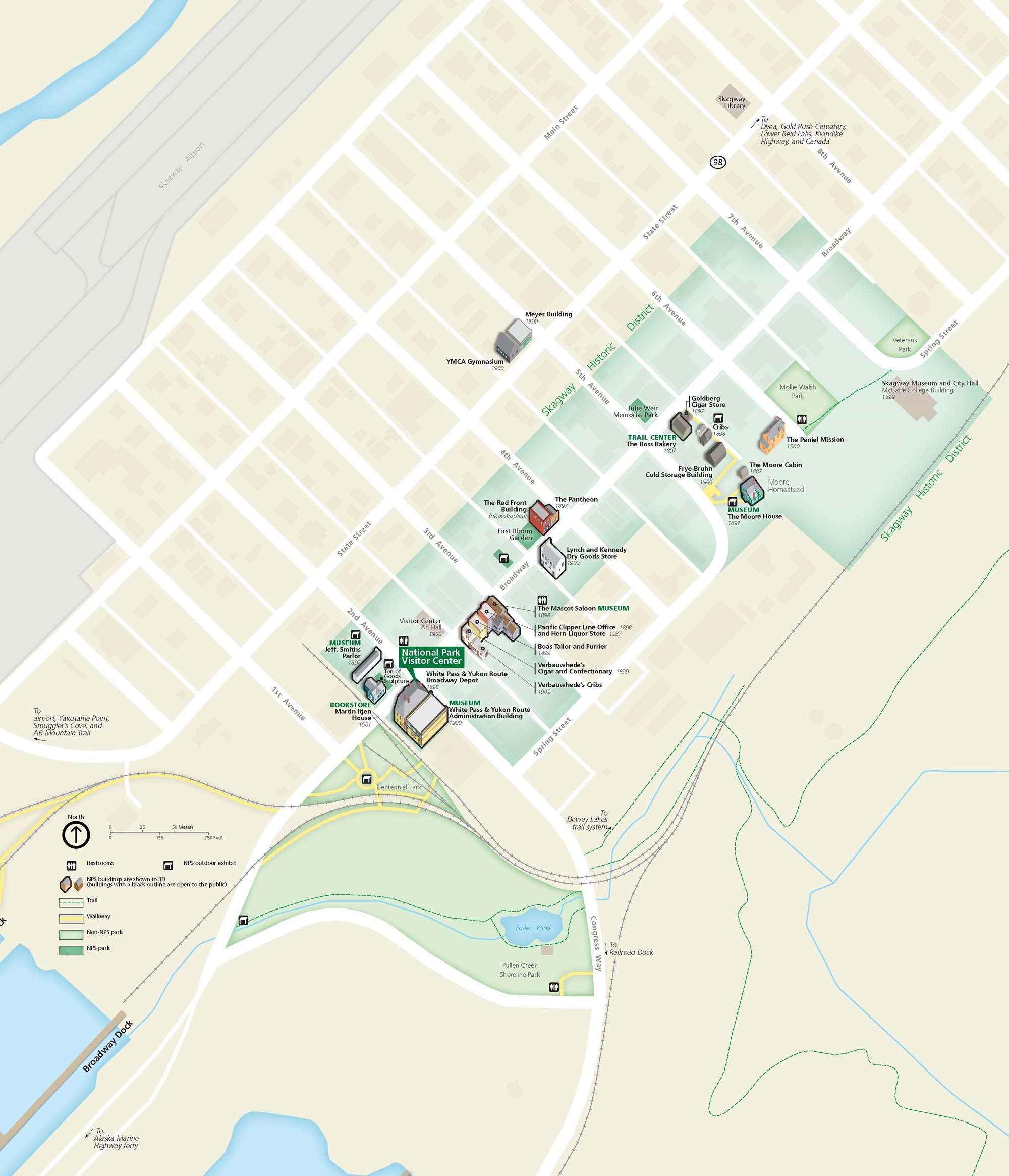
Downtown Skagway Map - Klondike Gold Rush National Historical Park
Map of the Skagway Historic District within Klondike Gold Rush National Historical Park in Alaska. White lines form a street grid stretching diagonally from the center of the map to the northeast corner. An area of about two by five city blocks is outlined in pale green to indicate the historic district.
Screen-viewable file; Adobe print production files can be downloaded from the Compressed zip Version link
Map Projection: WM; Map Type: park map
U.S. National Park Service
The National Park Service maps are government produced and are in the public domain. Anyone may, without restriction under U.S. copyright laws: Reproduce the work in print or digital form; Create derivative works; Perform the work publicly; Display the work; Distribute copies or digitally transfer the work to the public by sale or other transfer of ownership, or by rental, lease, or lending. Please note, a user who modifies and/or republishes National Park Service maps are responsible for any problems encountered with the maps, due to their change or modification.
Public domain
Document
Klondike Gold Rush National Historical Park, Code: KLGO
Klondike Gold Rush National Historical Park, Skagway Municipality, Alaska
Latitude: 59.6315994262695, Longitude: -135.292999267578
Latitude: 59.6315994262695, Longitude: -135.292999267578
2021-06-08
Public Can View
Person: Harpers Ferry Center
Organization: US National Park Service
Address: Harpers Ferry Center, Harpers Ferry, WV
Email: HFC_Cartography@nps.gov
Organization: US National Park Service
Address: Harpers Ferry Center, Harpers Ferry, WV
Email: HFC_Cartography@nps.gov
Thursday, May 15, 2025 3:15:15 PM
Friday, September 26, 2025 11:36:13 PM
KLGOmap4.pdf
pdf
9.8 MB
Map