Select Item below to DOWNLOAD - Once item is selected, right click and choose 'save as'
3fcefbbb-dfd3-489b-a81c-053925e4c9f7
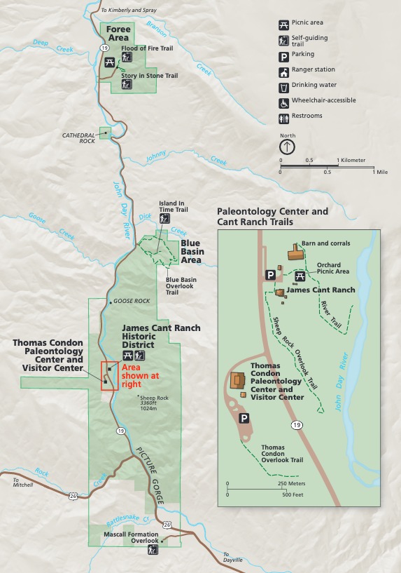
Sheep Rock Unit Map - John Day Fossil Beds National Monument
Map of the Sheep Rock Unit at John Day Fossil Beds National Monument in Oregon. Park areas are shown as green rectangular shapes along the John Day River, which is shown in blue. A road runs parallel to the river and stops at a highway that runs across the bottom.
Screen-viewable file; Adobe print production files can be downloaded from the Compressed zip Version link
Map Projection: Other; Map Type: park map
U.S. National Park Service
The National Park Service maps are government produced and are in the public domain. Anyone may, without restriction under U.S. copyright laws: Reproduce the work in print or digital form; Create derivative works; Perform the work publicly; Display the work; Distribute copies or digitally transfer the work to the public by sale or other transfer of ownership, or by rental, lease, or lending. Please note, a user who modifies and/or republishes National Park Service maps are responsible for any problems encountered with the maps, due to their change or modification.
Public domain
Document
John Day Fossil Beds National Monument, Code: JODA
John Day Fossil Beds National Monument, Oregon
Latitude: 44.5381088256836, Longitude: -119.649200439453
Latitude: 44.5381088256836, Longitude: -119.649200439453
2020-04-15
Public Can View
Person: Harpers Ferry Center
Organization: US National Park Service
Address: Harpers Ferry Center, Harpers Ferry, WV
Email: HFC_Cartography@nps.gov
Organization: US National Park Service
Address: Harpers Ferry Center, Harpers Ferry, WV
Email: HFC_Cartography@nps.gov
Tuesday, April 26, 2022 9:43:23 PM
Friday, September 26, 2025 11:36:01 PM
JODAmap4.pdf
pdf
10.8 MB
Map