Select Item below to DOWNLOAD - Once item is selected, right click and choose 'save as'
2b211cfb-7495-4146-b00b-bc4cbbee4d3a
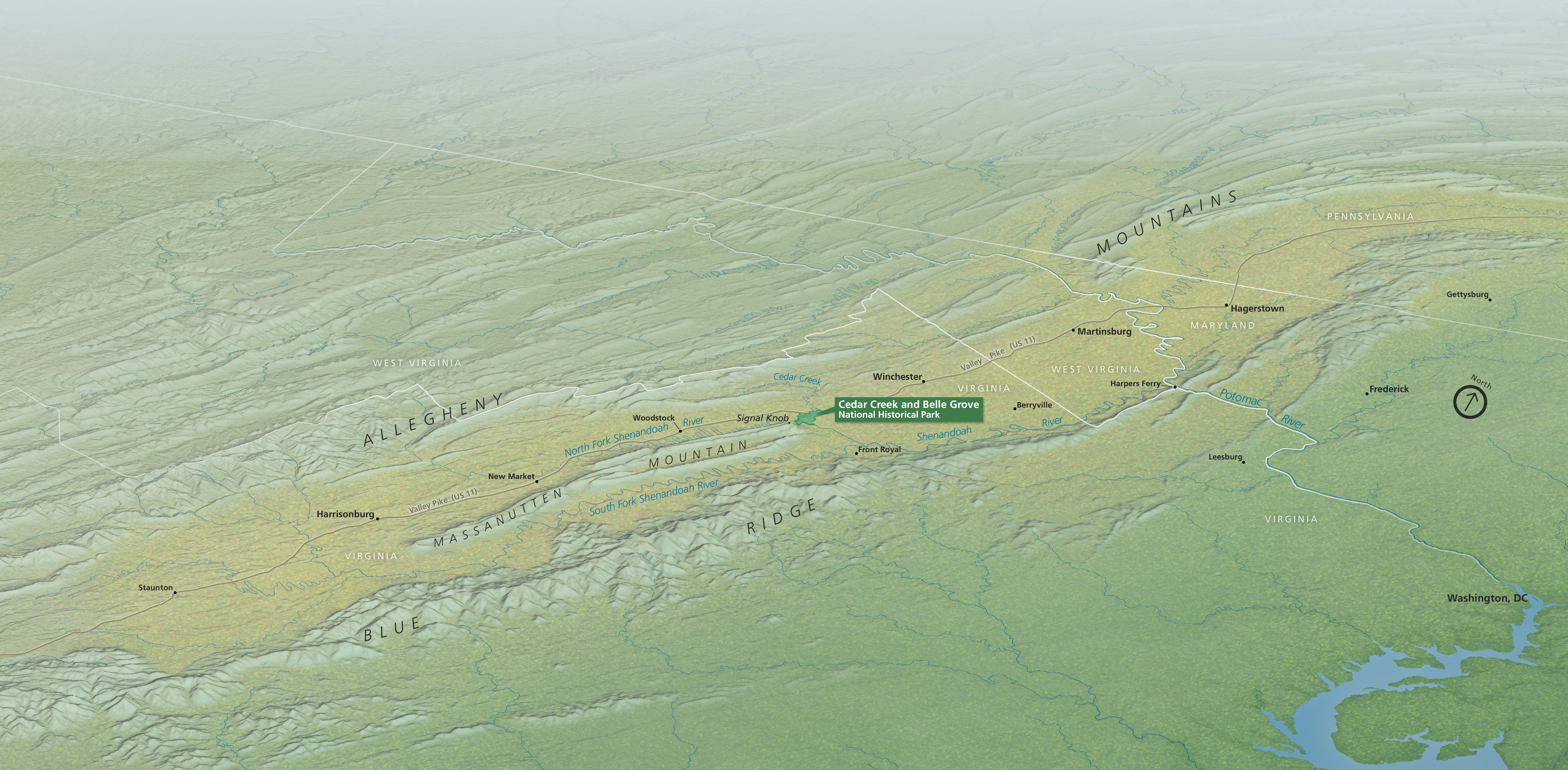
Shenandoah Valley Bird's-Eye View Map - Cedar Creek and Belle Grove National Historical Park
Bird’s-eye-view map of Cedar Creek and Belle Grove National Historical Park in Virginia. Topography is rendered in shades of green. Tiny in the vast landscape, the park is at the center of the map.
Screen-viewable file; Adobe print production files can be downloaded from the Compressed zip Version link
Map Projection: Other; Map Type: unassigned
U.S. National Park Service
The National Park Service maps are government produced and are in the public domain. Anyone may, without restriction under U.S. copyright laws: Reproduce the work in print or digital form; Create derivative works; Perform the work publicly; Display the work; Distribute copies or digitally transfer the work to the public by sale or other transfer of ownership, or by rental, lease, or lending. Please note, a user who modifies and/or republishes National Park Service maps are responsible for any problems encountered with the maps, due to their change or modification.
Public domain
Document
Cedar Creek and Belle Grove National Historical Park, Code: CEBE
Cedar Creek and Belle Grove National Historical Park, Virginia
Latitude: 38.9937210083008, Longitude: -78.3142166137695
Latitude: 38.9937210083008, Longitude: -78.3142166137695
2015-02-03
Public Can View
Person: Harpers Ferry Center
Organization: US National Park Service
Address: Harpers Ferry Center, Harpers Ferry, WV
Email: HFC_Cartography@nps.gov
Organization: US National Park Service
Address: Harpers Ferry Center, Harpers Ferry, WV
Email: HFC_Cartography@nps.gov
Monday, April 25, 2022 4:46:00 PM
Friday, September 26, 2025 11:34:29 PM
CEBEmap2.pdf
pdf
85.0 MB
Map