Select Item below to DOWNLOAD - Once item is selected, right click and choose 'save as'
1b22782b0d8d48fba264a891c9c4bc01
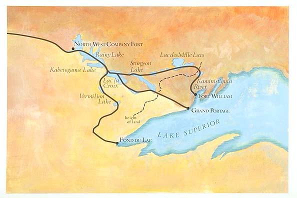
Map depicts areas around Lake Superior. Shown are locations of the North West Company Fort, Fort William and Grand Portage areas.
Map depicts areas around Lake Superior. Shown are locations of the North West Company Fort, Fort William and Grand Portage areas.
Abbr=AVA
U.S. National Park Service
Reflective Art
Government owns art and all reproduction rights.
Public domain
Image
Voyageurs National Park, Code: VOYA
Voyageurs National Park, Minnesota
Latitude: 48.48828125, Longitude: -92.8048095703125
Latitude: 48.48828125, Longitude: -92.8048095703125
Image Management System : IMS 03248
20190904
Miscellaneous, AVA Project #62, Plate 95
T15
Public Can View
Organization: Harpers Ferry Center
Address: Harpers Ferry Center, 67 Mather Place, Harpers Ferry, WV, 25425, 304-535-5050
Address: Harpers Ferry Center, 67 Mather Place, Harpers Ferry, WV, 25425, 304-535-5050
Monday, October 7, 2019 3:02:26 PM
Monday, October 7, 2019 3:02:26 PM
03248.jpg
jpg
35.4 kB
Museum